Importance of Aerial Photography in Real Estate Marketing
In the competitive Miami real estate market, high-quality aerial photography has become an indispensable tool for agents and property owners aiming to showcase their listings effectively. These images provide prospective buyers with a unique perspective, highlighting the property's surroundings, neighborhood amenities, and the property's spatial relationships that ground-level photos often fail to capture.
Aerial photos enhance property listings by offering a comprehensive view that emphasizes the property's size, layout, and proximity to key locations such as beaches, parks, and commercial centers. This vantage point helps potential buyers to appreciate the full scope of the property and its environment, facilitating a more informed purchasing decision.
Moreover, aerial images stand out in online listings, attracting more views and engagement from prospective buyers. This increased visibility can accelerate the sales process, ultimately providing a competitive edge in the bustling Miami market. Real estate professionals frequently incorporate aerial photos into their marketing strategies to create engaging virtual tours, compelling advertisements, and detailed property overviews that draw in a wider audience.
Beyond initial marketing efforts, aerial photography also aids due diligence by offering an accurate representation of the property’s exterior features and landscape. It can reveal details such as lot boundaries, landscaping elements, and the condition of rooftops and other structures. For developers and investors, aerial images provide critical insights into property potential and surrounding development trends, enhancing planning and decision-making processes.
High-quality aerial photography has established itself as a vital component of modern real estate marketing strategies in Miami. It enables a holistic view of properties that appeals to a broad spectrum of buyers and investors, ultimately driving faster sales and higher property values.
Types of Aerial Photos for Real Estate Listings
When selecting the appropriate aerial imagery for real estate marketing, professionals have several effective options to choose from, each offering unique advantages that enhance the property’s visual appeal. Understanding these different styles allows listing agents and developers to tailor their visual presentation to best highlight the property's features and surrounding environment.
Drone Photography
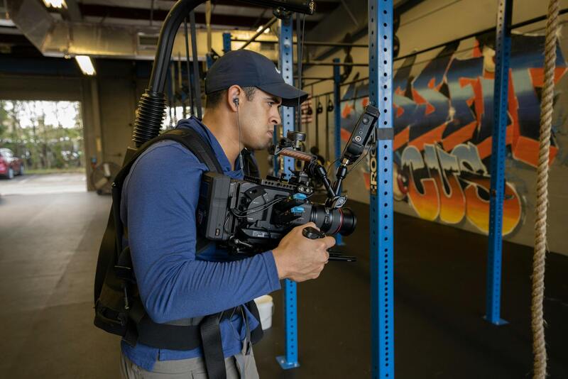
Drone photography has revolutionized property marketing by providing the ability to capture high-quality, detailed images from various angles and altitudes. This method is highly flexible, allowing close-up shots of specific features such as gardens, pools, or unique architectural details. Drones can access challenging angles that traditional ground photography cannot reach, delivering comprehensive views of the property’s exterior and its immediate surroundings. Additionally, drone images can be seamlessly integrated into virtual tours and promotional videos, enhancing overall listing appeal.
Helicopter Photography
Helicopter photography offers a broader perspective, capturing expansive landscapes and large-scale developments more effectively than ground-based methods. This approach provides sweeping views that highlight property size, neighboring features, and the context within the neighborhood. Although more costly and typically reserved for luxury estates or commercial developments, helicopter images are particularly impactful in emphasizing the scale and prestige of a property, making it stand out in competitive listings.
Aerial Videos
Beyond static images, aerial videos combine movement and sound to create compelling virtual presentations. These videos give viewers an immersive experience, allowing them to virtually walk around the property and appreciate its setting dynamically. Aerial videos are instrumental in storytelling, showcasing the property's spatial relationships, landscaping, and surrounding amenities, thereby increasing engagement and providing a comprehensive understanding of the property’s value proposition.
Choosing the appropriate aerial imaging style depends on the property type, marketing goals, and target audience. Integrating these visual methods effectively can elevate a listing’s prominence, attract a wider pool of potential buyers, and motivate faster transaction processes.
Legal and Regulatory Considerations in Miami
When engaging in aerial photography for real estate in Miami, it is essential to adhere to the established protocols governing the operation of unmanned aerial systems (UAS). Local authorities prescribe specific procedures and permit requirements to ensure that drone operations are conducted safely and responsibly. Property marketers and photographers must familiarize themselves with the Miami-Dade County regulations, which include restrictions on flight altitude, designated no-fly zones, and operational hours to minimize disruption and protect public safety.
Operators are often required to obtain specific flight permits, especially when capturing images over densely populated areas, private properties, or within proximity to critical infrastructure. These permits serve as official authorizations that facilitate compliant drone usage, providing both legal clarity and assurance for clients and service providers.
In addition to permits, it is crucial to observe privacy considerations. This involves respecting property boundaries and avoiding intrusive surveillance that could inadvertently infringe on individuals' privacy rights. Proper confidentiality measures should be adopted when handling footage or images, especially if they include neighboring properties or private spaces.
Staying informed about evolving regulations through official channels and industry associations can streamline the process of acquiring necessary permissions and prevent inadvertent violations. Working with certified drone operators who are well-versed in Miami’s local rules offers an additional layer of compliance, facilitating smooth project execution and high-quality results without regulatory interruptions.
Optimal Techniques for Capturing High-Quality Aerial Photos in Real Estate
Achieving compelling aerial images requires meticulous attention to various technical aspects that influence the final outcome. The selection of appropriate weather conditions, lighting, and timing plays a crucial role in highlighting the unique features of a property. Optimal lighting, particularly during the golden hour—shortly after sunrise or before sunset—provides warm, diffused light that minimizes shadows and enhances the overall visual appeal of the property. Such lighting conditions help to showcase the property’s architecture and landscape with clarity and vibrancy.
Angles and altitude are pivotal in capturing the essence of a property. Employing a variety of angles—including front, rear, and side perspectives—allows viewers to gain a comprehensive understanding of the property's layout and surroundings. Elevation angles that demonstrate the property's scale, neighboring amenities, and nearby features can significantly influence prospective buyers' interest.
Timing of the shoot also impacts the effectiveness of aerial photos. Scheduling during periods of minimal wind reduces drone shake, resulting in sharper images. Clear weather conditions devoid of haze or heavy cloud cover contribute to better image clarity. Additionally, considering the property’s natural sunlight exposure at different times of day can add depth and dimension to the photographs.
Equipment choice must align with the project's objectives. High-quality drones equipped with stabilizing gimbals and 4K or higher resolution cameras help ensure crisp, detailed imagery. Utilizing manual camera settings, such as adjusting ISO, shutter speed, and aperture, permits fine-tuning for specific conditions, resulting in well-exposed and focused photos. Regular maintenance and calibration of equipment prevent technical issues during shoots.
Strategies for Successful Aerial Photography Campaigns
- Pre-Flight Planning: Conduct detailed flight plans that outline the desired angles, altitudes, and specific shots needed. Review the area for potential hazards and no-fly zones to ensure safe operations.
- Scouting the Location: Visiting the site beforehand provides insights into optimal shooting angles and times, allowing for better preparation and efficient use of drone flight time.
- Weather Monitoring: Keep an eye on weather updates to avoid capturing images in adverse conditions that could compromise safety or image quality.
- Safety and Privacy: Respect property boundaries and ensure all activities comply with applicable drone operation standards. Maintain awareness of surrounding structures and individuals to prevent disruptions.
Implementing these techniques and strategies enhances the quality of aerial content, resulting in striking visuals that effectively display the property’s value and appeal. Combining technical proficiency with strategic planning produces images that stand out in competitive real estate markets.
Legal and Regulatory Considerations in Miami
For real estate professionals seeking to utilize aerial photography, adherence to official operational standards is essential. In Miami, drone operations are governed by specific protocols that ensure safe and responsible usage of aerial equipment. These protocols encompass restrictions on flight altitudes, designated no-fly zones around sensitive infrastructure, and requirements for obtaining necessary permissions or permits prior to executing drone flights. Familiarity with the local airspace regulations helps in planning effective shoots while avoiding disruptions or unintended infringements.
Operators must also coordinate with relevant authorities when necessary, especially when operating in densely populated or private areas. Proper documentation of flight plans, obtaining approvals, and respecting property boundaries contribute to seamless integration of aerial images into real estate marketing strategies. Ensuring that all aerial activities are conducted within these authorized parameters not only enhances safety but also maintains the professional standards of real estate listing presentations.
Maintaining up-to-date knowledge of Miami’s aviation rules and ongoing changes within the regulatory landscape enables real estate agencies and photographers to execute high-quality aerial shots responsibly. Such compliance supports smooth execution of campaigns and strengthens confidence among clients and viewers of the property listings.

Importance of Aerial Photography in Real Estate Marketing
Utilizing aerial photography elevates the presentation of property listings, offering prospective buyers a comprehensive view that ground-level images alone cannot provide. Aerial photos capture the full scope of a property's setting, landscape features, neighboring amenities, and overall neighborhood context. This perspective not only highlights the property's physical attributes but also emphasizes its location advantages, such as proximity to beaches, parks, or urban centers—factors that significantly influence buyer interest.
High-quality aerial images serve as a powerful marketing tool by creating visually compelling narratives around real estate properties. They help agents stand out in a crowded marketplace, facilitating quicker sales and often commanding higher market values. Additionally, aerial imagery can be particularly effective in showcasing expansive estates, commercial properties, or developments under construction, providing an immersive experience that engages viewers and encourages interaction across digital platforms.
In the competitive Miami real estate market, striking aerial photos can transform ordinary listings into standout advertisements. This strategic visual differentiation attracts more inquiries and fosters increased viewer engagement, ultimately accelerating the sales process. Given the scenic vistas, vibrant neighborhoods, and unique architectural styles prevalent in Miami, aerial photography captures these qualities more effectively than traditional methods, delivering a complete visual story that resonates with potential buyers and investors alike.
Types of Aerial Photos for Real Estate Listings
- Wide-angle Neighborhood Shots: These images showcase the property's immediate environment, including streets, nearby parks, and amenities, providing context about the neighborhood's character.
- Property Panorama Views: Elevated wide shots that encompass the entire estate, highlighting lot size, landscaping, and outdoor features such as pools and patios.
- Architectural Detailing: Close-up aerial images that focus on unique architectural elements or renovations, emphasizing craftsmanship and design.
- Construction Progress Shots: Sequential images documenting development stages, demonstrating project momentum for investors or buyers interested in new developments.
- Nighttime Aerials: Photos taken during dusk or night, capturing illuminated exteriors and emphasizing ambiance.
Legal and Regulatory Considerations in Miami
When capturing aerial imagery, adherence to official operational protocols ensures seamless integration into marketing efforts. Miami's airspace is governed by specific protocols that dictate permissible flight parameters, no-fly zones around critical infrastructure, and permissions required for operation. It is vital for aerial photographers and drone operators to stay current with local airspace guidelines to plan shoots effectively and avoid activities that might disrupt existing protocols or infringe on protected areas.
Operators should coordinate with relevant authorities when operating in densely populated zones or near private properties. Proper documentation, including flight plans and permissions, ensures that aerial activities are conducted within approved boundaries. Such diligence helps maintain professional standards within the industry, avoids potential conflicts, and fosters trust with property owners and stakeholders.
Best Practices for Capturing Effective Aerial Photos
To produce impactful aerial images, professionals should prioritize safety, consistency, and artistic composition. Planning flights during optimal lighting conditions—early morning or late afternoon—enhances color vibrancy and reduces shadows. Maintaining steady flight paths, using high-resolution cameras, and ensuring proper camera stabilization contribute to sharp, detailed images. Additionally, considering the composition from an elevated perspective helps capture the property’s best features and context in a balanced, visually appealing manner.

Post-shoot, image editing should enhance clarity, correct color balance, and remove any digital artifacts to maximize visual impact. Consistent editing styles across listings establish a professional brand presence, while selective enhancements draw attention to key property features. High-quality aerial imagery, produced through adherence to best practices, can significantly influence buyer perception, making listings more attractive and memorable in an increasingly digital-focused marketplace.
Legal and Regulatory Considerations in Miami
When conducting aerial photography for real estate purposes in Miami, professionals must adhere to established guidelines to ensure responsible operation. These include obtaining necessary authorizations to fly drones or operate other aerial equipment over specific properties. Working with local authorities and following drone flight protocols helps maintain smooth processes and minimizes disruptions to residents and other stakeholders.
Clear communication of flight plans and respect for private property boundaries are integral to professional conduct. Documentation of permissions, alongside detailed flight plans, supports a transparent workflow that emphasizes safety and respect for community standards. Using equipment with built-in geofencing features can aid in maintaining compliance by preventing accidental incursions into restricted zones.
Furthermore, understanding Miami’s unique airspace environment—including regulations specific to congested urban areas and nearby landmarks—assists operators in planning unobstructed and compliant flights. Employing experienced pilots familiar with local rules and terrain enhances the quality of the imagery while maintaining adherence to operational boundaries.
This approach not only safeguards the workflow but also upholds the reputation of the service provider, ensuring that every project aligns with official standards and best practices. A well-informed approach to regulation fosters trust among property owners, clients, and regulatory entities, ultimately supporting long-term success in aerial real estate marketing.
Enhancing Real Estate Listings through Professional Aerial Photography
Utilizing high-quality aerial images elevates the overall attractiveness of property listings and provides prospective buyers with comprehensive visual insights. When working with seasoned providers in Miami, clients can expect meticulously captured images that highlight a property’s best features, including its surroundings, proximity to amenities, and unique architectural elements. These images serve as a powerful marketing tool, enabling buyers to visualize the property within its neighborhood context, which is critical in competitive markets.

To maximize the impact of aerial photography, providers employ advanced drone technology equipped with stabilizers, high-definition cameras, and intelligent flight modes. This combination allows for capturing crisp, detailed visuals that stand out online and in print. Properly executed aerial shots can dramatically increase a property’s online engagement, drawing more attention from prospective buyers and investors.
Technical Quality and Image Composition
Achieving compelling aerial images hinges on rigorous technical standards. Professionals typically utilize drones with the capacity for 4K video and high-resolution still photography, ensuring clarity even when zoomed in. Composition aspects such as framing, lighting, and altitude are strategically managed to highlight elements like landscape features, swimming pools, or the architectural design of the house.
Utilizing Aerial Photos in Brochures and Digital Platforms
Once captured, these images are integrated into various marketing channels:
- Property website galleries that showcase expansive views
- Real estate listing platforms to attract online traffic
- Printed brochures and promotional materials
Additionally, paired with virtual tour technology, aerial images can offer a seamless, immersive experience that allows potential buyers to explore a property remotely, fostering greater interest and faster decision-making.
Ensuring Consistent Quality and Brand Standards
Working with professionals experienced in Miami’s diverse neighborhoods guarantees consistent image quality and adherence to branding standards. Skilled photographers are familiar with local landmarks, restricted zones, and optimal flight paths, which ensures safety and compliance without compromising image quality.
Professional Post-Processing for Optimal Results
Post-capture editing plays a crucial role in enhancing aerial images. Adjustments in color correction, brightness, contrast, and removal of minor imperfections refine the visual presentation. Advanced editing techniques, including HDR processing and panoramic stitching, can further magnify the visual impact, creating spectacular images that resonate with prospective buyers.
Implementing Aerial Photos within Broader Marketing Strategies
Integrating aerial images within comprehensive marketing campaigns amplifies a property’s visibility. Coordinating aerial visuals with interior shots, neighborhood features, and floor plans creates a cohesive narrative that informs and engages viewers. This multi-faceted approach results in more informed and motivated inquiries, ultimately accelerating the sales process.
Choosing the Right Miami Aerial Photography Partner
Selecting an experienced local provider ensures access to the latest technology, up-to-date knowledge of regional airspace regulations, and a portfolio of successful projects. Experienced teams bring a strategic approach to flight planning, image capture, and post-processing, delivering outstanding results tailored to specific real estate marketing goals. A reliable partner who understands the nuances of Miami’s urban and natural landscapes can effectively leverage aerial photography’s potential to boost property appeal and market performance.
