Overview of Aerial Property Photography
In the competitive landscape of Miami real estate, visual presentation plays a pivotal role in attracting potential buyers and investors. Aerial property photography refers to the practice of capturing images and videos of real estate properties from elevated vantage points, predominantly using unmanned aerial vehicles, commonly known as drones. This technology enables real estate professionals to showcase properties in a comprehensive manner, highlighting not only the home itself but also the surrounding landscape, neighborhood features, and proximity to local amenities.
Miami's vibrant real estate market benefits significantly from aerial property photography by providing prospective clients with an immersive view of a property’s total footprint. From sprawling waterfront estates to high-rise condominiums, aerial imagery offers a unique perspective that ground-level photos cannot replicate. This approach is especially vital in Miami, where ocean views, lush landscaping, and panoramic cityscapes are often key selling points.
The relevance of aerial property photography extends beyond simple display; it influences perception, fosters engagement, and can significantly accelerate the decision-making process for buyers. Professional aerial images help real estate listings stand out in online platforms, print marketing materials, and virtual tours. By offering a bird’s-eye view, agents and sellers can highlight features such as backyard size, proximity to beaches or parks, and the overall property layout, providing a comprehensive visualization that enhances marketing strategies.
Effective aerial property photography requires specialized equipment and skilled operators to ensure the images are both captivating and accurate. In the context of Miami, where urban development, coastal views, and diverse property types intersect, capturing compelling imagery demands attention to weather conditions, lighting, and the specific features that make each property distinctive. The resulting photographs not only serve as marketing tools but also contribute to a broader understanding of a property's context within its environment, making aerial photography an indispensable component of modern real estate presentation in Miami.
Types of Equipment Used in Aerial Property Photography
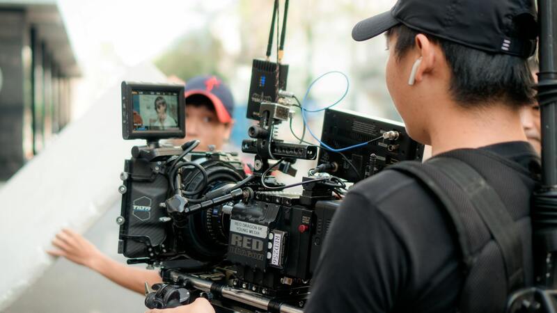
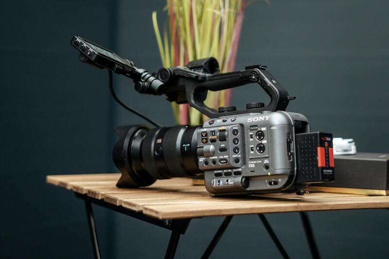
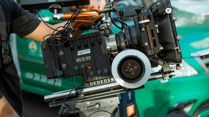
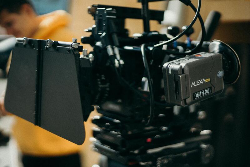
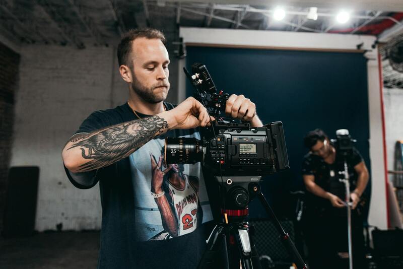
Achieving high-quality aerial property images relies heavily on selecting the appropriate equipment. Professional-grade tools are essential for capturing detailed, stable, and visually striking visuals that highlight the unique aspects of properties. The primary categories of equipment include multi-rotor drones, stabilizers, and high-resolution cameras.
Multi-rotor drones are the most common choice for aerial property photography. They offer agility and precision, enabling operators to navigate tight spaces and obtain dynamic angles. Modern drones are equipped with GPS stabilization, automatic flight modes, and obstacle avoidance sensors, which contribute to safety and shot accuracy. High-end models provide extended flight times and the capacity to carry professional camera systems, ensuring that aerial images are crisp and well-exposed.

High-Resolution Cameras and Gimbals
The backbone of quality aerial photography is a camera capable of capturing high-resolution images. Many professionals equip their drones with digital single-lens reflex (DSLR) or mirrorless cameras, which produce sharp, vibrant visuals. Gimbal stabilization technology is also crucial; it allows the camera to remain steady during flight, preventing motion blur and ensuring each shot is crisp. Advanced gimbals can adjust in real-time, compensating for drone movement and altitude changes.
Additional Accessories and Enhancements
- Filters: Neutral density filters help control exposure in bright conditions, maintaining image quality.
- LED Lighting: For low-light scenarios or detailed interior shots from aerial views, specialized lighting can be added.
- Flight Planning Software: Precise flight path planning and automated waypoint controls ensure comprehensive coverage and safe operations.
Utilizing these advanced tools enables operators to produce consistent, professional-standard imagery suited for premium property listings and marketing campaigns. The careful selection and maintenance of aerial photography equipment constitute the foundation for capturing compelling visual content that truly captures Miami’s diverse landscapes and architectural marvels.
Overview of Aerial Property Photography
Aerial property photography harnesses the power of drone technology to capture expansive and detailed images of real estate properties from a bird’s-eye perspective. By utilizing advanced unmanned aerial vehicles (UAVs), this method provides a comprehensive view of a property’s layout, surrounding environment, and architectural details, making it an invaluable tool for real estate professionals aiming to showcase homes and commercial properties effectively. The evolution of drone systems specializing in aerial imagery has revolutionized property marketing strategies, enabling agents and property owners to produce visually compelling content that stands out in a competitive market.
Benefits of Using Aerial Photography in Real Estate
Incorporating aerial imagery into real estate listings offers numerous advantages. First, it enhances the visual appeal of property advertisements by providing prospective buyers with a clear perspective of the property’s size, shape, and nearby amenities. Such images allow viewers to better understand the spatial relationships within a neighborhood, including proximity to schools, parks, and commercial centers.
Aerial property photos also facilitate an emotional connection by showcasing the property in its entirety, which is often unachievable through traditional ground-based photography. This broader vantage point can highlight landscaping features, outdoor living spaces, and unique architectural elements that may influence a buyer’s decision.
Furthermore, high-resolution aerial footage is a powerful marketing asset that can be used across multiple platforms, from online listing portals to social media campaigns. Its capacity to create immersive visual narratives helps real estate professionals attract more interest and ultimately close deals faster.
Enhancing Marketing Strategies with Drone Imagery
- Creates striking visual content that captures attention.
- Provides comprehensive property overviews for better client understanding.
- Allows for the highlighting of unique property features and surrounding amenities.
- Increases online engagement and listing visibility.
- Supports professional branding through consistent high-quality visuals.
Key Considerations for Professional Aerial Photography
Achieving the highest standards in aerial property photography requires specialized equipment, meticulous planning, and professional execution. Using high-resolution cameras mounted on stable drone platforms ensures sharp, vibrant images that accurately represent the property. Advanced stabilization technology, such as gimbals, plays a critical role in maintaining image clarity during flight, especially over complex terrains or windy conditions.
Operators should employ comprehensive flight planning software to map out optimal flight paths, maximize coverage, and ensure safety protocols are followed. This careful preparation results in consistent, high-quality imagery, capable of highlighting the true essence and appeal of each property.
Summary
In the competitive real estate landscape of Miami, aerial property photography serves as a game-changing asset. It enhances listings, attracts more prospective buyers, and helps properties stand out with vibrant, comprehensive visuals. By leveraging current technological advancements and professional drone services, real estate professionals can effectively communicate the unique features and value of their properties, ultimately leading to faster sales and higher returns.
Techniques for Capturing Effective Aerial Property Images
To maximize the impact of aerial property photography, applying specific techniques during the photo capture process is essential. Professionals often utilize advanced flight planning that considers optimal angles, lighting conditions, and timing to ensure each shot highlights the property's best features. Emphasizing natural sunlight during early morning or late afternoon hours can create warm, inviting visuals that accentuate the property's appeal. Additionally, employing high-dynamic-range (HDR) imaging techniques enables capturing details in both shadows and bright areas, resulting in well-balanced images that accurately depict the property's true character.
Utilizing varied flight angles and altitudes also enhances the visual storytelling. Overhead shots provide context and spatial relationships, while oblique angles can emphasize architectural design or landscape features. Implementing seamless panoramas or 360-degree views creates immersive experiences for potential buyers, fostering a deeper connection to the property. Consistent framing and composition, guided by professional pilot skills and state-of-the-art equipment, ensure each image aligns with marketing goals and maintains high visual standards.
It's vital to minimize movement and vibrations during flight to prevent image blur. High-quality stabilizing equipment like gimbals combined with precise drone control allows capturing crisp, detailed images even in challenging conditions. Establishing a stable hover before taking shots helps maintain image stability, ensuring clarity and sharpness. Repeatedly capturing multiple images from different vantage points provides options during post-processing, enabling selection of the most compelling visuals for marketing purposes.
Attention to detail extends beyond timing and composition. Ensuring the area is free of distractions such as moving vehicles, landscaping debris, or construction equipment enhances the overall visual appeal. Properly editing images to correct exposure, color balance, and contrast further refines the visuals, making them more attractive to prospective buyers.
Advanced Techniques to Elevate Property Visuals
- Implementing multi-layered shots—combining aerial footage with ground-level images for comprehensive viewports.
- Utilizing thermal and infrared imaging to reveal hidden features or landscape health, providing additional property insights.
- Employing fly-through videos and virtual tours to create dynamic presentations that engage viewers more effectively.
Mastering these techniques will significantly enhance the quality of aerial property imagery, making listings stand out and attracting more potential buyers by showcasing properties with clarity, vibrancy, and artistic precision.
Planning and Permitting for Aerial Shots in Miami
Executing aerial property photography in Miami requires thorough planning to ensure seamless operations and high-quality results. Prior to the shoot, a detailed assessment of the property and surrounding airspace should be conducted. This includes identifying potential obstacles such as neighboring structures, trees, power lines, and other air traffic that could interfere with drone operations. Mapping out optimal flight paths helps prevent accidental collisions and ensures comprehensive coverage of the property.
In Miami, specific flight regulations govern the use of unmanned aircraft systems, particularly in urban areas and near commercial zones. Engaging with local authorities or consulting with experienced drone service providers can facilitate obtaining the necessary clearances or permissions. This process involves providing technical details of the flight plan, including altitude, duration, and safety measures.
Weather considerations are also crucial, as high winds, rain, or fog common in Miami's subtropical climate can hinder drone flights or compromise image quality. Scheduling shoots during favorable weather windows minimizes disruptions and maximizes safety.
Additionally, understanding airspace restrictions around sensitive locations such as airports, government buildings, or crowded districts is vital. Employing geofencing technology integrated within aerial photography equipment helps prevent accidental entry into restricted zones.
Effective coordination with property owners or stakeholders ensures access to the site and aligns expectations regarding shot angles, timing, and scope. When working in protected areas, utilizing professional drone operators equipped with advanced navigation tools enhances safety and compliance.
Planning and Permitting for Aerial Shots in Miami
Effective aerial property photography in Miami begins with meticulous planning and adherence to the necessary procedures for obtaining permits. Miami’s vibrant urban landscape, dense development, and proximity to sensitive airspace zones require a comprehensive approach to ensure smooth operations. The process involves working closely with local authorities, property stakeholders, and experienced drone service providers to navigate specific requirements aimed at safeguarding public safety and managing airspace usage.
Engaging with the appropriate municipal agencies early in the planning process can streamline the permit acquisition. These agencies often require detailed documentation, including flight plans that specify the geographical coordinates, altitude restrictions, and flight duration. Precise mapping of the property and its surroundings aids in demonstrating how the aerial shots will be conducted without disrupting the local environment or infringing on restricted zones.

Key Steps in the Permitting Process
- Assessment of Airspace Restrictions: Identifying no-fly zones around airports, government buildings, and densely populated areas helps prevent complications. Miami International Airport and other flight-restricted zones are top considerations.
- Submission of Flight Plans: Providing detailed flight paths, safety measures, and emergency protocols ensures transparency and facilitates approval.
- Stakeholder Coordination: Collaborating with property owners, relevant municipal departments, and security agencies helps align expectations and obtain necessary consents.
- Weather Monitoring: Miami’s subtropical climate presents unpredictable weather patterns, including high humidity, storms, or fog, which can impact drone flights. Scheduling during optimal weather windows is crucial.
- Compliance with Local Regulations: Familiarity with Miami’s specific aerial operation guidelines, including altitude limits and no-fly zones, ensures adherence to best practices and smooth permit processing.
It’s vital to maintain open communication channels with all involved parties throughout the process. Experienced local drone operators often have established relationships with authorities and understand the nuances of Miami’s airspace, providing a valuable advantage in acquiring necessary permissions efficiently.
Post-permit approval, detailed pre-shoot site visits allow for final adjustments to planned flight paths and camera angles, ensuring the visuals captured meet marketing and promotional standards.
Planning and Permitting for Aerial Shots in Miami
Executing aerial property photography in Miami requires meticulous planning and adherence to established procedures that ensure seamless operation and high-quality results. The first step involves conducting a comprehensive site assessment to identify potential obstacles, no-fly zones, and safety considerations that could impact drone flights. Miami's diverse urban landscape, with its varying altitude restrictions and proximity to airports and helicopter routes, necessitates precise flight path planning to avoid interference with manned aircraft and sensitive areas.
Securing the appropriate permits is critical when operating unmanned aircraft systems within Miami’s airspace. This involves submitting detailed flight plans that outline the intended flight paths, altitudes, and operational times, along with safety protocols and emergency response measures. Local authorities and municipal agencies often require documentation demonstrating compliance with designated no-fly zones and restrictions around sensitive infrastructure and residential areas.
Effective stakeholder coordination ensures that all parties involved are aligned with the project scope. This includes engaging property owners, municipal departments, security personnel, and, if necessary, neighboring residents. Maintaining open lines of communication helps preempt issues and facilitates cooperation throughout the scheduling and execution phases.
Weather conditions represent another vital element in planning aerial photography sessions. Miami’s Subtropical climate can lead to rapidly changing weather, including periods of high humidity, thunderstorms, or fog, which pose risks to safe drone operations. Selecting optimal weather windows for flights is imperative to ensure clear visuals and safe flying conditions. Professional drone operators monitor weather forecasts closely and plan sessions accordingly, often utilizing real-time data to make informed decisions.
Additionally, understanding and respecting specific height restrictions and no-fly zones established by local aviation authorities prevent disruptions and ensure the safety of all airspace users. Familiarity with Miami’s geographic and regulatory landscape is crucial for smooth permit procurement and compliance checks. Building relationships with local authorities and airspace management agencies expedites the approval process, especially for frequent or large-scale projects.
Post-permit approval, site visits allow for final adjustments to flight plans, ensuring optimal vantage points and angles that highlight the property's best features. These on-ground assessments also assist in identifying any unforeseen challenges, such as obstructions or restricted areas, contributing to safer and more effective aerial shoots.
In essence, the planning and permitting phase is a detailed and strategic process that safeguards the quality, safety, and efficiency of aerial property photography within Miami’s unique environment. When executed correctly, these steps establish a solid foundation for capturing captivating visuals that elevate real estate marketing efforts.
Complying with Aerial Property Photography Standards in Miami
Acquiring aerial property images within Miami involves adhering to comprehensive procedures that uphold safety and image quality. Engaging with experienced aerial photography providers ensures that all operational protocols are followed meticulously, which includes pre-flight planning and real-time management of flight paths. These professionals conduct thorough site assessments to determine the best times of day for capturing optimal light conditions, minimizing shadows and glare that could detract from photo clarity.

Before flight execution, detailed assessments of the property and surrounding environment are carried out. This step is vital for identifying potential obstructions, such as power lines, trees, or nearby structures, that could interfere with drone or aircraft operations. Careful route planning ensures minimal disturbance to residents and compliance with local airspace regulations. Through a combination of technological tools like GPS mapping and flight planning software, operators map out the safest and most effective flight paths.
In addition to technical preparation, obtaining necessary approvals is a key aspect of legal operation. Miami's diverse urban landscape means that operators must be aware of specific no-fly zones around airports, helipads, and restricted airspace. Local authorities often require documentation and permits, especially for flights over densely populated or protected areas. Building cooperation and maintaining open communication channels with Miami’s aviation authorities streamline the process, allowing for swift approval and reducing delays in property marketing campaigns.
Implementing Precise Flight Operations
- Choosing flight times during optimal daylight hours for better visibility.
- Employing user-friendly obstacle avoidance technology to ensure drone safety.
- Monitoring real-time weather conditions to adapt the flight plan as needed.
- Planning specific flight altitudes to highlight property features effectively.
This meticulous approach guarantees that aerial assets are captured in accordance with the prescribed protocols, resulting in stunning visuals that accurately represent the property while safeguarding all stakeholders involved.
Post-Flight Procedures and Review
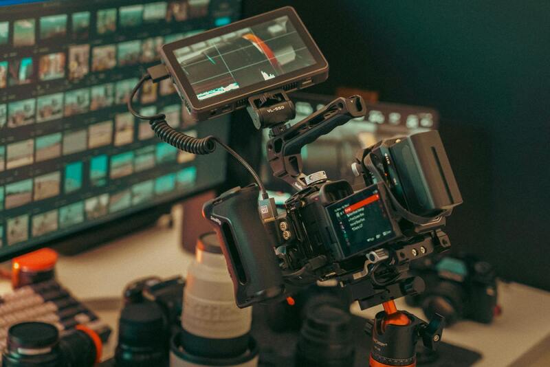
After the aerial session, high-resolution images are processed through professional editing workflows. Adjustments in color balance, contrast, and sharpness enhance the visual appeal and ensure consistency across marketing materials. Specialized software allows for the correction of lens distortions and the removal of any artifacts caused during flight.
Quality control is paramount in this stage, with multiple reviews conducted to select the best shots that showcase the property’s unique selling points. These images are then optimized for various digital platforms, ensuring maximum engagement and reach within Miami’s real estate market. Employing methodical post-production routines helps deliver polished visuals aligned with the strategic marketing objectives.
Adherence to comprehensive safety and quality standards in aerial property photography not only elevates the visual presentation but also reinforces a client’s confidence in the valuation and appeal of their Miami property. Employing legitimate techniques and maintaining transparency throughout the process fosters trust and positions real estate professionals as industry leaders who prioritize excellence in their marketing efforts.
