Overview of Aerial Property Photography
Aerial property photos are high-quality images captured from elevated vantage points, primarily utilizing remote-controlled aircraft such as drones. This innovative approach to real estate marketing offers prospective buyers a comprehensive perspective of a property and its surrounding environment. By elevating the view beyond traditional ground-level shots, aerial photography reveals features that might otherwise go unnoticed, such as property size, landscaping details, proximity to amenities, and overall neighborhood context.
The demand for aerial images in real estate has grown significantly due to their ability to enhance listings' visual appeal and provide a competitive edge in a crowded market. These images serve as powerful visual tools that facilitate an engaging narrative about a property, helping potential buyers understand spatial relationships, property layout, and landscape features from a bird’s-eye view. The strategic use of aerial property photos can also highlight features like large yards, pools, scenic views, and accessibility, which are highly valued by clients seeking premium properties.

For real estate professionals and developers, integrating aerial photos into property listings boosts visual storytelling, attracts attention online, and can significantly increase engagement rates. Whether showcasing a sprawling estate or a commercial property, aerial imagery offers a unique, captivating view that elevates marketing materials and generates interest from qualified buyers.
Aside from marketing benefits, aerial photography also plays a critical role in property planning, development, and management. It can assist in assessing land features, monitoring construction progress, or planning landscape improvements. As technology advances and drone equipment becomes more accessible, the quality and frequency of aerial property photos continue to improve, making them an essential component of modern real estate visualization strategies.
Legal and Regulatory Considerations in Miami
When planning to incorporate aerial property photos into real estate listings or promotional materials in Miami, it is essential to adhere to the local regulations governing the operation of aerial imaging equipment. These regulations are designed to ensure safety, privacy, and the responsible use of technology within urban and suburban landscapes.
Operators should conduct thorough research on Miami-Dade County and state-specific rules governing aerial photography activities. This includes understanding designated no-fly zones, restrictions around airports, heliports, and other sensitive areas. Certain regions within Miami might require permits or notifications prior to conducting aerial shoots, especially when operating within secure or protected zones.
Maintaining compliance with airspace restrictions is paramount. This often involves consulting the Federal Aviation Administration (FAA) guidelines, which govern drone flights across the United States. For commercial purposes, such as real estate marketing, obtaining necessary authorizations or waivers from the FAA ensures smooth operation and avoids potential legal issues.
Additionally, respecting individual privacy rights is vital. It is prudent to avoid capturing images that infringe upon private properties or personal spaces without necessary permissions. Employing a responsible approach not only safeguards privacy but also promotes good relations within the community.
Moreover, staying informed about evolving technology standards and local policies can help real estate professionals and aerial photographers remain compliant. Working with licensed and experienced operators who are well-versed in Miami’s specific requirements simplifies this process, reduces the risk of issues during or after a shoot, and ensures that the imagery produced adheres to all applicable guidelines.
In summary, successful deployment of aerial property photos in Miami relies heavily on a comprehensive understanding of local legal and regulatory frameworks. Engaging with qualified professionals who prioritize compliance not only streamlines the process but also enhances the integrity and professionalism of the resulting imagery. This approach ensures that the benefits of aerial photography—such as spectacular visual storytelling and increased market appeal—are fully realized without compromising safety or privacy standards.
Equipment and Techniques for Aerial Property Photography
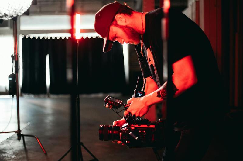
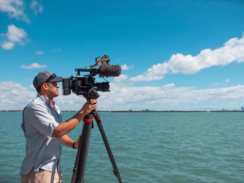
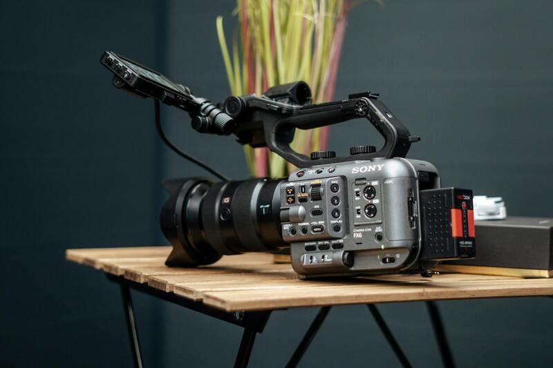
Achieving high-quality aerial property photos requires a combination of advanced equipment and refined techniques. The most effective drone platforms are equipped with high-resolution cameras capable of capturing sharp, detailed images that showcase the property’s features and surroundings. Professional-grade drones often include stabilization systems that eliminate blurring caused by wind or rapid movements, ensuring crisp visuals essential for marketing or documentation purposes.
When selecting a camera, sensor size, and lens specifications play a significant role in image quality. Wide-angle lenses are commonly used to encompass expansive views of properties and landscapes, while higher megapixel counts allow for detailed prints or large-format displays. ND filters can be employed to control exposure in varying lighting conditions, helping to enhance shadows and highlights in the images.
Operational techniques include pre-planning flight paths to optimize coverage and composition, ensuring the key aspects of the property are prominently featured. Utilizing panoramic or high-dynamic-range (HDR) imaging can create visually stunning results that highlight the property's best features while maintaining balanced exposure.
Additionally, pilots should implement best practices such as maintaining steady flight, avoiding sudden movements, and respecting safety protocols to prevent damage to equipment or the property itself. Post-flight, using specialized editing software enhances the images further, allowing for color correction, sharpening, and minor retouching to produce compelling visual content.
Legal and Regulatory Considerations in Miami
When conducting aerial property photography within Miami, adhering to established rules and guidelines is fundamental to ensure smooth operations and uphold professional standards. Ensuring proper planning and obtaining necessary permits when required contributes to a seamless process, allowing photographers to focus on capturing stunning visuals without undue concern.
Operators should familiarize themselves with the specific regulations governing drone flights in Miami, such as altitude restrictions, flight zones, and privacy considerations. Opting for authorization from relevant authorities when operating in areas with dense populations or near sensitive structures demonstrates a commitment to responsible filmmaking and documentation.
Maintaining accurate records of flight plans, permits, and safety checks can support transparency and accountability in your aerial projects. Conducting pre-flight assessments to identify potential hazards, such as weather conditions or restricted airspaces, minimizes risks associated with drone operations.
For aerial property photography in Miami, collaboration with licensed service providers who understand local rules ensures compliance and enhances the quality of results. Working with professionals attuned to the nuances of Miami’s cityscape and legal landscape allows for efficient scheduling, optimal flight paths, and high-resolution image capture.
It is also vital to prioritize safety at all times, including maintaining adequate distances from buildings and people, especially in busy urban settings. Skilled operators utilize advanced flight planning tools and real-time monitoring to avoid unintended incursions into no-fly zones or restricted areas.
Legal and Regulatory Considerations in Miami
When undertaking aerial property photography in Miami, it is essential to adhere to the specific operational guidelines established by local authorities. These regulations encompass a range of practices designed to ensure safe and responsible drone usage within the urban environment. Operators must be mindful of designated flight zones, which often include restrictions around airports, helipads, or sensitive infrastructures. Understanding these zones helps in planning routes that avoid inadvertent incursions into areas with heightened restrictions.
Altitude limitations are another crucial aspect to observe. Maintaining flight within prescribed height boundaries reduces the risk of interfering with manned aircraft operations or violating airspace regulations. Additionally, Miami’s dense urban landscape necessitates careful planning of flight paths to mitigate risks associated with flying near high-rise buildings or crowded public spaces.
Privacy considerations are a vital element in aerial property photography. Conducting flights with respect to neighboring properties and personal privacy not only aligns with best practices but also fosters a professional reputation for responsible aerial documentation. Operators should be aware of local privacy expectations and avoid capturing images in a manner that could be perceived as intrusive.
 igure>
Before executing any flight, comprehensive preparation—including the acquisition of necessary permits—ensures smooth operation. These permissions often involve submitting flight plans for review by local aviation authorities or urban planning departments. Working with experienced professionals familiar with Miami’s regulatory landscape streamlines this process and minimizes potential disruptions.
Maintaining meticulous records of each operation, such as flight logs, permits, and safety assessments, provides a transparent trail that supports compliance efforts. Pre-flight assessments—checking weather conditions, wind speeds, and potential hazards—are integral to safe and effective aerial photography sessions.
Involving licensed service providers with local expertise allows for consistent adherence to Miami’s operational standards. Such specialists possess a nuanced understanding of the city’s legal framework, urban density, and aerial safety protocols, enabling them to plan efficient flight paths that maximize image quality while respecting all regulations.
 igure>
Through diligent planning, informed FAA or local authority consultations, and strict safety protocols, aerial property photography in Miami can be successfully executed within the boundaries of established operational frameworks. This responsible approach underscores the professionalism and quality of the images captured, reinforcing the value of qualified service providers in the marketplace.
Legal and Regulatory Considerations in Miami
When undertaking aerial property photography in Miami, understanding and adhering to specific operational protocols is essential to ensure smooth execution and high-quality results. The city’s unique urban landscape, combined with its bustling airspace, necessitates meticulous planning and cooperation with relevant authorities. Engaging the right professionals who are well-versed in Miami’s aerial photography standards can significantly reduce potential hurdles, ensuring that each flight is performed ethically and responsibly.
Professionals operating in Miami typically follow stringent pre-flight procedures, including detailed planning of flight paths to avoid congested areas and sensitive zones. They also verify weather conditions thoroughly to prevent unsafe flight situations, such as high winds or sudden storms, which could compromise both safety and image quality. Prior to each operation, comprehensive safety assessments are conducted to identify hazards, such as power lines, tall structures, or restricted airspace zones.
Collaboration with experienced local service providers inherently includes navigation through Miami’s geographical and regulatory landscape. These specialists understand the city's urban density and avoid interference with busy air traffic routes, ensuring a seamless workflow. They also maintain detailed logs of each operation, documenting flight plans, permits obtained, safety checks, and weather conditions. Such records may be vital for review and demonstrating compliance during post-flight evaluations.
One critical aspect is obtaining all necessary permissions and authorizations before commencing drone flights. This process often involves submitting detailed flight plans to local authority departments for review and approval. These plans outline flight altitudes, times, and specific areas to be captured, helping to minimize disruptions and enhance safety. Engaging with local professionals who are familiar with Miami’s notification processes and permit acquisition expedites this process and fosters a smoother operation overall.

In addition to obtaining permissions, safety protocols, such as pre-flight inspections and real-time flight monitoring, ensure that aerial photography sessions proceed without incident. Crew members often include certified pilots who are adept at navigating complex flying environments while capturing precise, high-resolution images. Such professionalism not only ensures safety but also maintains the integrity of the photographic content captured during the mission.
Operational transparency, combined with diligent record-keeping and adherence to all Miami-specific regulations, ultimately leads to successful aerial property photography. This strategic approach underscores the importance of working with licensed and experienced service providers, aligning with local standards to produce stunning visuals that effectively showcase Miami’s real estate assets.
Equipment and Techniques for Aerial Property Photography
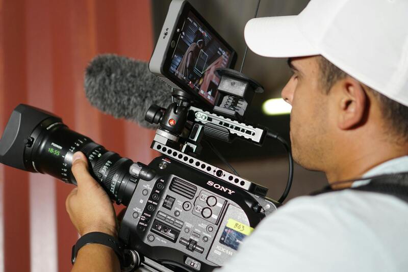
To achieve high-quality aerial property photos, professionals rely on advanced equipment coupled with proven techniques that ensure sharp, detailed images. The cornerstone of effective aerial photography is the use of unmanned aerial vehicles (UAVs), commonly known as drones, which are equipped with high-resolution cameras capable of capturing expansive views from various angles.
Selection of drone models is critical. Industry-standard drones for real estate applications often feature stabilized gimbal systems, multiple flight modes, and obstacle avoidance sensors. These features allow for smooth footage and safe operation in complex environments. Cameras with adjustable aperture, enhanced ISO capabilities, and wide-angle lenses can be configured to maximize image clarity under different lighting conditions.
In addition to drone equipment, photographers utilize auxiliary tools such as:
- GPS-based flight controllers for precise navigation and positioning
- Remote controllers with ergonomic grips for stability during flight
- High-capacity batteries to extend operational time
- Software for planning flight paths and managing camera settings
Techniques for capturing compelling aerial property images involve meticulous planning and execution. This includes considering optimal times for shooting—such as during sunrise or sunset to harness natural lighting— and assessing weather conditions to avoid wind or precipitation that could compromise image quality. Photographers often use pre-planned flight routes to systematically cover the property and surrounding areas, ensuring comprehensive coverage from multiple perspectives.

Utilizing advanced camera settings such as HDR (High Dynamic Range) and burst mode enhances the quality of images, capturing details in both shadows and highlights. Post-flight, images are reviewed for clarity, composition, and lighting, with edits applied to correct exposure or distortions as needed. The combination of sophisticated equipment and refined techniques ensures that aerial property photos meet the standards of recent real estate marketing demands.
Professional Techniques for Aerial Property Photography
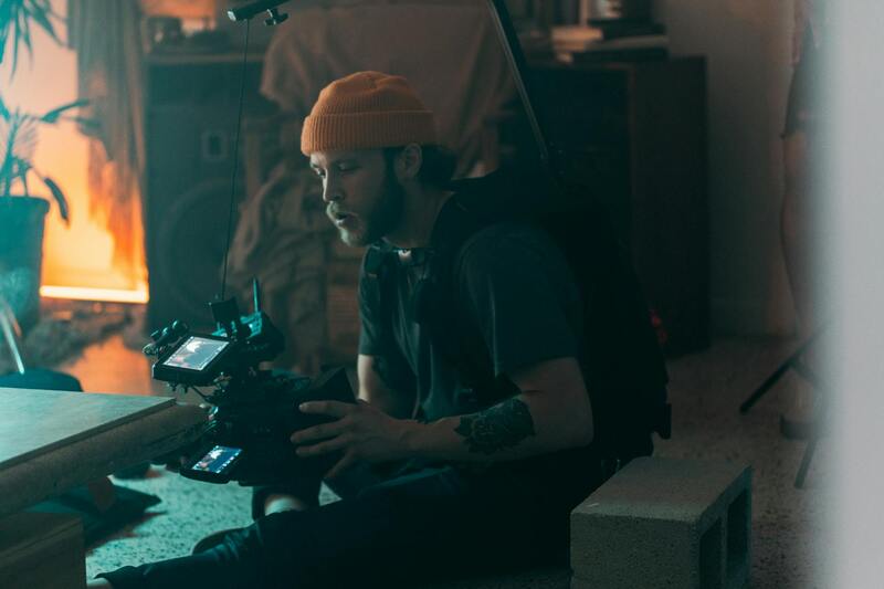
Achieving high-quality aerial property photos requires a combination of skillful operation and advanced technology. Experienced drone pilots deploy a systematic approach to capturing images that showcase a property’s best features, both for marketing and informational purposes. Meticulous planning begins with an understanding of the property layout and surroundings, allowing the photographer to determine optimal flight paths and angles that maximize visual impact. Critical factors such as lighting conditions, time of day, and weather are carefully considered to ensure the resulting images are vibrant, sharp, and free from unwanted elements like wind-induced shake or overexposure.
Preparation involves creating a detailed flight plan, often utilizing specialized software that maps out precise routes while respecting any designated no-fly zones. Filming during early morning or late afternoon can produce softer, more appealing lighting, emphasizing textures and depth in the landscape. Conversely, midday shoots may be useful for capturing the property in bright daylight, highlighting details such as roof textures and landscaping features. Weather assessment is essential; calm days with minimal wind and no precipitation result in steadier drone operation and clearer images.
High-resolution cameras on these drones capture a plethora of details from above, allowing for versatile marketing use. Techniques such as HDR imaging enable photographers to balance exposure across the entire frame, capturing details in shadowed areas without washing out highlights. Burst mode captures rapid sequences of images, ensuring that even in dynamic environments, the best moments are preserved. Once in post-processing, images undergo review and enhancement—adjusting contrast, brightness, and sharpness—to produce the most compelling visuals possible.
Advanced Equipment and Specialized Techniques
- Utilization of gimbal stabilization systems to minimize vibrations and produce steady footage
- Deployment of multi-axis stabilization technology for smooth panoramic shots
- Application of polarizing filters to reduce glare and reflections, especially on glass surfaces and bodies of water
- Use of high-capacity batteries and redundant power supplies to extend flight duration
These technical strategies and the proper handling of equipment culminate in aerial property photos that are both striking and informative—serving as an essential part of a successful real estate marketing campaign. Mastery of these methods ensures consistent, professional results that help properties stand out within competitive markets.
