Overview of Commercial Real Estate Drone Photography
In the competitive Miami real estate market, showcasing commercial properties with high-quality imagery is essential for attracting buyers, investors, and tenants. Commercial real estate drone photography has emerged as a transformative tool, offering a unique perspective that traditional photography cannot match. By utilizing advanced drone technology, real estate professionals can capture expansive views of property exteriors, surrounding landscapes, and strategic vantage points that highlight a property's size, layout, and location advantages.
Drone photography provides dynamic visuals that can significantly enhance marketing materials, including online listings, brochures, and presentations. This approach allows potential clients to virtually explore the property's scale and environment from multiple angles, fostering a stronger understanding of its market value and appeal. As Miami continues to grow as an international hub for commerce and industry, the demand for compelling visual content in commercial real estate has increased markedly.
The integration of drones in real estate marketing not only improves aesthetic appeal but also accelerates the decision-making process for clients by delivering clear, detailed images. These images can reveal property features hidden from ground-level views, such as rooftop amenities, large parking areas, and access points. As a result, commercial real estate professionals who leverage drone photography gain a competitive edge by showcasing their properties in a visually engaging manner that resonates with modern buyers.
Furthermore, the versatility of drone photography extends to capturing large-scale developments, construction progress, and land assessments. This comprehensive approach to visual representation is particularly vital in Miami, where coastal proximity and urban sprawl necessitate innovative marketing strategies. Staying ahead in this dynamic market involves utilizing high-quality, drone-captured imagery that not only highlights property features but also underscores the unique advantages of Miami's commercial landscapes.
Legal and Regulatory Considerations in Miami
In Miami, commercial real estate professionals engaging in drone photography must adhere to a comprehensive set of guidelines designed to ensure safe and compliant operations. Central to this framework are the regulations established by the Federal Aviation Administration (FAA), which oversee commercial drone usage across the United States. These regulations include registration requirements for drones weighing over 0.55 pounds, flight restrictions around sensitive areas, and the necessity for drone pilots to hold a Remote Pilot Certificate issued by the FAA.
Additionally, local restrictions specific to Miami and broader Florida laws further shape operational parameters. These can include altitude limitations, restrictions around urban and densely populated regions, and permissions required for flying near private properties or commercial establishments. It is advisable for commercial real estate entities to collaborate with licensed drone operators who possess an in-depth understanding of these regulations to mitigate risks and ensure seamless project execution.
Permits are often required for specific types of flights, such as those involving aerial videography or photography over private land, especially in areas with high population density or near critical infrastructure. Acquiring these permits typically involves submitting flight plans to relevant authorities, demonstrating compliance with safety protocols, and often coordinating with local law enforcement or municipal agencies. Proper planning and adherence to these procedures enable authorities to facilitate drone operations that support high-quality commercial property visuals, without disruptive incidents or policy violations.
In Miami's vibrant real estate market, the strategic use of compliant drone photography can significantly enhance a property's appeal while maintaining regulatory integrity. Engaging professional drone service providers familiar with local and federal laws ensures that all flights are conducted within established legal frameworks, thus safeguarding the interests of property owners and enhancing the overall reputation of marketing campaigns.
Equipment and Technologies Used in Drone Photography
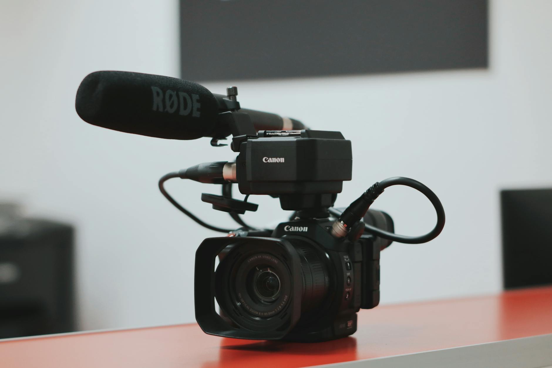
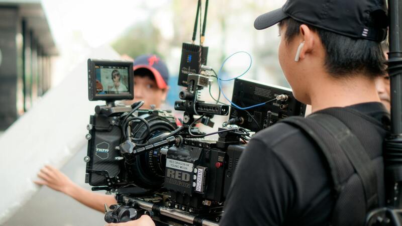
Achieving stunning and precise visual content for commercial real estate relies heavily on advanced drone technology and high-quality imaging equipment. Modern drone platforms are equipped with robust stabilization systems, ensuring smooth footage even in challenging wind conditions. Multi-rotor drones with GPS stabilization allow for precise navigation and positioning, which is essential when capturing the intricate details of commercial properties.
Cameras used in commercial real estate drone photography are typically mirrorless or digital single-lens reflex (DSLR) models, offering high resolution, excellent color accuracy, and broad dynamic range. These cameras are often mounted on gimbals, which eliminate vibrations and camera shake, resulting in crisp, sharp images and steady video footage.
 igure>
Accessories such as wide-angle lenses expand the field of view, capturing expansive shots of large properties in a single frame. ND filters are also commonly used to control exposure and maintain image quality in bright conditions, typical in Miami’s sunny climate. Additionally, accessories like extra batteries, signal range extenders, and protective casings ensure prolonged flight times and safety.
For data management and post-flight analysis, many operators utilize advanced flight planning software that allows for pre-programmed waypoint missions. These tools help in systematically covering large areas and obtaining consistent results. High-resolution imaging combined with efficient data processing pipelines translates into compelling marketing content that significantly boosts the visibility of commercial properties.
Equipment and Technologies Used in Drone Photography
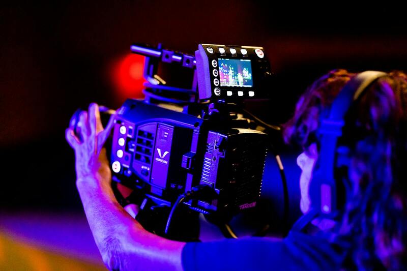
In the realm of commercial real estate drone photography, the selection of appropriate equipment is crucial for capturing high-quality imagery that effectively showcases properties. Typically, professional-grade drones are equipped with advanced flight stabilization systems, including GPS-assisted navigation and multiple rotors, which enable smooth and precise movements even in challenging weather conditions. These stabilization features are essential for maintaining steady footage and sharp images, particularly when highlighting the structural details of large commercial sites.
The core imaging component consists of high-resolution cameras, often mirrorless or DSLR models, optimized for aerial photography. These cameras are mounted on gimbals—specialized stabilization devices that counteract drone vibrations—ensuring the output remains clear and free from blur. The high resolution and excellent color fidelity of these cameras allow real estate professionals to produce captivating visuals that do justice to the properties’ grandeur and intricate features.

- Wide-Angle Lenses: These lenses expand the field of view, enabling the capture of expansive property layouts in a single shot. This is particularly useful for showcasing large commercial developments or industrial complexes.
- Neutral Density (ND) Filters: These filters are used to control brightness levels, especially in Miami’s sunny climate, ensuring optimal exposure and reducing glare during shooting.
- Extended Power Solutions: Extra batteries and signal range extenders are vital for prolonged flight sessions, allowing comprehensive coverage of large areas without interruptions.
- Protective Casings and Weatherproofing: Ensuring equipment safety from environmental elements such as heat, humidity, and dust is essential for maintaining operational reliability.
Post-flight workflows involve sophisticated flight planning and data management tools. Pre-programmed waypoint missions facilitate systematic coverage of extensive properties, while data processing software enhances image quality and prepares visuals for marketing use. These technologies integrate seamlessly to produce compelling visuals that can significantly elevate a property’s market appeal.
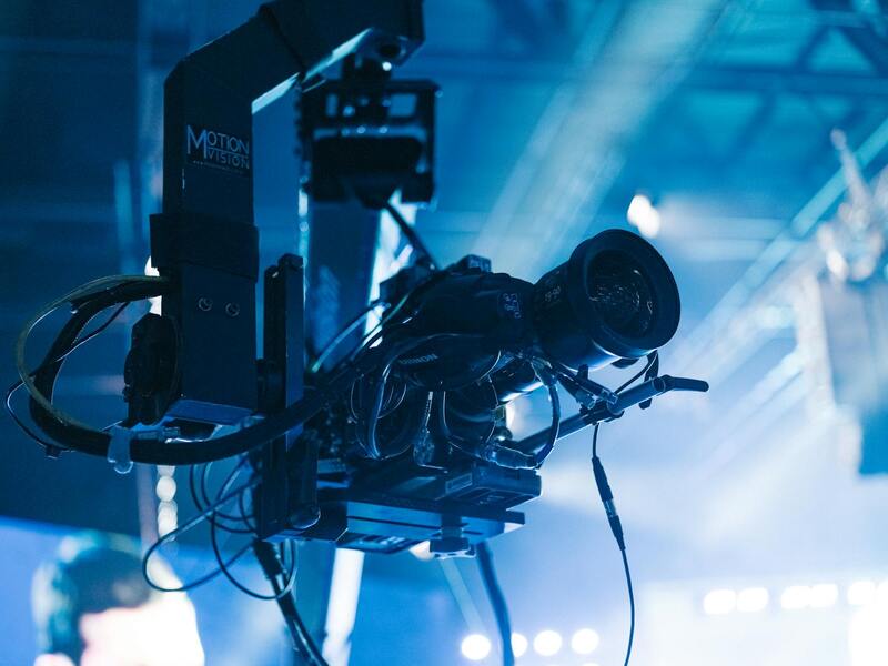
In addition to capturing still images and video footage, some drone systems offer thermal imaging and LiDAR capabilities, expanding the potential applications of aerial data collection. These technologies can assist in property inspection, environmental analysis, and site planning, providing comprehensive insights that benefit stakeholders across the commercial real estate sector.
Equipment and Technologies Used in Drone Photography
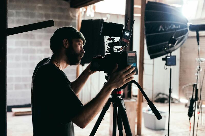
The success of commercial real estate drone photography relies heavily on the selection of advanced equipment and cutting-edge technologies. Modern drone systems are equipped with high-resolution cameras capable of capturing detailed images and smooth high-definition videos that are essential for professional property marketing. These cameras often feature features such as stabilization gimbals, which ensure blur-free footage even in challenging wind conditions, and adjustable apertures that allow precise control over exposure settings in varying lighting situations.
In addition to standard cameras, specialized imaging technologies have expanded the capabilities of drone photography. Thermal imaging cameras enable detailed analysis of building heat signatures, useful for energy audits or identifying insulation issues. LiDAR (Light Detection and Ranging) sensors are capable of creating high-precision 3D maps of large properties, providing valuable data for planning, development, and environmental assessments.

Powerful drones designed for extended flight time are equipped with high-capacity batteries and signal range extenders, allowing operators to cover expansive properties in a single flight session without interruption. These drones incorporate intelligent flight modes, such as waypoint navigation and obstacle avoidance systems, which improve accuracy and safety during complex shots around tall structures or crowded sites.
Moreover, weather-resistant enclosures and protective casings safeguard sensitive electronics from Miami’s humid climate, ensuring consistent performance regardless of environmental conditions. The integration of GPS and real-time data transmission enhances precision, letting operators optimize flight paths and capture comprehensive visuals efficiently.

The continuous evolution of drone hardware, combined with sophisticated software for flight planning and image processing, has set new standards in aerial visual documentation for commercial real estate. These innovations provide real estate professionals with reliable tools to gather high-quality visuals, produce accurate site models, and perform detailed inspections that inform investment decisions and marketing strategies.
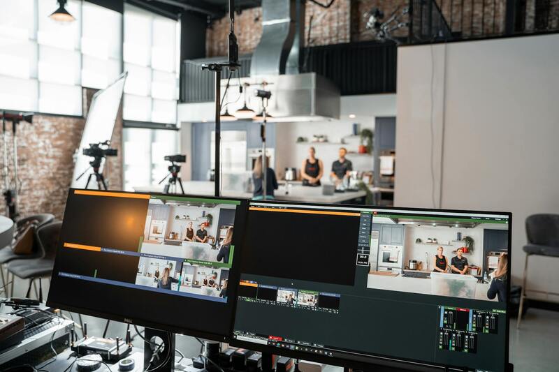
Post-Processing and Enhancing Drone Footage
Once raw footage has been captured through commercial real estate drone photography, the next critical step involves meticulous post-processing to maximize visual impact and informational value. High-quality editing ensures that the final presentation not only highlights the property's best features but also communicates key selling points effectively. Advanced editing techniques include color grading to enhance visual clarity and consistency, making structures appear more striking and environments more inviting.
Video stabilization plays a vital role in delivering smooth, professional-looking footage. This process mitigates any shakiness or jitter caused by drone movement or wind conditions, resulting in seamless visuals that engage viewers and foster confidence in the property's appeal. Furthermore, cutting-edge software can incorporate motion tracking to emphasize specific features, such as architectural details or landscaping elements.
Adding graphics and overlays is another essential component in drone footage enhancement. Informative annotations, property boundaries, and directional arrows can clarify site layouts and highlight key areas of interest. This visual augmentation supports precise communication, especially for potential investors, developers, and leasing agents who rely on clear and compelling property representations.

Beyond visuals, audio integration can also augment the overall presentation. Including background narration or onsite commentary provides context, explaining the property's strategic advantages or recent renovations. Transition effects and pacing are carefully applied to maintain viewer engagement, making virtual walkthroughs as immersive and informative as possible.
In practice, professional editing tailored to commercial real estate enables agents to craft comprehensive marketing materials. These include virtual tours, detailed listing videos, and detailed site analyses, which are essential for conveying full property value in competitive markets like Miami. Well-edited footage becomes a vital asset in online listings, presentations, and social media campaigns, amplifying outreach efforts and attracting qualified prospects.
Post-Processing and Enhancing Drone Footage
After capturing high-quality footage of commercial properties, the next critical step involves meticulous post-processing to maximize visual impact and clarity. Raw drone footage, while impressive, often requires adjustments to brightness, contrast, and color balance to ensure all aspects of the property are visually appealing and true to life.
Advanced editing software enables professionals to perform precise color correction, correcting for weather conditions and lighting inconsistencies encountered during filming. This ensures that renderings are vibrant, detailed, and capable of highlighting the property's best features, from expansive facades to intricate architectural details.
In addition to color grading, stabilization techniques are essential in removing any camera shake that may occur during drone operation. Smooth footage enhances viewer engagement and reflects a high level of production quality. Transition effects can be applied between shots to create seamless walkthroughs, offering potential clients or investors an immersive virtual experience of the property.
Graphics and overlays further augment the visual presentation. These include property boundaries, area measurements, and directional arrows that facilitate understanding of site layouts. Annotations can draw attention to specific amenities, structural features, or strategic locations within the property, aiding communication in marketing materials and presentations.
Incorporating audio elements can also significantly enhance the viewer's comprehension. Narration explaining the property's value proposition, recent renovations, or strategic advantages adds depth and context, making virtual tours more engaging and informative.
Transition effects, pacing adjustments, and thoughtful editing are critical in maintaining viewer interest, particularly during virtual walkthroughs of large or complex sites. These professional editing elements help craft compelling marketing videos that can be used across online listings, social media campaigns, and presentations, ultimately attracting qualified prospects and accelerating the sales or leasing process.
Furthermore, delivering polished content that aligns with the branding and messaging of the client ensures consistency and professionalism in all marketing efforts. High-quality post-processed footage stands out in the competitive Miami real estate market, offering a visually striking representation of commercial properties that appeals to investors, developers, and tenants alike.
Final Considerations for Commercial Real Estate Drone Photography in Miami
In Miami's dynamic commercial real estate landscape, leveraging drone photography is an essential component of modern marketing strategies. To maximize the potential of drone footage, property owners and real estate professionals must focus on selecting reputable service providers who adhere strictly to authorized operational practices. These providers employ advanced technologies and maintain rigorous standards to deliver high-quality visuals that accurately represent the property's features and surroundings.
Engaging with experienced Miami-based drone operators ensures access to state-of-the-art equipment, such as high-resolution cameras, stabilization gimbals, and intelligent flight systems. These tools enable capturing smooth, detailed footage that highlights architectural details, nearby infrastructure, and community amenities, providing prospective tenants, investors, or buyers with an immersive view of the property.

Collaborating with professionals also involves transparent communication about project scope, desired outcomes, and scheduling. Clear understanding of the property's unique selling points allows for tailored shoot plans that emphasize these aspects through different angles and aerial perspectives. Moreover, professional drone services include expert editing, color grading, and enhancement techniques that elevate raw footage into compelling visual narratives.
Post-Flight Review and Content Deployment
Once the flight session is complete, the editing process becomes crucial. High-quality post-production work refines lighting, stabilizes footage, and optimizes resolution to ensure the visuals are crisp and engaging. Incorporating strategic overlays, annotations, and branding elements can further enhance the video's impact, making it a powerful tool for presentations, online listings, and social media campaigns.
Properly optimized drone content also involves adhering to data management standards, ensuring secure storage, and delivering materials in formats compatible with various marketing platforms. Accurate, captivating, and compliant visuals are invaluable assets in attracting prospective clients and securing deals in Miami’s competitive commercial real estate market.
Overall, the investment in professional commercial real estate drone photography, executed by qualified Miami agencies, guarantees a superior promotional experience. The combination of cutting-edge technology, strategic planning, and skilled editing results in compelling visual content that effectively communicates the property’s value proposition and enhances its market visibility.
