Overview of Drone Photography for Houses
Drone pictures of houses have revolutionized the real estate industry by providing an innovative perspective that captures the full scope and context of a property. Unlike traditional ground-level photography, aerial images offer a comprehensive view of a home's exterior, surrounding landscape, and neighborhood environment. This panoramic perspective is invaluable for showcasing large estates, expansive gardens, or unique architectural features that might otherwise be difficult to capture effectively.
High-quality drone photography elevates property listings, attracting more potential buyers and making properties stand out in a competitive market. By integrating aerial images into online listings, real estate agents can provide a more engaging visual narrative, demonstrating aspects such as property size, outdoor amenities, driveway layouts, and proximity to local attractions. These images serve as a dynamic introduction, creating a lasting impression and fostering greater interest among prospective buyers.
To maximize their impact, drone photography often combines various angles and heights, revealing intricate architectural details and landscaping. The strategic use of aerial imagery also assists real estate professionals in marketing properties efficiently and effectively, making the visual content a key component of modern real estate campaigns.
While integrating drone images enhances marketing efforts, it requires careful planning, professional operation, and adherence to established standards for aerial photography. When executed properly, drone pictures not only improve visual storytelling but also contribute to faster sales and higher property values, confirming their vital role in contemporary real estate marketing strategies.
Legal Regulations and Permits in Miami
When engaging in drone photography of homes within Miami, it is essential to be aware of the established procedures and requirements that govern aerial imaging activities. Drone operators must obtain the necessary authorizations to ensure their operations align with regional standards. In Miami, this involves adhering to specific guidelines issued by local authorities and overseeing agencies responsible for aerial safety and airspace management. Prior to conducting drone flights, operators are advised to secure permits that specify the intended use, flight paths, and altitude restrictions. These permits are designed to facilitate safe and responsible drone usage in residential areas, especially where property privacy and community standards are prioritized.
In addition to obtaining permits, drone pilots should be familiar with Miami's operational zones and restricted airspace. Certain zones around sensitive locations such as airports, government buildings, or densely populated neighborhoods may require additional permissions or be entirely restricted from aerial photography. Strategies for compliance include conducting pre-flight assessments, submitting detailed flight plans, and maintaining communication with local authorities when necessary. Maintaining thorough documentation of permits and flight logs ensures accountability and smooth coordination during each project.
Best Practices for Drone Photography in Residential Settings
To produce high-quality aerial images that meet professional standards, it is essential to implement best practices that respect local restrictions while maximizing visual appeal. This involves meticulous planning of flight routes, choosing optimal times of day, and selecting appropriate camera settings. Early morning or late afternoon lighting, often called golden hour, enhances the aesthetic quality of images by providing softer shadows and warm tones. Utilizing high-resolution cameras with stabilizers allows for sharp, clear images that highlight the property's architecture and landscape features.
When capturing drone pictures of houses, the following principles should be observed:
- Height and angle considerations: Varying perspectives provide comprehensive views, from close-up details to expansive property overviews.
- Consistent image framing: Maintaining steady framing ensures a cohesive visual story for marketing materials.
- Environmental awareness: Monitoring weather conditions helps avoid issues caused by wind or rain that could compromise image quality or flight safety.
- Privacy respect: Avoid capturing neighboring properties or private areas unless explicit permission has been obtained.
Technology and Equipment Selection
Procuring the right drone hardware and accessories is fundamental for achieving professional-grade images. Multi-rotor drones equipped with high-definition cameras and GPS stabilization systems are preferred for residential photography. This combination provides the flexibility to capture both wide-angle shots and detailed close-ups with minimal distortion. Additionally, drones featuring obstacle avoidance sensors enhance safety during flight, especially in complex residential environments.
Investing in quality camera lenses, such as wide-angle or zoom lenses, allows for versatile shot composition. Pairing this hardware with software tools for flight planning and image processing streamlines the workflow and ensures precise, repeatable results. For optimal outcomes, operators should regularly update firmware, calibrate sensors, and perform routine maintenance to maintain equipment reliability.
Legal Regulations and Permits in Miami
Operating drone images of houses within Miami necessitates adherence to specific operational protocols and obtaining essential permits to ensure smooth and compliant usage. Drone operators must familiarize themselves with local ordinances and airspace regulations that govern the use of unmanned aerial vehicles (UAVs) in urban and residential areas. These regulations often specify altitude limits, no-fly zones, and restrictions related to privacy and property rights. Securing permits typically involves submitting detailed flight plans and ensuring the UAV is equipped with appropriate safety features.
For residential properties, especially in densely populated neighborhoods, permission from property owners is a prudent step. While formal permits may be required for commercial drone operations, obtaining clear consent from homeowners can prevent misunderstandings and streamline the process. It’s also advisable to schedule flights during times that minimize disturbance to residents and to communicate intentions clearly beforehand.
Various local authorities provide guidelines on drone flight operations, and staying updated on any changes to these regulations is essential for continual compliance. Registering drones with relevant agencies and maintaining proper documentation of flight plans and permits not only facilitates legal operations but also demonstrates professionalism in the field of aerial photography. Proper adherence to these protocols ensures that drone photography projects conducted for residential properties are executed smoothly and peacefully.
Ultimately, understanding and navigating the legal landscape in Miami helps secure the necessary permissions, reduces potential disruptions, and provides a foundation for producing high-quality drone images of houses that meet all safety and procedural standards.
Professional Equipment and Techniques for Capturing Drone Pictures of Houses
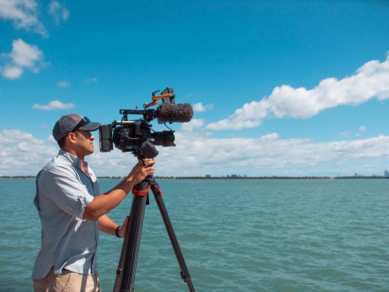
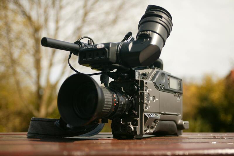
Achieving high-quality drone pictures of residential properties requires the right combination of advanced equipment and refined techniques. When selecting a drone for home photography, cameras with high-resolution sensors—preferably 4K or higher—are preferred to capture detailed images that showcase a property's best features. Gimbals offering 3-axis stabilization are essential to ensure smooth, distortion-free footage and photographs, particularly when dealing with windy conditions or uneven terrain.
Beyond the drone hardware, consider accessories like wide-angle lenses to encompass expansive views of property layouts or specialized filters such as polarizers to enhance clarity and reduce reflections from windows or water features. Proper battery management and redundant power supplies guarantee uninterrupted shooting sessions, which are crucial for capturing all desired angles efficiently.
Technique-wise, drone pilots should focus on optimal flight angles that complement the architecture of the house, emphasizing unique features like rooftop designs, elegant landscaping, or outdoor amenities. Light plays a decisive role; scheduling shoots during the golden hours—early morning or late afternoon—ensures soft, warm lighting that highlights colors and textures without harsh shadows.
Flying at different altitudes allows for a comprehensive portfolio—close-up shots focusing on intricate exterior details, medium-range images capturing the entire property, and aerial views to portray the estate within its environment. Automated flight paths can streamline the process, ensuring consistent framing and coverage of the property site.
Post-flight, the images should undergo careful editing to correct exposure, enhance colors, and remove any distracting elements captured unintentionally during the flight. Consistent editing standards across a portfolio of images create a cohesive visual narrative, elevating the property’s appeal for prospective buyers or listings.
Advanced Techniques for Capturing High-Quality Drone Pictures of Houses
Achieving striking drone images of residential properties requires meticulous planning and an understanding of advanced photography techniques. Beyond basic flying skills, professional drone operators employ various methods to ensure each shot accentuates the property’s best features and provides prospective buyers with compelling visual narratives.
Optimal Flight Planning and Angles
Effective drone photography begins with thorough flight planning. This includes selecting precise altitudes and angles that highlight architectural details such as roof design, façade textures, and landscape features. Flying at different heights provides diverse perspectives — lower altitudes to emphasize detailed craftsmanship and upper ones for sweeping wide-angle views of the property and its surroundings.
Moreover, adjusting the pitch and orientation of the drone helps capture both frontal and oblique shots, creating depth and dimension that static images cannot achieve. Techniques like orbiting around the house or conducting vertical ascents and descents can produce dynamic perspectives aligning with the house's visual narrative.
Lighting and Timing Strategies
Light quality dramatically influences drone images. To maximize visual impact, flights are often scheduled during the golden hours — shortly after sunrise or before sunset — when soft, diffused sunlight enhances colors and minimizes shadows. Proper timing accentuates the property’s architectural features, landscaping, and outdoor amenities, making the images more inviting and vibrant.
Utilizing Advanced Camera Settings
Professional-grade drones equipped with high-resolution cameras enable manual adjustments for exposure, ISO, and shutter speed. Fine-tuning these settings ensures clarity in varying light conditions and reduces issues like glare or overexposure. Additionally, employing ND filters can help manage reflections and achieve proper motion blur effects, adding cinematic quality to the shots.
Executing Complex Flight Path Techniques
Modern drone technology allows for automated flight paths that consistently cover the entire property with minimal operator input. Pre-programmed waypoints facilitate comprehensive shooting sequences, capturing multiple angles around the house seamlessly. These standard flight plans are especially useful for producing a homogenous set of images suitable for real estate marketing and virtual tours.
Repetitive flight paths combined with high-precision GPS tracking minimize discrepancies, ensuring that each photo aligns perfectly with previous shots, which is critical in creating a polished, professional presentation of the property.
Post-Processing Enhancements
After capturing the images, dedicated editing processes further elevate their quality. Techniques such as color correction, exposure adjustment, and sharpness enhancement help produce realistic and appealing visuals. Removing minor distractions or artifacts captured during flights also contributes to a clean, professional look. When properly processed, drone photographs of houses serve as impactful tools in real estate listings, helping properties stand out in a competitive market.
Effective Techniques for Capturing High-Quality Drone Pictures of Houses
Achieving exceptional drone imagery of residential properties involves a combination of precise planning, optimal equipment, and advanced flight techniques. The process begins with meticulous site assessment to determine the best angles and flight paths that highlight the property's unique features. Photographers often rely on high-resolution cameras mounted on drones equipped with gimbals to ensure stability and clarity throughout the shoot.
One fundamental method is the use of automated flight plans, which involve pre-programming waypoints to systematically cover different angles and elevations of the house. This approach guarantees comprehensive coverage and consistent image quality, reducing the chance of missed details or uneven lighting conditions. By setting predefined paths, operators can focus on fine-tuning camera settings such as aperture, shutter speed, and ISO for optimal results under varying light conditions.
Optimal altitude selection plays a crucial role. Flying at higher elevations captures the entire property—including surrounding landscaping and neighboring structures—while lower altitudes allow for detailed close-up shots of architectural elements. Incorporating different angles, such as linear, oblique, and top-down perspectives, offers a versatile portfolio of images that enhance visual interest and provide potential buyers with a comprehensive view of the property.
Executing smooth, controlled flight maneuvers minimizes motion blur and jitters. Skilled pilots utilize advanced stabilization features in their drones to maintain steady shots, even in slightly windy conditions. Additionally, employing specific camera settings like a narrow aperture reduces depth of field issues, while appropriate shutter speeds prevent motion artifacts during movement.
Post-Flight, the significance of image processing cannot be overstated. Techniques such as HDR (High Dynamic Range) imaging help balance exposure across varied lighting conditions, revealing details in shadows and highlights. Ensuing editing workflows typically include color correction, cropping, and perspective adjustments to deliver crisp and visually compelling photographs that accurately reflect the property's features.
By adhering to these detailed techniques, real estate professionals and property owners can leverage drone photography to create persuasive visual narratives. The resulting images are invaluable assets for marketing campaigns, virtual tours, and online listings, capturing attention and facilitating quicker sales by providing prospective buyers with a vivid, accurate portrayal of the home from every enticing angle.
Choosing the Right Drone Equipment and Photography Techniques
High-quality drone images of houses require more than just a capable drone; it involves employing advanced equipment and refined techniques to produce stunning visuals that highlight the property's best features. To capture compelling imagery, professionals need drones equipped with high-resolution cameras, gimbals for stabilization, and versatile flight controls.
Modern drone cameras often feature sensors with 20MP or higher, providing crisp detail essential for both online listings and printed marketing materials. A drone equipped with a 3-axis gimbal ensures steady shots by compensating for drone movement, eliminating blurriness, and maintaining image clarity even in challenging wind conditions.
Operational techniques such as optimal altitude selection, preferred shooting angles, and precise camera settings contribute significantly to image quality. For example, using manual exposure settings allows for better control over lighting conditions, ensuring the property's features are neither overexposed nor underexposed. Shooting in RAW format provides maximum flexibility during post-processing, allowing for detailed adjustments to color, contrast, and exposure.
Techniques such as flying at different heights and angles help showcase various aspects of a property, from expansive aerial views to detailed shots of architectural elements. Implementing intelligent flight plans allows for efficient coverage and consistent image quality, especially when capturing complex or large properties. Additionally, employing software for automated flight paths ensures smooth, repeatable shots, which are crucial for creating seamless virtual tours or marketing videos.
Post-flight, the emphasis shifts to meticulous editing to enhance the raw images. Color grading, perspective correction, and HDR processing help balance exposure and accentuate the property's aesthetics. Skilled editors can also remove unwanted reflections or distracting elements from the scene, ensuring the final images are polished and professional.
By integrating state-of-the-art equipment with strategic shooting and thorough post-processing, real estate professionals can maximize the visual impact of drone images. These photos serve as powerful tools to attract potential buyers, providing them with immersive, detailed perspectives of homes from vantage points that traditional photography cannot achieve. precision in execution through careful selection of equipment and techniques is the foundation for creating compelling real estate imagery that stands out in competitive markets.
Effective Strategies for Capturing Drone Pictures of Houses in Miami
To maximize the visual appeal and informational value of drone images, professionals employ a combination of the latest technology and refined techniques. Selecting the appropriate aerial platforms involves considering camera specifications, flight stability, and operational endurance—ensuring high-resolution images are captured with minimal distortion and optimal clarity. Advanced drones equipped with gimbals allow for smooth, steady shots that faithfully represent architectural details and surrounding landscapes, even in challenging weather conditions.
In terms of flight planning, defining precise altitudes, angles, and paths based on the property's features ensures comprehensive coverage. Utilizing pre-programmed flight routes and automated waypoint management enhances efficiency, reduces human error, and maintains consistent image quality across multiple shoots. Professionals often employ software solutions that allow for detailed planning and repeatability, which is especially valuable when creating virtual tours or updating marketing materials.
Optimal Shooting Techniques for Impressive Home Imagery
- Vertical and oblique shots: Combine direct overhead images with angled perspectives to showcase property layouts and architectural details.
- Time-of-day considerations: Capture images during the golden hour—shortly after sunrise or before sunset—for warm lighting and soft shadows that enhance home features.
- HDR imaging: Use High Dynamic Range techniques to balance bright skies and shaded areas, ensuring detailed and vibrant images.
- Multi-altitude captures: Vary flight heights to provide both sweeping aerial views and detailed close-ups of specific features like landscaping, pools, or decorative elements.
Post-flight, the editing process emphasizes fine-tuning images to optimize their visual impact. Techniques such as perspective correction eliminate distortions caused by wide-angle lenses, while color grading adjusts tones to create a cohesive and appealing look. HDR merging enhances contrast and detail, ensuring both shadows and highlights are well-defined. Removing distracting elements, like reflections or unintended objects, further refines the images, resulting in polished visuals suitable for sophisticated marketing platforms.
Complementing Techniques and Industry Standards
When combined with strategic planning, the use of cutting-edge equipment, and expert editing, drone images become powerful tools for real estate professionals. They provide potential buyers with immersive virtual views of the property, highlighting unique features and the surrounding environment. These images also support a range of marketing strategies from online listings to print advertisements, ultimately expanding reach and engagement.

