Overview of Drone Property Photography
Drone property photography involves the use of unmanned aerial vehicles (UAVs) equipped with high-resolution cameras to capture comprehensive visual representations of real estate properties from the air. This innovative approach enhances traditional photography by providing unique perspectives that showcase a property's extent, layout, and surroundings with striking clarity. The importance of drone photography in Miami's real estate market cannot be overstated, as it significantly elevates the presentation of property listings, making them more attractive to potential buyers.
By utilizing drone technology, real estate agents and property owners can capture sweeping views of residential and commercial properties, surrounding landscapes, neighborhoods, and access points. Such images deliver a sense of space, scale, and context that ground-level photos often cannot achieve alone. For properties in Miami—known for its vibrant neighborhoods and scenic waterfronts—drone imagery offers a compelling visual narrative that can help properties stand out in a competitive market.
Remarkably, drone property photography not only improves the visual appeal of listings but also facilitates quicker sales by providing an immersive experience for prospective buyers. They can virtually explore the property's exterior and surroundings, gaining valuable insights into its features and benefits. This immersive quality enables real estate professionals to highlight property's unique characteristics, such as expansive yards, swimming pools, waterfront access, and nearby amenities—all captured beautifully from above.
In the Miami real estate scene, where properties often boast luxurious outdoor spaces and scenic views, drone photography has become an essential tool for effective marketing. For sellers, it increases visibility and desirability; for buyers, it offers an accurate and captivating depiction of what the property entails. As a result, drone property photography has rapidly gained prominence as a best practice in modern real estate marketing strategies across Miami and beyond.
Legal and Regulatory Considerations
For property professionals utilizing drone technology in Miami, adherence to established operational protocols is vital to ensure seamless integration into marketing activities. While the focus remains on utilizing responsibly operated UAVs, understanding the framework within which these devices are employed is crucial for maintaining professional standards and client trust.
In Miami, drone operations are governed by a combination of federal, state, and local guidelines. These regulations specify the requirements for drone pilots to operate aircraft safely and ethically. Professional drone operators typically obtain certification through authorized agencies, which involves demonstrating knowledge of airspace rules, safety procedures, and operational best practices. Such certification verifies that operators possess the skills necessary to execute flight plans without compromising safety.
Moreover, operators must familiarize themselves with designated airspace classifications in Miami, including any restrictions around airports, classified wildlife areas, or densely populated zones. These restrictions are in place to prevent interference with manned aircraft and to safeguard public welfare. Prior to any shoot, a detailed flight plan should be devised that respects these contextual boundaries and ensures compliance with all applicable signage and arcades.
Beyond operational compliance, privacy considerations are an integral aspect of conducting aerial photography responsibly. Content capturing must avoid encroaching on private residences or commercial properties without permission. Best practices include obtaining client approval, clearly defining shoot boundaries, and respecting individuals' privacy rights. When working in densely populated areas or near private properties, effective communication with property owners and obtaining necessary permissions enhances transparency and minimizes misunderstandings.
Safety remains a core component of drone use for property photography. Ensuring all equipment is regularly inspected and maintained reduces the risk of malfunction during flight. Additionally, having clear safety protocols, including emergency procedures, protects both operators and bystanders. Insurance coverage further solidifies responsible practices, offering financial protection in case of unforeseen incidents.
Ultimately, lawful drone photography in Miami is achieved through meticulous planning, adherence to operational regulations, and a commitment to safety and privacy. Professionals who incorporate these principles uphold their reputation and provide clients with high-quality, compliant visual content that elevates real estate marketing efforts.
Key Equipment and Technology
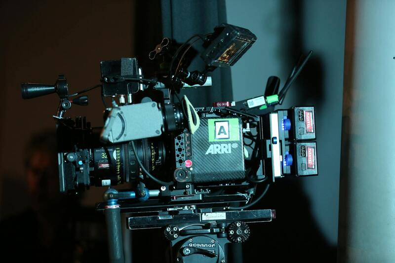
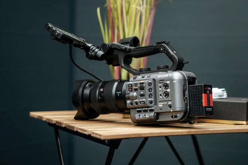
Securing the right equipment is essential for producing exceptional drone property photography that highlights the full potential of a property. High-performance drones equipped with advanced stabilization systems and powerful sensors enable capturing sharp, high-resolution images from various angles. The selection of camera payloads is equally critical; professional-grade cameras with wide-angle lenses facilitate sweeping shots that provide comprehensive views of properties, while macro lenses can be attached to capture intricate details like architectural features or landscaping elements.
To maximize image quality, drones should feature high dynamic range (HDR) capabilities, which improve the clarity and depth of photographs taken in complex lighting conditions. Multi-directional gimbal stabilization ensures smooth, vibration-free captures even during windy conditions or complex flight paths. Accessories such as spare batteries, propeller guards, and remote controllers with real-time feedback enable operators to conduct efficient shoots with minimal disruptions.
Furthermore, integrating software tools for flight planning and GPS waypoint navigation enhances operational precision. These platforms allow pre-programming flight paths to systematically cover all desired perspectives, ensuring no critical angles are missed. Real-time image transmission systems provide immediate feedback during shoots, allowing for on-the-spot adjustments. Such technological advancements ensure that drone property photography can meet the high standards required for professional real estate marketing and promotional materials.
Legal and Regulatory Considerations
When engaging in drone property photography, understanding and adhering to established protocols is essential for smooth operation and professional reliability. Operators should ensure they are familiar with the specific guidelines governing drone use within the region, including restrictions on altitude, flight zones, and privacy boundaries. Obtaining necessary permissions often involves coordinating with local authorities or property owners to schedule shoot times that align with community standards and minimize disruptions.
It is also important to conduct thorough risk assessments prior to each shoot. This includes evaluating the site for potential hazards such as power lines, tall structures, or crowded areas that could interfere with safe drone operation. Ensuring the drone is equipped with reliable safety features, like automatic return-to-home functions and obstacle avoidance sensors, can mitigate unforeseen issues during flight.

Operators should also maintain up-to-date certifications or licenses if required by governing bodies. These credentials demonstrate a commitment to safe and ethical drone practices, fostering trust with clients and property stakeholders. Implementing comprehensive operational protocols, including pre-flight checklists, clear communication with team members, and contingency plans for weather or equipment failures, are vital components of a responsible approach to drone property photography.
Key Equipment and Technology
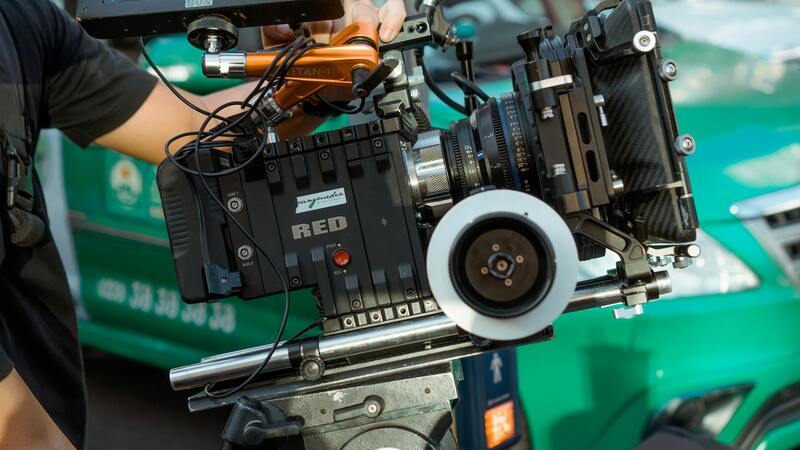
Utilizing the right tools is fundamental to capturing compelling aerial views of properties. High-quality drones equipped with stabilized gimbal cameras ensure steady, clear images even in challenging conditions. Cameras with HDR capabilities and wide-angle lenses allow for expansive shots that showcase a property’s full scope, from landscaped gardens to architectural features. Macro lenses can also be employed to highlight intricate design elements or landscaping details, adding depth to the visual presentation.
Modern drone systems often include features like GPS waypoint navigation for precise flight planning, enabling systematic coverage of all angles without manual control. Real-time image transmission enhances workflow efficiency by providing immediate visual feedback, allowing quick adjustments to framing or angles. Accessories such as spare batteries, propeller guards, and remote controllers with intuitive interfaces support smooth operations, reducing downtime and maximizing productivity.
Integration of software for flight planning and automatic waypoint programming allows for pre-mission rehearsals, making shoots more predictable and comprehensive. As a result, drone operators can achieve consistent, professional results that elevate property marketing efforts and create engaging content for various platforms, from website galleries to social media campaigns.
Legal and Regulatory Considerations for Drone Property Photography
Engaging in drone property photography within Miami requires adherence to specific operational guidelines that ensure safety and professionalism. Licensed drone operators typically secure certifications that certify their compliance with prevailing standards, demonstrating their proficiency in handling drone systems responsibly. These certifications often involve completing rigorous training programs that cover airspace regulations, safety protocols, and operational best practices.
Operational approvals involve understanding designated airspace zones and restrictions, particularly around residential and commercial areas. Proper planning ensures flights are conducted within authorized boundaries, minimizing disruption and maintaining safety. Many professionals utilize pre-flight planning tools to identify flight zones, avoid restricted areas, and establish safe distances from people and properties.
Data management is another crucial aspect. Handling imagery and video content responsibly includes securing files against unauthorized access and ensuring that sensitive property details are protected. A comprehensive approach to data security reflects a commitment to client confidentiality and professional integrity.
Weather conditions also influence flight planning. Weather assessments are performed to verify suitable conditions—avoiding high winds, rain, or fog—to achieve clear, sharp images and prevent mishaps that could compromise safety or image quality.
Lastly, drone operators often hold liability insurance, which provides coverage for potential accidents or property damage during shoots. This protection reassures clients and upholds a high standard of accountability, fostering trust and confidence in professional drone services.
[Image Placeholder] 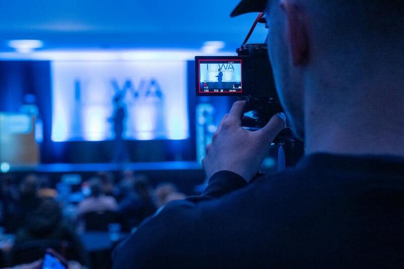
Adherence to Official Procedures for Drone Property Photography
Implementing drone property photography involves meticulous adherence to established processes that emphasize professionalism and safety. Before conducting any flight, operators should thoroughly review the designated flight zones and obtain necessary clearances for specific locations. This ensures that flights are executed within authorized airspace, respecting boundaries around private properties, commercial areas, and sensitive zones.
Pre-flight planning is critical and typically includes comprehensive site surveys. These surveys help identify potential obstacles such as power lines, trees, or structures, and plan optimal flight paths for capturing high-quality imagery. Using advanced planning tools allows operators to visualize flight routes, set appropriate altitudes, and avoid restricted zones, thus enhancing safety and efficiency.
Operators are also responsible for securing any required permissions from property owners or relevant authorities. Clear communication facilitates cooperation and helps prevent misunderstandings. Maintaining records of approvals and flight logs demonstrates adherence to procedural standards and contributes to transparent operations.
Operational safety protocols should be strictly followed, including conducting pre-flight checks on all drone components—batteries, rotors, sensors—and verifying weather conditions. Monitoring wind speeds, visibility, and other atmospheric factors ensures the success of the shoot while safeguarding the drone and nearby structures.
During flight execution, maintaining a safe distance from bystanders and neighboring properties minimizes risks. Professionals often employ real-time monitoring systems and have contingency plans ready for unexpected circumstances, such as sudden weather changes or technical malfunctions. These measures uphold high standards of accountability and professional responsibility.
Post-flight procedures include comprehensive data management, where imagery and footage are securely stored and backed up. This step not only preserves the quality of captured content but also ensures that sensitive property visuals are protected against unauthorized access. Documenting each phase of the operation—from planning to post-processing—supports a structured, professional workflow that aligns with best practices in drone photography.
By consistently following these disciplined procedures, drone operators deliver reliable, high-quality property images that meet industry standards and client expectations. Such due diligence fosters confidence and demonstrates a commitment to excellence in the evolving field of drone property photography.
Legal and Regulatory Considerations
For professionals engaged in drone property photography, adherence to established operational standards is crucial. This involves understanding the procedures and restrictions that govern drone usage to ensure seamless, compliant operations. Maintaining records of flight plans, maintenance logs, and safety protocols contributes not only to operational efficiency but also to building credibility with clients and stakeholders. Regularly updating knowledge of regional airspace rules, no-fly zones, and operational limits helps drone pilots navigate the legal landscape effectively.
It is vital to implement comprehensive risk assessments before each flight. This includes evaluating potential obstacles, such as power lines, trees, and neighboring structures, to plan safe flight paths. Conducting thorough site surveys beforehand ensures minimal disruptions during the shoot and reduces the risk of incidents. Establishing clear communication channels with property owners and other relevant parties guarantees coordination and respects privacy concerns.
Only authorized personnel should operate the drone, ensuring they are trained in specific flight techniques and emergency response procedures. Using official certification and keeping documentation of training completions further enhances operational accountability. Employing preset flight parameters and geofencing technologies prevents unauthorized or accidental deviations from designated airspaces, thus maintaining a safe operational environment.
Operational safety is also supported by conducting pre-flight checks, verifying batteries, calibrating sensors, and confirming weather conditions are suitable. Continuous monitoring during flight, along with real-time data on wind speed and visibility, helps maintain control and adapt to changing conditions. Post-flight, all data should be securely stored, with backup copies retained to safeguard against data loss. Such disciplined, methodical practices build trust and demonstrate professionalism in drone property photography.
Ensuring Proper Use of Drone Property Photography
Utilizing drone technology for property photography requires adherence to established procedures that prioritize safety and image quality. The primary step involves conducting comprehensive site assessments, which include evaluating the terrain, checking for any obstructions, and identifying potential hazards such as power lines, tall trees, or neighboring structures that might interfere with drone flight paths. These assessments help in creating detailed flight plans that ensure safe navigation and optimal shot angles.
Prior to the shoot, it is essential to verify weather conditions. Clear skies, low wind speeds, and absence of precipitation contribute to stable drone operation, reducing the risk of mishaps and blurry images. Consistent communication with the property owner and other stakeholders ensures that everyone is aware of scheduled flights, minimizing unexpected disruptions and fostering a cooperative environment.
 igure>
Operator proficiency is critical for executing safe and effective drone flights. Only trained and certified operators should conduct flights, who are well-versed in controlling the drone, managing emergency procedures, and adhering to the designated flight zone. Ensuring that operators have undergone recognized training programs and possess current certifications enhances operational integrity. Maintaining detailed records of training and certifications supports accountability and ongoing professional development.
Operational protocols include performing pre-flight checks involving calibration of sensors, confirming battery levels, inspecting propellers, and verifying that safety features like geofencing and obstacle detection are active. During the flight, real-time monitoring of weather conditions, wind speeds, and drone stability is vital for maintaining precise control and adjusting flight paths as needed. Post-flight, all data—photos and videos—should be securely downloaded, backed up, and organized for easy retrieval. Proper data management guarantees that high-quality images are preserved and available for immediate use or further editing.
This disciplined approach builds trust and demonstrates professionalism in drone property photography. It underscores the importance of systematic planning, proficient operation, and meticulous data handling to produce compelling imagery that effectively highlights a property’s best features while maintaining safety standards.
Measuring and Analyzing Image Impact
Success in drone property photography isn't solely about capturing stunning visuals; it also involves assessing how well these images serve marketing objectives. Advanced analytics tools can track engagement metrics such as online views, shares, and inquiries generated by the photos. Analyzing these data points allows real estate professionals and marketers to gauge the effectiveness of aerial imagery in attracting prospective buyers.
Additionally, A/B testing different image versions helps determine which perspectives or compositions resonate best with audiences. Collecting client feedback on drone imagery further informs optimization strategies. Continuous improvement efforts, guided by performance metrics, ensure that drone photo services deliver maximum value and contribute positively to property marketing campaigns.
In practice, integrating drone images into broader marketing packages—such as virtual tours, online listings, and promotional videos—creates a cohesive visual narrative that highlights a property's unique appeal. The strategic use of high-quality aerial imagery not only differentiates listings but also helps in establishing a competitive edge in the real estate market.
