Overview of Drone Real Estate Footage
In the rapidly evolving landscape of real estate marketing, drone technology has become a pivotal tool for showcasing properties with unparalleled clarity and perspective. Drone real estate footage involves the use of unmanned aerial vehicles equipped with high-resolution cameras to capture stunning aerial views of properties, surrounding landscapes, and neighborhood features. This method delivers a comprehensive and engaging visual presentation that static images or traditional videos often cannot achieve.
In Miami, where real estate development is booming and properties often feature expansive landscapes or located in scenic neighborhoods, drone footage enhances the marketing strategy significantly. It offers an immersive experience, allowing potential buyers to appreciate the property's scale, architectural design, and its position within the community from an elevated vantage point. These dynamic visuals can captivate viewers' attention immediately, creating a competitive edge for listings in a competitive market.

The importance of drone footage in real estate marketing continues to expand, driven by the demand for innovative visual content that can elevate online listings. As digital platforms dominate property advertising, high-definition aerial footage serves not just as a supplement but as a primary marketing asset. It provides potential buyers with a realistic sense of space and surroundings, fostering an emotional connection to the property.
Growing Significance in Property Marketing in Miami
Miami's unique real estate market leverages drone footage to highlight properties' proximity to beaches, parks, commercial centers, and other amenities. This geographic advantage is most effectively communicated through sweeping aerial shots that emphasize the property's environment and neighborhood ambiance. Such visuals aid real estate agents and sellers in presenting properties compellingly, ultimately increasing engagement and accelerating sales processes.
- Enhanced property presentation through immersive visuals
- Ability to showcase property features and surroundings comprehensively
- Increased engagement on digital listings and social media platforms
- Competitive advantage in a vibrant and diverse real estate market
The adoption of drone technology in Miami's real estate sector is aligned with broader trends towards innovative digital marketing. The strategic deployment of drone footage not only elevates property visibility but also aligns with buyers' expectations for high-quality visual content. As a result, real estate professionals are increasingly integrating drone imaging into their standard marketing practices to meet market demands and stand out in a crowded marketplace.
Legal and Regulatory Requirements in Miami
When utilizing drone technology for real estate marketing in Miami, adherence to local regulations ensures that aerial filming is conducted responsibly and ethically. The Florida Department of Transportation (FDOT) oversees various aspects of drone operations, including registration and operation guidelines, especially for commercial purposes such as property marketing. Real estate professionals and drone operators must familiarize themselves with the specific permits required for aerial photography over private and public properties, ensuring compliance with airspace restrictions.
Operators are encouraged to obtain necessary authorizations through platforms such as the Federal Aviation Administration’s (FAA) Remote Pilot Certification Program, which affirms that pilots have undergone the requisite training to operate drones safely. In Miami, particular attention should be paid to local ordinances that regulate drone flights over certain districts, parks, or sensitive zones, to prevent unauthorized intrusions or disruptions.
Privacy considerations are also paramount. Respecting property owners’ rights and avoiding filming in restricted areas without explicit permission are essential components of ethical drone operations. Proper consent and clear communication with property owners contribute to a smooth process, ensuring that drone footage captures the desired visual content without infringing on individual privacy rights.

Moreover, maintaining comprehensive documentation of permissions, permits, and flight plans can serve as verification of adherence to all applicable rules. Engaging with licensed drone service providers that possess up-to-date knowledge of Miami’s regulatory landscape can streamline the process, preventing potential disruptions and fostering professional standards in the industry.

Best Practices for Shooting Drone Real Estate Footage
Achieving high-quality drone footage requires meticulous planning and adherence to established protocols. Before initiating any flight, it is essential to conduct a thorough site assessment, evaluating potential obstacles such as trees, power lines, and neighboring structures. Conducting this pre-flight analysis minimizes risks and ensures smooth operation during the shoot.
Another critical aspect involves optimal flight path planning. This entails mapping out specific routes that capture the property from multiple angles and altitudes, highlighting its key features and surroundings. Flight paths should be designed to maximize visual appeal while maintaining a safe distance from private properties and restricted zones.
 igurecaption> Careful planning ensures comprehensive coverage of the property from various angles.
Choosing the right weather conditions is paramount. Clear, windless days provide stable flying conditions and optimal image clarity. Overcast days can also be effective, offering even lighting that reduces harsh shadows and highlights property details convincingly.
Operational precision involves maintaining steady, smooth flight motions. Using high-quality gimbals and stabilization equipment ensures that footage remains stable and professional-looking. Skilled pilots also employ precise camera controls, adjusting angles and zoom levels to emphasize particular features of the property.
Additionally, adhering to a consistent shooting altitude not only guarantees coverage but also aligns with best practices for framing and composition, allowing viewers to gain a clear understanding of the property’s size and layout.
Editing and Enhancing Drone Footage
After capturing raw footage, editing becomes a vital step in transforming clips into compelling visual marketing tools. Color correction enhances the vibrancy and realism of the images, ensuring that property features look inviting and attractive. Incorporating transitions between scenes provides a seamless viewing experience, maintaining viewer engagement.
Advanced editing software allows for adjustments in brightness, contrast, and sharpness, further refining the overall quality. Stabilization tools can be applied to smoothen any residual camera shakiness, especially in sequences shot in challenging conditions.
Adding textual overlays and branding elements can reinforce marketing messaging, while strategic sound design can evoke emotional responses. Consider integrating subtle background music to complement the visuals without overpowering the message.

Utilizing drone footage in conjunction with traditional listing photos offers a comprehensive presentation of the property, enriching the overall marketing strategy and attracting a wider buyer audience.
Methods for Official Drone Footage Acquisition
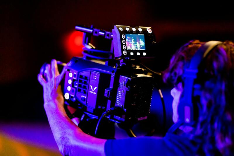
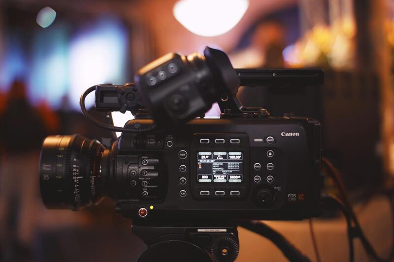
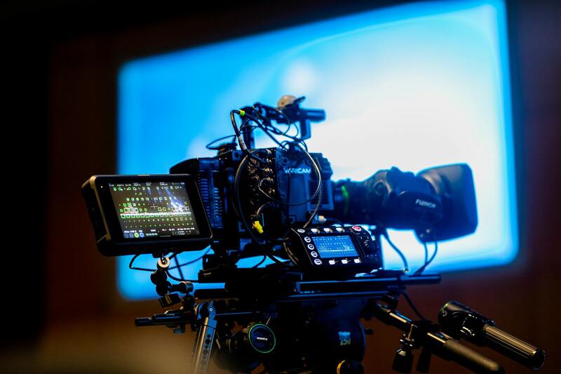
Securing high-quality drone real estate footage requires adherence to established official practices that ensure comprehensive coverage, optimal image quality, and safety compliance. Professionals in Miami typically follow specific steps to achieve this goal, focusing on using authorized equipment operated by experienced pilots trained in both technical skills and best operational protocols.
First, engaging with a licensed drone operator who possesses valid permits issued by relevant authorities is crucial. These operators are well-versed in local airspace regulations, ensuring each flight adheres to operational boundaries and safety standards. They utilize FAA-registered drones equipped with advanced stabilization systems, high-resolution cameras, and GPS technology to deliver crisp, cinematic footage.
Pre-flight planning is another vital component. This involves detailed site surveys, understanding the property layout, and assessing environmental conditions like wind and lighting. Such preparation allows the drone pilot to determine the most effective flight paths and camera angles, maximizing the visual appeal while ensuring comprehensive property coverage.
During the flight, operators follow strict protocols to maintain a safe distance from structures and avoid flight zones with restrictions. Enforcing altitude limits and maintaining line-of-sight control helps provide consistent footage quality and safety assurance. Post-flight, the raw footage undergoes meticulous processing, including stabilization, color correction, and stabilization to produce polished, professional-grade visuals suitable for marketing campaigns.
To uphold integrity and quality, many Miami real estate professionals opt to work with established drone service providers that specialize in property marketing. These companies bring extensive experience, the right equipment, and knowledge of the regional airspace, ensuring the entire process—from planning to post-production—is handled with precision and professionalism.
Utilizing verified methods for capturing drone real estate footage not only enhances visual storytelling but also reassures clients of a commitment to quality and compliance. As the property market becomes increasingly competitive, leveraging official and legitimate drone footage methods turns out to be a pivotal element in creating compelling property presentations that attract buyers and elevate listing standards.
Overview of Drone Real Estate Footage
Drone real estate footage has revolutionized the way properties are showcased in Miami’s competitive market. Utilizing unmanned aerial vehicles equipped with high-resolution cameras, real estate professionals can capture stunning visuals that highlight a property's unique features, surrounding landscapes, and neighborhood amenities from perspectives previously unattainable. This dynamic perspective not only enhances the visual appeal of listings but also provides potential buyers with a comprehensive understanding of the property layout and its environment, fostering a more engaging shopping experience.
By integrating aerial views into their marketing strategies, agents and sellers can illustrate property size, proximity to local attractions, and the overall ambiance more effectively than traditional photography alone. As a result, drone footage has become an essential tool in modern real estate marketing, providing a competitive edge and increasing engagement across digital platforms.
Legal and Regulatory Requirements in Miami
To ensure the responsible use of drone technology for real estate purposes within Miami, adherence to established operational standards is key. Permitted drone operations are governed by specific policies that stipulate when and how drones can be flown for commercial purposes. Operators must secure appropriate authorizations that demonstrate the drone’s compliance with safety protocols and operational limitations.
Key considerations include maintaining proper altitude restrictions, respecting no-fly zones designated around sensitive locations, and ensuring flights are conducted under direct visual line-of-sight. Regular updates to drone airspace regulations aim to improve safety and coordination among aerial operators, which is why professional drone service providers often maintain ongoing communication with relevant authorities and stay current with any policy changes.
Official Certification and Training
- Operators typically undertake comprehensive certification processes to demonstrate their proficiency in drone piloting and regulations adherence.
- Ongoing training programs are recommended to stay informed about regional compliance, safety practices, and advancements in drone technology.
- Proper documentation and insurance coverage further support professional service delivery and project accountability.
Maintaining all necessary credentials ensures that drone footage acquisition aligns with the highest standards of professionalism and safety, ultimately benefitting your real estate marketing campaigns with credible, high-quality visuals.
Advantages of Using Drone Footage in Real Estate
Incorporating drone footage into property marketing offers numerous advantages that can significantly influence buyer perception and engagement. First, aerial videos and photos provide a comprehensive view of the property and its surroundings, which is difficult to achieve with traditional ground-based photography. This visual breadth helps potential buyers better understand spatial relationships and contextualize local amenities, infrastructure, and landscape features.
Second, drone footage can highlight key property features such as extensive gardens, waterfront access, or scenic views that are pivotal selling points but may be less apparent from street-level photos. Additionally, the dynamic nature of drone videos adds a compelling storytelling element, making listings more memorable and shareable across social media and digital platforms.
Furthermore, high-quality drone visuals contribute to a more polished and professional listing appearance, increasing perceived value and differentiation among competing properties. As visual content continues to dominate online real estate searches, the strategic use of aerial footage can stretch marketing budgets further by attracting increased interest and facilitating quicker sales.
Best Practices for Shooting Drone Real Estate Footage
Achieving the most effective drone footage requires adherence to precise shooting techniques and operational strategies. It begins with thorough planning—selecting optimal flight paths and camera angles to maximize visual impact while capturing the property’s full scope. Pre-flight surveys are essential to identify potential obstacles, restricted zones, and to ensure compliance with regional flight regulations.
During the shoot, maintaining steady, smooth movements and appropriate flight altitudes ensures footage stability and clarity. Utilizing gimbals and professional-grade cameras enhances image quality and reduces vibrations or jitters. Lighting conditions are equally critical; shooting during golden hour—the hour after sunrise and before sunset—creates warm, inviting visuals with optimal natural light.
Post-flight, a detailed editing process involving stabilization, color grading, and sometimes adding graphical overlays elevates raw footage into a compelling marketing asset. It is also crucial to work with experienced drone operators who understand how to balance safety protocols with artistic vision, ensuring that footage is not only captivating but also responsibly captured under all applicable guidelines.
Best Practices for Flying Drones for Real Estate Footage in Miami
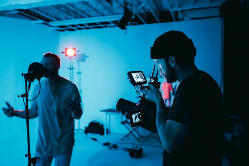
Executing high-quality drone footage for real estate purposes demands meticulous planning and adherence to established operational standards. The process begins with pre-flight preparation, where detailed site surveys are conducted to map out ideal flight paths that encompass all exterior aspects of the property. This involves selecting vantage points that highlight key selling features and ensure comprehensive coverage of the property and its surroundings.
Operators should ensure all equipment is functioning correctly before takeoff, including checking battery life, camera settings, and control systems. Establishing clear communication protocols among crew members minimizes the risk of mismanagement during the flight. Prior to taking off, a thorough inspection of the immediate environment is crucial to identify potential obstacles such as power lines, trees, or other structures that could interfere with safe drone operation.
During flight, pilot skill plays a vital role in capturing smooth, cinematic footage. Maintaining steady, controlled movements involves utilizing gimbals and stabilizers to prevent shaky visuals. Drones should fly at heights that provide clear perspectives without encroaching on privacy, typically between 20 to 100 feet, depending on the property size and surrounding environment.
Lighting conditions greatly influence the quality of footage. The golden hour—shortly after sunrise or before sunset—offers warm, soft natural light that enhances the property's appearance, casting appealing shadows and highlighting architectural details. Ensuring correct exposure settings on the drone’s camera helps achieve vivid, well-exposed images without glare or overexposure.
Post-flight, it is essential to review footage promptly to identify any needed retakes. Follow-up shots should be scheduled if initial captures miss critical angles or are affected by weather fluctuations. During editing, operators enhance the raw footage through stabilization, color grading, and sometimes adding graphical overlays that emphasize property features. These professional touches transform basic clips into captivating marketing tools.
Choosing a skilled drone operator with experience in real estate footage ensures adherence to safety protocols while delivering visuals that accurately represent the property’s unique selling points. While capturing footage, operating within specific altitude and distance guidelines maintains the balance between visual impact and privacy concerns, creating an appealing and responsible marketing asset.
Best Practices for Shooting Drone Real Estate Footage
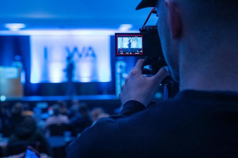
Capturing high-quality drone footage for real estate requires meticulous planning, technical expertise, and adherence to key shooting principles. It begins with a comprehensive pre-flight strategy, ensuring that all necessary permits are secured and flight paths are mapped out to avoid hazards. Employing a detailed shot list helps focus the shoot on crucial property features, including aerial views of the entire estate, close-ups of architectural details, and panoramic shots of surrounding landscapes.
Optimal camera settings are fundamental to achieving professional results. Operators should set the drone's camera in manual mode when possible to control exposure, ISO, and white balance manually. Shooting in 4K resolution enables impressive clarity and allows for versatile post-production editing, such as cropping or stabilization without losing detail. Using ND filters can enhance contrast and color saturation, especially in bright sunlight conditions, yielding more vibrant footage.
Flight stability is paramount; therefore, maintaining smooth, controlled movements ensures fluid footage that appears cinematic. Utilizing automated flight modes like waypoint navigation allows for precise, repeatable routes that cover key angles efficiently. During the shoot, multiple takes of each scene should be performed from different altitudes and angles to provide flexibility during editing.
Effective composition techniques are essential. Applying principles of the rule of thirds helps position key features within the frame naturally, drawing viewers' attention to the property's most attractive aspects. Incorporating movement—such as gradual upward lifts or sweeping panoramic shots—adds visual interest and storytelling depth. Additionally, avoiding abrupt camera motions or jerky movements ensures a professional, polished look.
Weather conditions significantly impact footage quality. Clear, sunny days with minimal wind provide the most stable environment for drone flights. Overcast days can offer softer lighting, reducing harsh shadows and glare, but rain or strong winds should be strictly avoided to prevent safety risks and poor footage results. Planning shoots during optimal weather windows enhances the overall quality and safety of drone operations.
Post-flight, reviewing footage promptly allows operators to identify any missed angles or technical issues. Properly logging and backing up raw footage ensures readiness for editing. During editing, stabilization techniques correct minor shakiness, while color grading enhances visual appeal, emphasizing the property's best features. Including aerial overlays, labels, and annotations within the editing process can further explain property layouts or point out unique amenities, making the footage more engaging and informative for viewers.
Final Considerations for Drone Real Estate Footage in Miami
Successfully integrating drone footage into your real estate marketing strategy involves meticulous planning, execution, and adherence to professional standards. For property developers, agents, and marketers operating within Miami, leveraging high-quality drone videos can significantly elevate property visibility and attract potential buyers. To maximize these benefits, focus on selecting experienced drone operators known for precision and safety, ensuring that every shot captures the property's unique features without compromising safety protocols. Such professionals utilize advanced equipment capable of producing crisp, stable footage that highlights both the grandeur and detail of the property.
Furthermore, implementing a strategic shot list aligned with the property's selling points enhances narrative storytelling and viewer engagement. Commencing with overarching aerial views to establish context, then zooming into detailed shots of key features such as landscaping, pools, or architectural details, creates a comprehensive visual story. Employing smooth, deliberate camera movements—like gentle lifts, circling shots, or tracking shots—maintains a professional appearance and prevents viewer fatigue. These techniques allow prospective buyers to virtually explore the property, fostering an emotional connection and inducing a sense of familiarity even before a physical visit.
Post-production processes are equally crucial. Professionals often apply color grading to enhance visual aesthetics, making the property more appealing under various lighting conditions. Stabilization tools address minor shake issues, resulting in smooth, cinematic footage. Consider adding informative overlays or labels to highlight key amenities or property boundaries, providing viewers with contextual information that enhances understanding. Additionally, incorporating dynamic transitions between scenes can maintain viewer interest and create a seamless viewing experience.
When budgeting for drone footage, it is vital to allocate funds that reflect the scope and quality desired. While costs vary depending on the complexity and duration of the shoot, investing in skilled operators and quality equipment ensures the footage's effectiveness. Miami-based production agencies offer diverse packages, often including pre- and post-production services, allowing clients to select options aligned with their marketing goals. Comparing these offerings based on portfolio quality, turnaround time, and client reviews can guide the selection process, ensuring a fruitful partnership.
Optimal Deployment of Drone Footage in Listings
Integrating drone videos into property listings requires strategic placement and presentation. Embedding these dynamic visuals on websites, social media platforms, and virtual tours significantly enhances user engagement. To achieve optimal results, ensure the videos are properly formatted for various devices, maintaining high resolution for desktops and mobile compatibility. Sharing snippets or teaser clips on social media can generate increased interest and drive traffic to the full listing.
- Embed videos prominently on property listing pages.
- Use engaging thumbnails with a representative aerial shot.
- Include virtual tour features to provide immersive experiences.
- Share concise, captivating clips on social media channels.
This multi-channel approach ensures that the property's features are showcased effectively, reaching a broader audience and increasing the likelihood of sale. Properly edited drone footage not only elevates the aesthetic appeal but also offers potential buyers a comprehensive understanding of the property's surroundings, layout, and scale—elements critical in high-stakes real estate transactions.
