Understanding Drone Realty and Its Benefits
Drone realty has rapidly transformed the landscape of real estate marketing by offering high-quality aerial imagery that vividly captures the essence of Miami's properties. This innovative approach involves utilizing unmanned aerial vehicles, or drones, to capture sweeping visuals from above, providing a comprehensive view of a property’s exterior and surrounding environment.
Incorporating drone footage into real estate listings significantly enhances the visual appeal and informational value of property presentations. Potential buyers can experience a virtual walkthrough that highlights key features such as the layout of expansive yards, proximity to local amenities, scenic views, and the property's integration within its community. Such visuals generate a stronger emotional connection, increasing engagement and interest.
From a marketing perspective, drone imagery allows real estate professionals to showcase properties in places that traditional photography cannot easily reach—like rooftop angles, aerial panoramas, or hard-to-access features. For properties with large plots of land, waterfronts, or those situated in scenic neighborhoods, aerial shots can create an impactful first impression that helps listings stand out in competitive markets.
Furthermore, drone videos and images facilitate a more transparent and comprehensive presentation, which can lead to shorter selling cycles. Buyers gain a clearer understanding of spatial relationships and property scope, reducing uncertainties often associated with remote purchasing decisions.
The integration of drone technology into real estate practices enhances the overall professionalism of property marketing. It reflects a commitment to using cutting-edge tools to present properties in the best possible light, ultimately driving more interest and opportunities for lucrative transactions.

As Miami continues to grow as a vibrant real estate hub, the strategic deployment of drones serves as a valuable asset for realtors aiming to optimize their listings and appeal to an increasingly digital-savvy clientele. Mastering the use of drone realty not only sets professionals apart but also enhances the overall quality and reach of property marketing in this dynamic market.
Types of Aerial Shots Used in Drone Realty
Effective use of drone technology in real estate marketing relies on a variety of aerial shot types, each serving specific purposes to enhance property presentation. Recognizing these different shots helps real estate professionals craft compelling visual narratives that attract potential buyers and highlight property features comprehensively.
- Panoramic Shots: Wide-angle views that encapsulate the entire property and surrounding environment, providing a sense of scale and context. These shots are particularly useful for large estates, waterfront properties, or homes in scenic neighborhoods, emphasizing location benefits.
- Vertical or Top-Down Shots: Directly overhead images offer a bird’s-eye view that can showcase the layout, boundary lines, and landscaping. They are ideal for illustrating property boundaries and spatial relationships between structures.
- Rooftop and High-Altitude Shots: Elevated angles that focus on roof details, architectural features, and overall building height. These shots can reveal design elements and help buyers assess roof condition and property grandeur.
- Property Walkthroughs: Guided flyovers that follow a logical path through the property, giving a virtual tour experience. This approach engages viewers more effectively, allowing them to visualize walking through the space remotely.
- Sunrise and Sunset Views: Shots during golden hour capture properties in warm, inviting light, enhancing visual appeal and mood. Such images can make listings more memorable and emotionally compelling.
- Scenic Context Shots: Incorporating natural features like water bodies, parks, or cityscapes contextualizes the property within its environment, highlighting neighborhood amenities and scenic views that add value.
Choosing the appropriate aerial shot depends on the property type, location, and marketing objectives. Combining these techniques allows real estate agents to create dynamic visual content that stands out in competitive markets, offering prospective buyers an immersive understanding of the property and its environment. Properly executed aerial photography not only elevates listing quality but also demonstrates a professional approach aimed at attracting serious inquiries.
Official Methods for Operational Excellence in Drone Realty
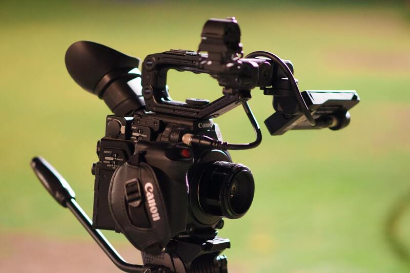
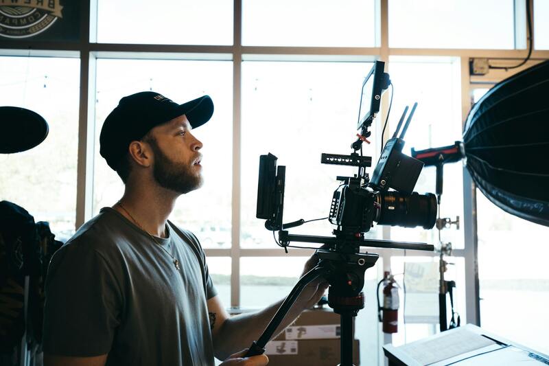
Achieving optimal results in drone realty relies heavily on utilizing official channels and established practices that ensure seamless, compliant operations across Miami. Real estate professionals and drone operators should prioritize acquiring precise geographic data, advanced imaging tools, and maintained equipment to deliver high-quality aerial content. Using reliable GPS systems enhances positional accuracy, facilitating complex flight paths that capture detailed views from multiple angles. These technological features underpin professional-grade outputs, ensuring that imagery aligns with strategic marketing goals.
In addition to technology, adherence to certified operational procedures—including pre-flight checklists, detailed flight planning, and restricted airspace protocols—constitutes a vital aspect of legitimate drone utilization. These procedures help mitigate risks, preserve public safety, and maintain the integrity of drone operations within Miami’s diverse urban landscape. Incorporating professional-grade software for flight management and data processing ensures navigational precision, optimized flight paths, and superior imaging quality. Such standards facilitate the creation of compelling virtual tours and promotional materials that are both informative and visually striking.
Utilizing Authorized Data and Asset Management
Effective management of aerial footage and data begins with secure storage and systematic cataloging. Cloud-based platforms and professional asset management systems allow seamless access, editing, and distribution of high-resolution images. Employing official licensing and copyright management safeguards intellectual property and confirms the legitimacy of visual content used in marketing campaigns. When sharing aerial footage, permissions and clear documentation reinforce transparency and establish trust with clients and stakeholders.
The deliberate use of vetted flight paths, official software tools, and authorized data handling contributes to a robust, reliable drone realty operation. This approach not only elevates listing standards but also aligns with professional expectations of quality, safety, and compliance. Ensuring that all processes adhere to these structured methods assists real estate agencies in establishing a reputable presence in Miami’s competitive property market, ultimately boosting client confidence and engagement.
Types of Aerial Shots Used in Drone Realty
In the realm of drone realty, the selection of specific aerial shots plays a pivotal role in capturing the essence and appeal of Miami properties. Different shot types serve unique purposes, highlighting various attributes of a property and its surroundings while enhancing visual storytelling for potential clients.
Common aerial shot types include:
- Vertical or Bird’s Eye Views: These shots provide a direct overhead perspective of the property, emphasizing its layout, size, and immediate landscape features. Such images are invaluable for giving viewers an overall sense of the property’s footprint and spatial relationships.
- 360-Degree Panorama Shots: Using a sequence of images stitched together, these shots offer a comprehensive panoramic view of the estate and its environment. They are particularly effective for showcasing expansive properties or scenic locations unique to Miami, such as beachfronts or lush gardens.
- Line or Path Shots: These involve the drone following a specific route along the property’s perimeter or through key points of interest, illustrating flow and accessibility within the estate. Path shots help convey property size in relation to its surroundings, urban or natural.
- Elevated Property Close-Ups: Focused close-up images from an elevated angle highlight specific features such as pools, outdoor kitchens, or architectural details. These shots accentuate the property’s luxury elements and unique selling points.
- Time-Lapse or Dynamic Motion Shots: Incorporating motion, such as the drone flying through the property or over scenic Miami locales, adds a dynamic element to marketing videos. These capture the vitality and lifestyle potential associated with the property, engaging viewers more effectively.
Strategically combining these shot types allows real estate professionals to craft compelling visual narratives that highlight both the property’s grandeur and its unique location within Miami’s vibrant environment. When executed with precision and adherence to authorized procedures, these visuals substantiate a property’s value and appeal in a competitive market.
Secure and Approve Drone Operations Through Official Licensing and Certification
Operating drones for real estate marketing in Miami requires adherence to established procedures that ensure all activities are conducted responsibly and efficiently. This involves obtaining recognition and approval from authorized entities that oversee drone operations within the region. The process typically includes applying for certifications that validate drone pilots' expertise, ensuring they possess the necessary skills and knowledge to operate aerial devices safely and effectively. Such credentials often involve comprehensive training on airspace rules, safety protocols, and technological handling, aligning operations with official standards.
Alongside pilot certification, it is essential to register the drone itself with the appropriate authority. Registration procedures involve providing detailed information about the drone model, specifications, and intended uses, which are then documented to maintain accountability and regulation compliance. Registration enhances operational transparency and fosters an environment of professional integrity in the drone realty sector.
For commercial endeavors, such as real estate marketing, securing specific operational permits or authorizations is mandatory. These permits are granted after a thorough review process, ensuring that drone flights are planned and executed within designated parameters. This includes submitting detailed flight plans, which outline the intended flight paths, altitudes, and times, minimizing interference with other airspace users and ensuring public safety.
Partnering with licensed drone production agencies further streamlines the process. Such agencies possess the necessary certifications and permits, allowing real estate firms to leverage their expertise in drone deployment. Working with qualified professionals not only guarantees compliance but also enhances the quality of footage captured, resulting in polished marketing materials that meet industry standards.
Adherence to these regulated methods safeguards the reputation of real estate professionals and ensures that aerial marketing ventures are conducted within the bounds of official guidelines. These practices also facilitate smoother project execution, preventing interruptions caused by regulatory non-compliance. Maintaining up-to-date knowledge of evolving procedures is essential for continuous, effective drone marketing in Miami, fostering trust with clients and stakeholders alike.
Ensuring Proper Methodologies for Drone Operations in Miami
Utilizing drones safely and effectively in Miami's real estate sector involves adopting official procedures that prioritize safety, professionalism, and compliance. This begins with detailed planning of flight operations, which includes preparing flight plans that specify the intended routes, altitudes, and specific timeframes for drone activities. These plans are scrutinized by overseeing authorities to confirm they respect existing airspace regulations and do not interfere with other aerial activities.
Partnering with certified drone service providers is a strategic approach to guarantee adherence to these standards. These agencies operate with the necessary authorization and possess experienced pilots familiar with Miami’s airspace dynamics. Their expertise ensures that each flight is conducted within a well-defined framework, reducing the risk of unforeseen issues and improving the quality of visual content produced.

In addition to professional oversight, using approved equipment designed for aerial filming enhances safety and image quality. This equipment includes drones equipped with stabilized gimbals, high-resolution cameras, and flight safety features that prevent accidents and ensure the footage meets industry standards. Regular maintenance and calibration of drone hardware are key practices that sustain operational safety and optimal footage output.
Operators are also responsible for conducting pre-flight checks to verify the functionality of all drone components, assess environmental conditions that might affect flight, and plan for emergency procedures. This meticulous approach minimizes risks and ensures smooth execution from takeoff to landing.
Maintaining Updated Operational Protocols
As Miami's drone regulations evolve, it is paramount that real estate professionals and drone operators stay informed about new guidelines, permitted flight zones, and altitude restrictions. Continuous education and participation in authorized training sessions can help maintain compliance, avoid inadvertent violations, and promote responsible drone usage in property marketing endeavors.

By integrating these official operational practices, Miami's real estate sector can leverage drone technology effectively, resulting in compelling visual content that highlights property features while respecting airspace regulations. This combination of professionalism and compliance enhances the reputation of real estate professionals and fosters smoother project execution, making drone footage a vital component in modern property marketing strategies.
Understanding Drone Realty and Its Benefits
Drone realty has transformed the landscape of property marketing by providing visually striking, comprehensive aerial perspectives that traditional methods cannot achieve. Utilizing advanced drone technology allows real estate professionals to showcase properties with high-definition footage, revealing not only the home's exterior but also its surroundings, neighborhood amenities, and nearby landmarks. This holistic view is especially valuable in Miami, where proximity to beaches, parks, and bustling city centers enhances property appeal.
The integration of drone footage into real estate listings boosts engagement, giving prospective buyers a seamless virtual experience that highlights the property's unique features. High-quality aerial visuals can effectively capture a property's spatial relationships, land boundaries, and surrounding environment, facilitating informed decision-making. Additionally, drone realty enhances marketing campaigns by creating compelling visual narratives that differentiate listings in a competitive market.
Furthermore, drone photography is instrumental during open houses and virtual tours, offering a dynamic perspective that challenges static images. Enhanced imagery can generate increased interest, leading to faster sales and often commanding higher listing prices due to the perception of premium presentation.
With continuous advancements in drone camera technology, real estate professionals can access features like 4K resolution, wide-angle lenses, and stabilized gimbals, which contribute to crisp, captivating visuals. These tools also facilitate capturing various shot types, from sweeping wide views to detailed close-ups, giving a comprehensive portrayal of properties across Miami’s diverse neighborhoods.
Investing in drone realty services provides not only quality content but also demonstrates a commitment to innovative marketing strategies. As the market increasingly expects multimedia-rich listings, leveraging drone footage ensures properties stand out and attract the right buyers efficiently.

Effective Strategies for Promoting Miami Real Estate with Drone Content
Scientists and marketing experts continually explore innovative ways to maximize the impact of drone imagery and video in real estate marketing efforts. To harness the full potential of drone realty, professionals should implement strategic approaches that enhance visibility, engagement, and buyer interest. This includes creating compelling narratives around the aerial footage, emphasizing the unique features of Miami properties, and integrating drone content seamlessly into broader marketing campaigns.
Leveraging Storytelling through Drone Footage
High-quality aerial footage can serve as a storytelling tool that highlights the lifestyle, environment, and exclusive features of Miami real estate. By capturing iconic cityscapes, waterfront views, and lush landscaping from strategic angles, agents can craft visual stories that resonate with prospective buyers. Combining drone shots with interior walkthroughs and neighborhood insights creates a comprehensive narrative that underscores the property's value.
Optimizing Listings with Professional Drone Content
Embedding professionally produced drone videos and high-resolution images into online property listings significantly enhances their appeal. Interactive virtual tours supplemented by aerial footage provide prospective buyers with a multi-dimensional view, facilitating better engagement and quicker decision-making. When integrated thoughtfully, drone media can elevate the listing's overall presentation, making it more memorable and compelling.
Utilizing Social Media and Digital Platforms
Social media channels, real estate websites, and online advertising are vital platforms for sharing drone-based content. Utilizing targeted advertising options helps reach specific demographics interested in Miami’s diverse neighborhoods. Consistent posting of aerial videos showcasing properties and surrounding amenities helps build a strong digital presence and establishes authority within the local real estate market.
Monitoring and Analyzing Performance Metrics
To continually refine drone marketing strategies, real estate professionals should leverage analytics tools to monitor viewer engagement, click-through rates, and property inquiries generated by drone content. Data-driven insights inform decisions on content refinement, allowing agents to focus on the most compelling visuals and formats to attract interested buyers effectively.
By adopting these advanced promotional tactics, Miami real estate professionals can maximize the impact of drone technology. Harnessing visually appealing, strategically placed content across multiple channels not only attracts a broader audience but also reinforces the perceived value of properties, fostering faster sales and higher returns. Maintaining an innovative approach ensures listings stand above competitors and effectively showcase Miami’s luxurious and diverse real estate offerings.
Emerging Opportunities in Drone-Driven Marketing
With the rapid development of drone technology, new possibilities continually emerge that can further elevate real estate marketing efforts. For example, 3D mapping, thermal imaging, and real-time live drone tours are becoming increasingly accessible. These advancements allow for more detailed property analysis, immersive viewing experiences, and dynamic virtual open houses. Integrating such tools into Miami’s real estate marketing strategies will better serve clients by providing richer, more engaging content that highlights the distinctiveness of local properties.
