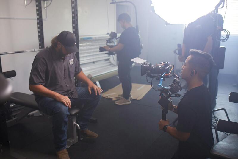
Introduction to Drone Services in Real Estate
In the rapidly evolving landscape of real estate marketing, drone technology has become an indispensable tool for showcasing properties with unparalleled clarity and appeal. Miami, a city characterized by its vibrant real estate market and stunning coastal properties, has witnessed a significant transformation driven by drone services. These advanced aerial solutions empower real estate professionals to generate compelling visual content that captures the unique aspects of each property, from sweeping oceanfront views to sprawling estate landscapes.
Utilizing drone technology enables real estate agents and brokers to create dynamic property listings that stand out in a competitive market. High-quality aerial images and videos provide potential buyers with a comprehensive understanding of a property’s layout, size, and surrounding environment, facilitating more informed decision-making. The immersive perspective offered by drone footage not only enhances online listings but also helps to generate greater interest and engagement from prospective buyers.

In addition to marketing advantages, drone services contribute to a more accurate overall presentation of properties. They enable real estate professionals to highlight key features, such as swimming pools, gardens, or panoramic views, which may be challenging to capture with traditional ground-level photography. Moreover, drone footage can be instrumental during property inspections, land surveys, and promotional campaigns. As Miami continues to attract both residential and commercial developments, the integration of drone technology becomes essential for real estate stakeholders aiming to showcase properties effectively and stay ahead in a competitive market.
The adoption of drone services in Miami's real estate sector reflects a commitment to innovation and professionalism. By leveraging legitimate, regulated drone applications, real estate professionals can ensure compliance while maximizing the impact of their visual marketing strategies. As drone technology becomes more accessible and sophisticated, its role in real estate marketing is set to expand further, offering endless possibilities for elevating property presentations and accelerating sales.
Types of Drone Services for Real Estate
In the realm of real estate marketing, various drone-based services cater to different property presentation needs, ensuring that listings stand out in a highly competitive market. Each service is designed to highlight unique aspects of a property or project, providing comprehensive visuals that traditional photography cannot match.
- Aerial Photography: This foundational drone service captures high-resolution images from multiple angles, showcasing the property's exterior, landscaping, surrounding environment, and proximity to amenities. Aerial shots help convey the property's scale and context, making it easier for prospective buyers to visualize living in the space.
- Video Tours: Using drone-mounted cameras, professional videographers create dynamic walkthroughs that encompass sweeping views and smooth transitions. These videos enable viewers to explore the property virtually, enhancing engagement and providing a realistic sense of space and flow.
- 360-Degree Virtual Tours: Advanced drone services allow the capture of 360-degree panoramic imagery, creating interactive virtual walkthroughs that can be experienced online. This immersive approach attracts remote buyers and increases listing exposure.
- Land and Site Surveys: Precise land surveys and topographic mapping are vital for property development, land purchase, or renovation projects. Drones equipped with specialized sensors and GPS technology provide accurate data and detailed 3D models, streamlining planning and planning regulations adherence.
- Inspection Services: Drones facilitate thorough inspections of roofs, façades, and hard-to-reach areas without the need for extensive scaffolding or ladders. Regular aerial inspections can identify issues early, aiding property management and maintenance plans.
- Promotional Content Creation: Custom content, such as branded videos or thematic cinematic footage, elevates marketing efforts, making listings more compelling and shareable across various platforms.

By selecting the appropriate drone service for specific marketing goals, real estate professionals can maximize property visibility, attract targeted audiences, and accelerate sales processes. The diversity of drone offerings ensures a tailored approach to each unique property, development project, or inspection need, solidifying drone technology as a critical asset in the contemporary real estate landscape.
Types of Drone Services for Real Estate
When evaluating drone services for real estate, it is essential to understand the specific applications that can enhance property marketing, development assessments, and maintenance routines. Each service is designed to offer detailed, high-quality visuals and data that align with various real estate objectives.
- Aerial Photography: Dynamic images captured from optimal altitudes provide prospective buyers with a comprehensive view of the property's exterior, surrounding neighborhood, and landscape features. High-resolution imagery emphasizes property size and external features, which are critical for attracting interest.
- Video Tours: Cinematic video walkthroughs offer an engaging experience that allows viewers to explore properties remotely. These videos highlight key features, convey the property's ambiance, and can be easily integrated into online listings or marketing campaigns.
- 3D Mapping and Modeling: Advanced drone platforms equipped with photogrammetry technology create detailed three-dimensional models of real estate sites. These models assist investors and developers in assessing land topography, planning construction projects, and analyzing terrains accurately.
- Exterior and Roof Inspections: Drones facilitate meticulous inspections of rooftops, facades, and hard-to-access areas. High-resolution imagery and thermal sensors help identify issues such as leaks, cracks, or material deterioration without intrusive or costly manual inspections.
- Land Surveys and Topographic Mapping: Precise measurements and surface mapping utilize drones with GPS and specialized sensors to generate detailed topographical data. These surveys support land development, property boundary verification, and compliance documentation.
- Promotion and Virtual Tours: Customizable content, including branded videos and virtual walkthroughs, enhance online listing presentations. Incorporating drone footage increases engagement metrics and broadens outreach to potential buyers and investors.
 igure>
Utilizing these targeted drone services empowers real estate professionals to showcase properties more effectively, facilitate accurate site assessments, and implement innovative marketing strategies. When tailored to specific needs, drone solutions can significantly influence listing performance, buyer engagement, and project planning processes, establishing a competitive edge in the dynamic Miami market.
Legal Regulations and Compliance in Miami
Implementing drone services for real estate in Miami requires adherence to established protocols and regulations designed to promote safe and responsible drone operations. To ensure that drone flights are conducted within the bounds of jurisdictional standards, professionals and clients should familiarize themselves with the specific procedures for obtaining operational permits and adhering to altitude and operational limitations. This includes registering unmanned aircraft with relevant authorities, which helps in tracking and managing drone use across the region.
Operators must also implement comprehensive safety measures tailored to urban environments, especially around populated areas, residential neighborhoods, and commercial districts. Conducting pre-flight risk assessments and establishing clear flight boundaries are essential steps in mitigating unforeseen incidents and ensuring the safety of bystanders and property.
Furthermore, maintaining current knowledge of airspace restrictions, temporary flight bans, and no-fly zones prevents unauthorized operations. This is particularly relevant during major events or in proximity to critical infrastructure, where drone activity may be scrutinized more closely. Reputable drone service providers in Miami stay updated on the latest regulatory changes and maintain rigorous compliance protocols to facilitate smooth project execution.
Employing professional drone operators with a thorough understanding of Miami’s local and federal guidelines ensures that real estate visuals and data collection are performed responsibly. This minimizes operational disruptions and upholds the integrity of the marketing and assessment process, providing clients with confidence that their listings meet all required standards.
In summary, professionals engaged in drone services must integrate compliance into their operational workflows. This includes meticulous planning, obtaining necessary permissions, and following safety protocols, which collectively uphold the integrity and professionalism of drone-assisted real estate activities in Miami. Adhering to these standards helps create a seamless experience for clients while leveraging the full potential of drone technology for property marketing, inspection, and surveying tasks.
Ensuring Accurate Data Collection and Property Insights with Drone Technology
In the competitive Miami real estate market, obtaining precise, comprehensive information about properties and surrounding environments is fundamental to crafting compelling listings and making informed investment decisions. Drone services utilize high-resolution cameras and advanced sensors to gather detailed imagery and data, including topographical maps, thermal imagery, and 3D models. These tools provide a layered understanding of the property landscape that traditional imaging cannot match.
For residential and commercial real estate, this level of data collection serves multiple purposes. It enables prospective buyers to experience a property virtually, gaining a realistic perspective on layout, scale, and spatial relationships. For developers and architects, drone-acquired aerial surveys inform design and planning processes by capturing accurate site measurements and environmental conditions. Additionally, property managers and inspectors leverage drone imaging for ongoing maintenance assessments, identifying structural issues or landscape changes without invasive procedures.
The precision offered by drone imaging supports effective marketing campaigns. High-quality footage and 3D visualizations foster deeper engagement from potential buyers, increasing the likelihood of faster sales and better offers. For investors, detailed site analysis ensures thorough due diligence, minimizing risks associated with unseen site conditions or overlooked features.

Legitimate drone services employ sophisticated equipment capable of capturing data with exceptional clarity. This includes 4K or higher resolution video footage, ultra-high-definition photographs, and LIDAR scans where necessary. Such data enhances the credibility and professionalism of real estate visuals, reinforcing trust among clients and stakeholders.
Integration of Aerial Data with Real Estate Marketing Strategies
Incorporating drone-derived visuals into marketing materials is essential for standing out in Miami's high-stakes real estate market. Aerial photography can showcase a property's external features, landscape design, and neighborhood context with compelling clarity that static images or ground-level videos cannot convey. By integrating these visuals into virtual tours, social media campaigns, and listing presentations, agents and sellers can attract more qualified buyers.
Moreover, the comprehensive data collected through drone services supports virtual reality (VR) applications and interactive online tours, offering remote clients an immersive experience. This technology broadens the reach of Miami property listings, attracting international and out-of-state investors who rely on high-quality visual data to make decisions.

Utilizing drone services for data collection and visual content creation ensures a professional, detailed, and engaging presentation of real estate assets. This approach not only improves marketing effectiveness but also supports accurate evaluations, informed decisions, and ultimately, faster transaction processes within Miami’s vibrant property market.
Choosing a Drone Service Provider in Miami
Selecting a suitable drone service provider in Miami requires meticulous evaluation of experience, equipment quality, and service offerings. It is essential to partner with providers who possess a proven track record in real estate aerial imaging, as their expertise directly impacts the quality of visuals and data collected. Experienced operators understand the nuances of capturing optimal lighting, angles, and timing to showcase property features authentically and attractively. A professional drone service company should utilize state-of-the-art UAV technology equipped with high-resolution cameras, stabilizers, and advanced imaging capabilities. This ensures that images and videos are crisp, detailed, and suitable for various marketing platforms, from online listings to large-scale marketing campaigns. Furthermore, a dedicated Miami-based provider understands the local landscape, weather patterns, and pertinent regulations—factors critical to efficient project execution. Their familiarity with the regional real estate market can enhance the relevance and appeal of the visual content produced. It is equally important to assess the provider’s compliance with safety standards and operational protocols to mitigate risks during drone flights. Transparent communication about service scope, turnaround times, and support for tailored marketing needs allows for a seamless integration of aerial visuals into individual real estate strategies. Lastly, reviewing client testimonials and portfolio examples provides insight into the provider’s consistency, creativity, and professionalism. A reliable drone service partner not only supplies high-quality content but also offers guidance on best practices for maximizing the impact of aerial imagery within Miami’s competitive real estate environment.

Types of Drone Services for Real Estate
When it comes to leveraging drone technology in the real estate sector, a variety of specialized services can significantly enhance property marketing efforts. Each service is designed to showcase different aspects of properties, neighborhoods, or land parcels, providing prospective buyers with comprehensive visual insights. Understanding these different types of drone services allows real estate professionals to select the most effective visual tools for their listings.
Aerial Photography
Aerial photography involves capturing high-resolution images from an elevated perspective, offering a sweeping view of the property and its surroundings. These images can highlight land features, landscaping, outdoor amenities, and the property's overall appeal. Aerial shots are particularly valuable for large estates, commercial properties, and land developments where a ground-level perspective doesn't fully capture the scope and scale.
Fly-through and Virtual Tours
Beyond static images, drone operators can produce dynamic fly-through videos or virtual tours. These are immersive experiences that guide viewers through interior and exterior spaces, simulating a walk-through experience. Such videos are highly engaging and allow potential buyers to virtually explore the property, identifying layout flow, spatial relationships, and property details from a comfort of their device.
3D Mapping and Modeling
Advanced drone services include creating detailed 3D maps and models of the property or land parcel. These models are invaluable for commercial real estate, development planning, and land surveying. They provide precise topographical data that supports development proposals, zoning applications, and environmental assessments, offering a comprehensive understanding of terrain contours and property boundaries.
Thermal Imaging
Thermal imaging drones are increasingly used for specialized assessments, such as inspection of building exteriors, detecting heat leaks, or evaluating energy efficiency. In real estate, thermal imagery can reveal hidden defects, moisture issues, or insulation problems, offering transparency and reassurance to potential buyers or investors.
In choosing the appropriate drone service, real estate professionals should assess the specific needs of each property type and marketing goal. A versatile drone service provider can adapt techniques and incorporate innovative technologies to create compelling visual content, ultimately increasing property visibility and appeal in Miami's competitive real estate market.
Comprehensive Approach to Drone Services for Real Estate in Miami
Implementing drone services within the real estate sector necessitates adherence to standardized, well-established methods that guarantee both safety and quality. When selecting an aerial imaging service provider, it is imperative to prioritize those who employ certified operators equipped with the latest drone technology, ensuring accurate and high-resolution visuals that meet the stringent standards expected in Miami’s dynamic market.
Key practices involve thorough pre-flight planning, where professionals assess the property landscape, identify potential obstacles, and establish optimal flight paths. This meticulous planning minimizes risks and enhances the quality of captured content. During operation, skilled pilots employ stable flight techniques and adaptive controls to produce smooth, professional footage and images, capturing every detail of the property from various angles.
Post-flight procedures also play a critical role in delivering a comprehensive service. This includes high-quality editing, color correction, and the integration of specialized imaging techniques such as HDR (High Dynamic Range) to enhance visual detail. When creating virtual tours or promotional videos, professionals ensure that the final product aligns with the marketing strategy, effectively showcasing the property’s unique features.
To uphold standards of quality and consistency, reputable drone service providers in Miami typically adhere to systematic workflows that encompass safety checks, calibration routines, and detailed documentation of flight operations. These measures preserve the integrity of both the equipment and the resulting media content, fostering trust and delivering measurable value to real estate clients.
Legal and safety compliance is integral to legitimate drone operations. Certified pilots must operate within designated flight parameters, maintain clear communication with local authorities when necessary, and respect privacy boundaries. Through established, approved operational protocols, drone services can reliably support property marketing efforts, creating impressive visual assets that enhance listing visibility and attract qualified buyers.
Financial transparency and structured package offerings enable real estate professionals to select solutions tailored to their project scope and budget. By partnering with providers who offer scalable options—ranging from basic aerial photography to comprehensive virtual tour packages—clients gain access to versatile tools that elevate property marketing without compromising on quality.
