Overview of Drone Photography in Real Estate
In the dynamic landscape of real estate marketing, the integration of drone technology has revolutionized how properties are showcased to potential buyers. Professional drone real estate photography involves the use of specialized unmanned aerial vehicles equipped with high-resolution cameras to capture striking aerial images and videos of properties. These visuals offer a comprehensive perspective that traditional ground-based photography often cannot achieve, highlighting property features, surrounding landscapes, and neighborhood amenities with clarity and emotional appeal.
Using drones for real estate visuals enhances the presentation of properties by providing expansive views, impressive aerial panoramas, and detailed close-ups from unique angles. This approach helps in differentiating listings, attracting more interest, and accurately conveying the property's scale and environmental context. Whether it's a luxury estate, commercial property, or a residential home, high-quality drone imagery can significantly impact a property's marketability and perceived value.
Compared to traditional photography, drone imagery offers several distinct advantages:
- Enhanced Visual Appeal: Striking from above shots draw attention and create memorable listings.
- Comprehensive Property Presentation: Showcases the full extent of large properties and outdoor spaces efficiently.
- Neighborhood Context: Highlights proximity to amenities and scenic surroundings, adding value to the property story.
- Speed and Efficiency: Rapidly captures multiple angles and details, reducing filming time and improving turnaround.
- Marketing Impact: Professionally produced drone visuals increase engagement across digital platforms and marketing channels.
In sum, professional drone photography has become an essential tool for real estate agents and property marketers aiming to present listings with precision, creativity, and an engaging visual narrative. This innovative approach helps capture not just the property itself, but also the lifestyle that comes with it, making it a powerful asset in today’s competitive real estate environment.
Legal and Regulatory Considerations in Miami
When engaging in professional drone real estate photography within Miami, adherence to established operational standards is paramount. The process involves obtaining the necessary certifications and permits from relevant authorities to ensure compliance with local policies. Proper registration of the drone with the appropriate agencies, such as the Federal Aviation Administration (FAA) in the United States, is a fundamental step. These registrations verify that the drone operator meets specific safety and competency standards, fostering responsible use of aerial equipment.
Furthermore, Miami's specific coastal and urban environments necessitate thorough planning to avoid interference with other airspace users. This includes understanding designated no-fly zones, which often encompass sensitive areas such as airports, heliports, and certain public spaces. Drone pilots must also familiarize themselves with local ordinances that may impose altitude restrictions or spatial boundaries for aerial photography.
Operational safety is critical when capturing high-quality images. A detailed risk assessment should be conducted prior to each shoot to identify potential hazards, such as crowded areas, power lines, or wildlife. Maintaining a safe distance from people and property is essential to prevent accidents and ensure a smooth shooting experience.

Ultimately, working with licensed and experienced drone operators ensures that all activities align with Miami’s regulatory environment. This not only upholds safety standards but also streamlines the process, minimizing delays and maximizing the quality of the final visual assets used in real estate marketing.
Official Documentation and Filming Permits
- Drone Registration Certificates: All unmanned aerial vehicles (UAVs) must be registered with the FAA, and operators should carry proof of registration during shoots.
- Operational Clearance: Certain locations or times may require special permits or approvals from city authorities or landowners.
- Insurance Coverage: Comprehensive liability insurance often forms part of responsible drone operation, protecting against potential damages or accidents.
Staying informed about the latest regulations and maintaining professional credentials in drone operation are essential for consistent, compliant, and effective real estate imagery capture.
Official Documentation and Filming Permits
To ensure the smooth execution of aerial photography projects, securing the appropriate documentation is a critical step. Drone registration certificates, issued by relevant authorities, serve as proof that the UAVs used are compliant with operational standards. Operators should carry these certificates at all times during shoots to demonstrate accountability and adherence to protocol.
Furthermore, obtaining operational clearance for specific locations or time windows might be necessary. This process involves engaging with city officials or property owners to secure permissions for aerial maneuvers over particular sites, especially in densely populated or restricted zones.
Insurance coverage complements responsible drone operation by providing a financial safety net in case of accidents or damages. Such comprehensive liability insurance should be part of the standard operating procedures for professional drone services, covering potential impacts on property, third parties, or individuals involved in the shoot.
Staying up-to-date with industry requirements and maintaining valid certifications facilitate a professional workflow, minimizing delays and ensuring that all visual content aligns with established standards. Employing licensed drone operators guarantees that all phases of aerial filming—from pre-shoot planning to post-production—are conducted within prescribed guidelines, resulting in high-quality, compliant real estate imagery.
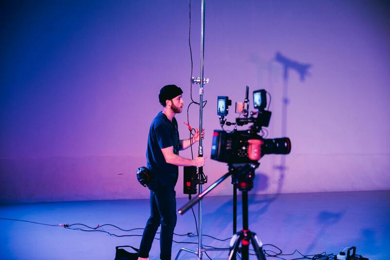
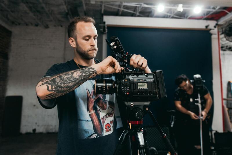
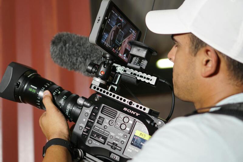
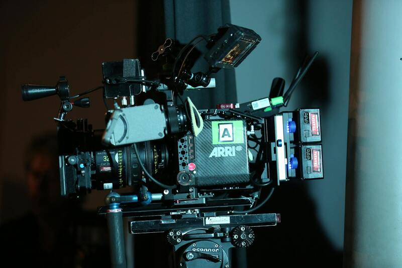
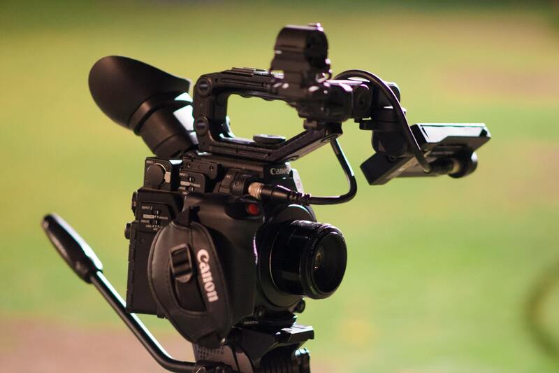
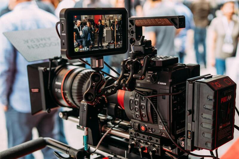
Equipment and Technology for High-Quality Drone Shots
Achieving top-tier imagery in real estate requires the use of advanced drone technology combined with high-quality cameras. Professional-grade drones are equipped with stabilization systems and high-resolution sensors that deliver sharp, clear images and smooth, cinematic videos. These drones often feature multiple flight modes and obstacle avoidance systems to facilitate complex shots in tight or challenging environments.
The cameras mounted on these drones can capture 4K or higher resolution footage, enabling detailed views of property exteriors, architectural features, and surrounding landscapes. Accessories such as polarized filters, gimbals, and extra batteries enhance the quality and variety of shots, providing versatility for different lighting conditions and angles.
Utilizing the latest technology allows for capturing dynamic, high-definition images that effectively showcase property features and ambiance. The integration of intelligent flight planning software facilitates precise navigation and automated shooting routines, ensuring consistent, professional results regardless of the operator’s experience level.
Additionally, software solutions for post-processing enhance raw footage, correcting color discrepancies, and emphasizing key property attributes. When combined, these technological tools enable real estate professionals in Miami to present their listings with impactful visuals that engage prospective buyers and elevate marketing standards.
Techniques for Capturing Effective Drone Shots
Implementing the right techniques in drone photography significantly enhances the visual appeal and informational value of real estate listings. Starting with planning, it’s essential to scout the property beforehand to identify optimal flight angles, vantage points, and lighting conditions that highlight unique architectural features and landscape assets. Effective use of natural light, typically during golden hour, produces warm, inviting visuals that resonate with prospective buyers.
In terms of flight paths, a combination of straight-on shots, oblique angles, and panoramic sweeps creates a comprehensive visual narrative of the property. Vertical shots from higher altitudes can showcase the property's layout and surrounding environment, while lower angles emphasize specific architectural details or landscaping elements.
- Optimal Angles: Aim for angles that accentuate the property's size, curb appeal, and distinctive features. For example, a slightly elevated side angle can reveal driveway depth while also capturing the architectural façade.
- Camera Settings: Use high-resolution settings, adjusting exposure and focus for the lighting conditions. Polarizing filters can reduce reflections on windows or water features, ensuring clarity.
- Lighting Conditions: Schedule drone flights during periods of consistent, diffuse sunlight. Avoid midday when shadows are harsh, as softer light imparts a more appealing and balanced appearance.
- Flight Maneuvers: Incorporate smooth, controlled movements—panning, circling, and vertical ascents or descents—to produce cinematic footage. Autopilot modes enable precise, repeatable shots which are vital for consistent marketing material.
Post-flight editing plays a crucial role in refining visuals. Adjusting color balance, contrast, and sharpness can elevate the shot quality, making property features stand out. Combining well-planned flight techniques with meticulous editing results in striking imagery that captures the essence and appeal of each listing.
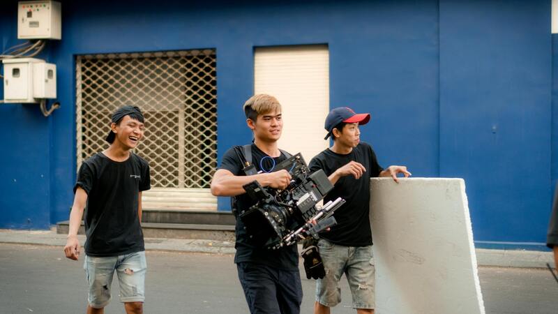
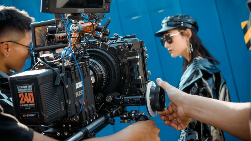
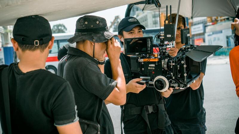
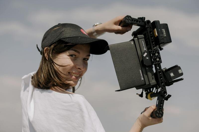
Hiring a Professional Drone Photographer
Engaging a skilled drone photographer ensures the attainment of superior aerial images that elevate property listings. Professionals possess extensive expertise in operating high-end drone equipment, understanding optimal flight paths, and employing advanced shooting techniques to capture the property's full potential. Their experience translates into compelling visuals that resonate with prospective buyers, highlighting unique property features and the surrounding landscape effectively.
When selecting a drone photographer, it's essential to evaluate their portfolio, specifically noting previous real estate projects in Miami. A diverse array of images showcasing various architectural styles, terrains, and lighting conditions demonstrates adaptability and mastery. Furthermore, reputable professionals adhere to industry standards for flight safety and image quality, utilizing the latest camera technology to deliver high-resolution visuals with excellent detail and color accuracy.
Clear communication of project goals and expectations is crucial. A professional will understand the importance of lighting, angles, and timing to maximize visual impact. They can advise on the most advantageous times of day for shooting, such as during the golden hour, which produces warm, soft lighting that enhances property appeal. Additionally, skilled operators often utilize post-processing techniques to refine images, ensuring colors are vibrant and details sharp.
Advantages of Hiring a Recognized Expert
- High-quality, cinematic footage that stands out in listings
- Consistent results through professional flight planning and execution
- Compliance with Miami's prescribed flight standards, promoting safe operation
- Expert guidance on optimal shooting angles and techniques
- Post-production expertise to enhance visual appeal
Choosing a knowledgeable drone operator not only delivers stunning images but also minimizes the risk of technical issues or subpar results. Their familiarity with the local Miami landscape ensures unobstructed shots while respecting privacy boundaries and property rights. This level of professionalism is vital in creating marketing materials that truly capture the essence of a property and attract discerning buyers.
Professional Drone Photography: Ensuring Compliance and Optimal Results in Miami
When engaging in professional drone real estate photography in Miami, it is essential to adhere strictly to established operational practices that meet industry standards. These practices not only guarantee high-quality visual outputs but also uphold the integrity of the shoot process, ensuring safety, privacy, and overall effectiveness. The process begins with careful planning and collaboration with seasoned operators who possess comprehensive knowledge of drone technology and the specific nuances of Miami’s unique urban and coastal landscapes.
Pre-Flight Planning and Site Analysis
Prior to any flight, a detailed site analysis is conducted to identify optimal shooting angles, potential obstructions, and areas of privacy concern. This preparatory phase involves leveraging aerial maps, 3D modeling, and environmental data to create a tailored flight plan. Such planning minimizes risks and enhances the efficiency of each session, ensuring the drone captures all the key visual elements needed for compelling property marketing.
Utilizing Approved Equipment and Flight Protocols
Professional operators adhere to rigorous standards in selecting high-performance drones equipped with 4K or higher-resolution cameras, stabilizers, and advanced sensors. Flight protocols include maintaining safe distances from structures, avoiding no-fly zones explicitly designated within Miami, and operating within designated altitude limits. Routine maintenance and calibration of drone systems are integral to sustain optimal image quality and flight performance during each mission.
Post-Flight Data Management and Image Processing
Following each flight, collected data undergoes meticulous processing using specialized software that enhances image sharpness, corrects color imbalances, and removes artifacts. Such processing enables real estate professionals to showcase the property at its best, highlighting architectural details, landscape features, and surrounding amenities with clarity and vibrancy. Ensuring consistency in editing standards across projects maintains a professional visual identity for Miami real estate listings.
Compliance and Respect for Local Regulations
Staying within approved flight parameters is crucial when executing professional drone photography. Operators typically obtain necessary permissions through authorized channels, respect privacy boundaries, and coordinate with property owners for unobstructed shots. By following these established procedures, professionals help foster trust, ensure seamless project execution, and produce captivating visuals that comply with Miami’s operational standards.
Leveraging Technology for Consistent Results
Employing the latest in drone navigation, collision avoidance, and real-time monitoring technology ensures a safer, more precise flight experience. These tools facilitate complex shoot plans, allowing for the capture of multiple angles and detailed coverage without risking damage or infringing on restricted airspace. Advanced software for flight planning and image stitching also streamlines post-processing, delivering consistent, high-quality outputs for each project.
Hiring a Professional Drone Photographer
Engaging a qualified drone photography service is essential for capturing compelling visuals of Miami real estate. When selecting a professional, consider their experience with aerial imaging specifically for property marketing, as well as their familiarity with local regulations and best practices. Look for portfolios showcasing a range of real estate projects that highlight diverse property types, from luxurious waterfront estates to urban condominiums.
Trustworthy drone operators prioritize safety protocols, ensuring flight operations comply with all established standards while delivering high-resolution imagery. They utilize comprehensive pre-flight planning to optimize shot angles and lighting conditions, which is crucial in Miami’s vibrant real estate market. Moreover, professional drone services are equipped with advanced hardware and software tools, allowing for precise flight execution, stable footage, and detailed imaging that elevates property listings.
In addition to technical proficiency, a professional operator understands the marketing importance of timing and environment. They choose optimal weather conditions and times of day—such as golden hour—to ensure that property exteriors are illuminated attractively and that shadows do not obscure key features. This strategic approach results in compelling images that resonate with potential buyers and increase listing attraction.
Furthermore, professional drone photographers provide comprehensive post-processing services. Their expertise extends to image enhancement, color correction, and 3D mapping, which can be integrated into virtual tours or augmented reality platforms. These enhancements help convey a full sense of space and design that static photographs alone may not fully capture.
Optimizing Drone Footage for Property Listings
To maximize the impact of drone imagery on property listings, the focus must be on meticulous planning and execution. A professional approach begins with pre-flight site assessment, which involves evaluating the property surroundings to determine the best angles and flight paths. This ensures that the shots highlight the property's unique features while avoiding obstructions like trees, power lines, or neighboring structures.
Post-flight, the editing process plays a critical role in refining the footage. High-resolution renders are enhanced through professional color grading, contrast adjustments, and stabilization techniques that eliminate shaky footage. Additionally, integrating aerial shots with ground-level images creates comprehensive virtual tours, providing potential buyers with immersive experiences that capture the property's complete appeal.
Strategic use of lighting is another important aspect. A skilled drone operator chooses optimal times during the day, such as early morning or late afternoon, to leverage natural light. This approach accentuates architectural details and landscape features, and creates a warm, inviting atmosphere for the property presentation.
Enhancing Listing Visibility Through Aerial Perspectives
Drone footage offers a unique vantage point that traditional photography cannot replicate. Highlighting the property's extent, surrounding neighborhood, or nearby amenities can significantly influence a buyer’s perception. Establishing contextual shots—such as a sweeping view of the entire estate, proximity to parks or waterways, or showcasing land features—can deliver a competitive edge in Miami’s vibrant real estate market.
Incorporating dynamic shots, like circular fly-arounds or orbit sequences, adds visual interest and demonstrates the property's scale and grandeur. These techniques, when executed with professional precision, provide a compelling narrative that resonates with prospective clients and aids in faster sales.
The Role of Post-Processing and Digital Enhancement
Beyond simple footage capture, using specialized software to perform post-production editing is essential. Professionals utilize tools to correct color discrepancies, adjust exposure levels for consistent lighting, and remove any noise or disturbances from the footage. These adjustments result in images and videos that appear polished and realistic, aligning perfectly with the high standards expected in premium property marketing.
Advanced techniques also include creating 3D models or aerial maps from drone data, which provide buyers with detailed spatial awareness. Such visuals are particularly valuable for large estates, waterfront properties, or developments where understanding the land layout is crucial.
Maintaining Professional Standards and Ethical Practices
Engaging in ethical drone operation goes beyond obtaining clear footage. It involves respecting property boundaries, avoiding privacy infringements, and adhering to safety protocols during flights. Ensuring that these practices are in place maintains trust and upholds the professionalism of the service provider.