Overview of Realtor Drone Photography
Realtor drone photography has rapidly transformed the landscape of property marketing across Miami, FL. Utilizing unmanned aerial vehicles (UAVs), this innovative approach captures high-quality aerial images and videos that provide comprehensive views of properties, surrounding neighborhoods, and key amenities. The ability to showcase a property from diverse angles—highlighting its unique features and the appeal of its location—has become an essential component of modern real estate marketing strategies.
In Miami, where properties often boast expansive landscapes, waterfronts, or distinctive architectural designs, drone photography offers an unparalleled perspective that traditional ground-based imagery cannot achieve. It not only enhances visual appeal but also facilitates a more immersive experience for prospective buyers, fostering increased engagement and interest.
The adoption of drone technology in real estate marketing aligns with the evolving expectations of today's property consumers. Buyers increasingly seek detailed, dynamic views that help them envision their future homes more vividly. Realtors leveraging drone photography are positioned to deliver this high level of presentation, thereby gaining a competitive edge in the Miami real estate market.
Furthermore, high-resolution drone imagery complements virtual tours and online listings, making properties stand out in digital platforms. This method also aids in showcasing large estates, commercial properties, and developments, providing comprehensive insights that attract serious inquiries and expedite sales.

Legal Regulations and Licensing Requirements
Implementing realtor drone photography within the Miami real estate sector entails adherence to specific operational standards designed to ensure safety, privacy, and high-quality image capture. To achieve optimal results, real estate professionals and drone operators must align with established procedures that govern aerial imaging activities in urban and suburban settings alike.
Operators are typically expected to acquire necessary certifications that demonstrate proficiency in drone operation, understanding of airspace management, and awareness of environmental conditions that could affect flight safety. Many jurisdictions rely on licensed commercial drone pilots who have completed regulated training programs, ensuring that their skills meet industry standards for aerial data collection.
Furthermore, drone flights often require prior notification or authorization when conducted over certain areas, such as densely populated neighborhoods, construction sites, or sensitive landmarks. Proper planning and authorization help mitigate disruptions and privacy concerns, fostering cooperation among stakeholders involved in real estate marketing efforts.

In addition, real estate professionals should establish clear protocols for data management, ensuring that aerial footage and images are stored securely and used ethically in marketing campaigns. Regularly updating knowledge about evolving regulations keeps practices current and minimizes risk, while also enhancing the credibility and professionalism of realtor drone photography services.
Licensing and Certification for Drone Operators
- Obtaining a Part 107 certification or similar credential, which covers the fundamentals of drone operation and airspace rules.
- Maintaining insurance coverage that includes liability for commercial drone activities, providing protection against potential mishaps or damages.
- Staying informed about Miami-Dade County and Florida state-specific requirements related to aerial photography and drone use.
- Documenting all permissions, flight logs, and compliance measures to demonstrate adherence to established standards.
Compliance with these protocols ensures that realtor drone photography in Miami is performed responsibly, ethically, and in accordance with best practices, ultimately fostering trust with clients and stakeholders.
Overview of Realtor Drone Photography
Realtor drone photography leverages unmanned aerial vehicles (UAVs) equipped with high-resolution cameras to capture expansive, detailed images of properties and their surrounding environments. This innovative approach allows real estate professionals to showcase properties from unique perspectives that traditional ground-based photography cannot achieve. By incorporating aerial views, agents can highlight property size, landscaping, nearby amenities, and geographic features with precision and clarity. These images play a pivotal role in capturing the interest of prospective buyers and providing a comprehensive visual representation of the property’s appeal.
Furthermore, the integration of 3D mapping, virtual tours, and cinematic video sequences generated through drone footage strengthens marketing campaigns. Drones equipped with stabilizers and advanced cameras enable the production of smooth, professional videos that highlight architectural features, interior layouts, and neighborhood attributes. These visual tools support the decision-making process for potential buyers, providing immersive experiences that static images cannot fully deliver.
Enhanced Marketing Strategies
Incorporating drone photography into real estate listings elevates the overall marketability of properties. It allows agents to create compelling listing presentations, social media content, and virtual open houses that attract a wider audience. As search behaviors evolve, high-quality aerial imagery becomes an essential component of modern property marketing, aligning with the visual preferences of contemporary homebuyers. Additionally, real estate agents can gain a competitive edge by utilizing the dynamic, engaging content produced through professional drone services, ultimately leading to faster sales and higher property values.

Implementing drone technology also facilitates the visualization of large-scale developments, construction progress, and land assessments. For real estate developers, these capabilities are invaluable for project marketing, planning, and stakeholder engagement. Due to the rapid advancements in drone hardware and imaging software, real estate professionals now have access to tools that support sophisticated imaging techniques, ensuring their marketing efforts remain impactful and current.
Professional Collaboration and Ethical Use
Partnering with qualified drone operators ensures that imagery collection adheres to established standards of safety, quality, and compliance. These professionals possess specialized training, certification, and experience in aerial photography, which guarantees high-quality results while maintaining responsible flight practices. Ethical use of drone technology includes respecting privacy, avoiding sensitive areas, and securing necessary permissions, thereby fostering trust with clients and the community.
Implementing Drone Photography Responsibly for Real Estate Success
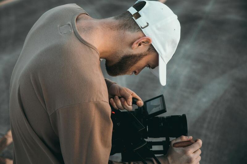
To maximize the potential of realtor drone photography, professionals must focus on responsible deployment. This entails using drones equipped with high-resolution cameras, stabilized gimbals, and advanced imaging software to capture crisp, compelling visuals that truly showcase a property's unique features. Proper flight planning is critical, including selecting optimal lighting conditions, planning flight paths to cover key viewpoints, and ensuring all shots include contextually relevant surroundings. This strategic approach results in comprehensive visual narratives that resonate with prospective buyers and enhance appeal.
Operators should be thoroughly familiar with the technical capabilities of their equipment, utilizing features such as high dynamic range (HDR), panoramic shots, and 4K video recording. These enhancements allow for versatile presentation formats, including immersive virtual tours and detailed property showcases that attract a wider audience.

Best Practices for Effective Drone Photography in Real Estate
- Pre-Flight Preparation: Ensure all equipment is properly maintained, batteries are fully charged, and flight plans are mapped out. Confirm that the weather conditions are suitable for flying to avoid motion blur, poor lighting, or safety risks.
- Shot Composition: Focus on capturing properties from multiple vantage points to highlight layout, landscaping, and unique exterior features. Incorporate vertical shots for height perspective and panoramic shots for comprehensive views.
- Timing: Schedule shoots during optimal lighting periods, such as early morning or late afternoon, to achieve natural, warm tones and avoid harsh shadows. Proper timing enhances the visual appeal and mood of the imagery.
- Maintaining Privacy and Respect: Conduct flights that avoid encroaching on private property or sensitive areas. Always seek necessary permissions when necessary to uphold standards of responsible drone operation.
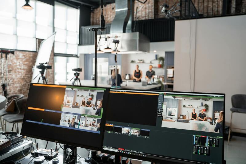
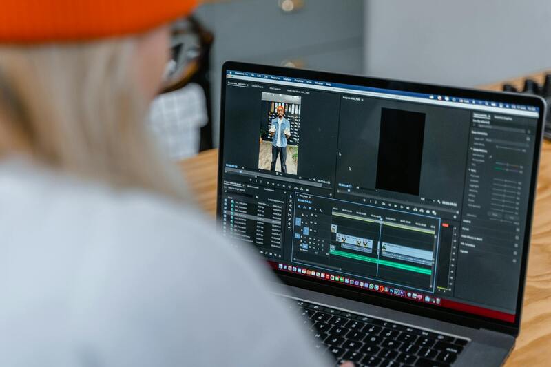
Post-Production and Presentation of Drone Content
After capturing the footage, meticulous editing elevates a property's visual narrative. This involves color correction, stabilization, and the integration of branding elements such as logos or contact information to reinforce marketing consistency. Incorporating drone footage into virtual tours, interactive listings, or social media campaigns broadens reach and engagement.
Responsive, high-quality visual content enhances online listings, making properties stand out in competitive markets. Embedding compelling drone videos and photographs into digital marketing channels ensures that potential buyers receive a comprehensive, immersive view of the property, often leading to increased inquiry rates and quicker sales.
Integrating Drone Footage into Marketing Strategies
Once the drone captures high-quality images and videos of the property, the next step involves integrating this content into comprehensive marketing strategies. Professionals often embed drone footage into virtual tour platforms, creating interactive and immersive experiences that help prospective buyers explore the property remotely. Virtual tours enriched with aerial views provide a unique perspective on property layout, surroundings, and landscape features, fostering increased engagement and interest.
In addition to virtual tours, drone visuals are powerful assets for online listings, social media campaigns, and email marketing. High-resolution aerial photos and dynamic videos can be optimized for various digital channels to catch the eye of potential buyers in their initial research phase. Incorporating drone content into social media posts boosts visibility, encourages shares, and enhances overall brand recognition for real estate agencies.
Property websites should host tailored galleries that showcase aerial shots along with interior visuals, offering a balanced and comprehensive presentation. Using 360-degree panoramic drone shots can further elevate the listing by allowing viewers to virtually explore exterior spaces and landscaping in detail. Coupling aerial images with detailed property descriptions and neighborhood highlights creates a well-rounded marketing package, poised to attract serious buyers.
Cost Considerations and Working with Service Providers in Miami
Engaging professional drone photography services requires investment, but the return on effort often justifies the expense through increased property visibility and faster sales. Local providers like Miami Video Services offer tailored packages that include pre-shoot planning, footage capture, and post-production editing. These companies typically utilize advanced drone technology combined with seasoned pilots to ensure high-quality, compelling visuals.
Clients should consider the scope of their project, including the property size, the complexity of the shots required, and the level of editing needed. Different service providers may offer a range of options, from basic aerial shots to cinematic-grade footage suitable for high-end listings. Transparent pricing and clear communication about deliverables help ensure the final product meets expectations and market needs.
Additionally, selecting a service provider with a strong portfolio of real estate drone projects and positive client references can be instrumental in achieving desired outcomes. It is important to discuss licensing, safety protocols, and the specific techniques used to capture the most appealing visuals of the property.
Future Trends and Innovations in Realtor Drone Photography
The landscape of drone photography continues to evolve with technological advancements. Future trends include the increasing use of 3D mapping and modeling, offering detailed topographical views and virtual property staging. AI-powered editing tools will enable faster processing times and enhanced image quality, allowing realtors to produce more captivating visual content without significant delays.
Furthermore, the integration of drone footage with augmented reality (AR) applications will revolutionize property viewing experiences. Buyers could potentially walk through a virtual property with real-time aerial views, gaining a full sense of space and surroundings from their devices. These innovations will provide real estate professionals with innovative ways to showcase properties more effectively, attracting a broader audience and facilitating higher engagement levels.
Legal Regulations and Licensing Requirements
Successfully implementing realtor drone photography relies heavily on understanding and adhering to established standards governing drone operations. These standards are designed to ensure safety and optimal quality of captured imagery. Professionals typically pursue specific certifications or authorizations that demonstrate their ability to operate drones responsibly. Such certifications often involve comprehensive training sessions covering airspace regulations, safety protocols, and technical skills necessary for aerial photography.
Operators must also familiarize themselves with local aviation authorities’ guidelines to maintain compliance during shoots. This includes planning flight paths that avoid restricted zones or sensitive areas, ensuring respect for privacy rights, and managing flight times to prevent disturbances. Many established drone service providers maintain detailed operational procedures aligned with these standards, helping to minimize risks while delivering high-quality visual content.
Developing expertise in flight planning, especially within bustling urban environments like Miami, requires a thorough understanding of local airspace regulations and a proactive approach to safety considerations. This includes conducting pre-flight assessments, ensuring all equipment is properly maintained, and documenting flight activities for accountability. Certification bodies often require ongoing education to stay current with evolving policies and technology advancements.
By choosing drone operators who adhere to these stringent methods, real estate professionals can be confident in the safety, legality, and quality of their aerial imaging. This responsible approach not only elevates the professionalism of realtor marketing efforts but also fosters trust with clients and stakeholders.
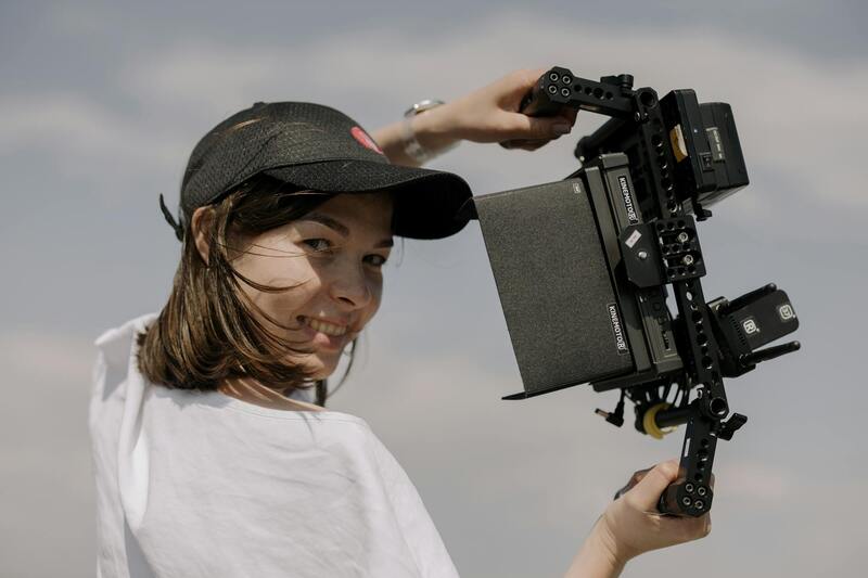
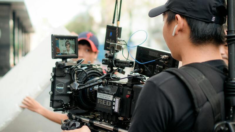
Choosing the Right Drone Equipment for Real Estate
When it comes to realtor drone photography, selecting appropriate equipment is essential to achieve high-quality aerial visuals that effectively showcase property features and neighborhood amenities. The right drone setup should balance camera capabilities, flight stability, battery life, and ease of use. For real estate purposes, high-resolution cameras with stabilized gimbals are preferred to capture sharp, detailed images and smooth videos. Cameras capable of shooting in 4K resolution facilitate crisp visuals, allowing potential buyers a clear view of property exteriors and surrounding landscapes.
Modern professional-grade drones often incorporate GPS positioning systems, which enable precise flight paths and automated shot routines—reducing operator fatigue and enhancing shot consistency. These features are particularly useful for generating comprehensive property tours or panoramic views of larger estates. Additionally, obstacle detection sensors contribute to safe flight operations, especially in urban environments with dense structures or tree-lined properties.
Battery technology also plays a significant role. Drones with extended flight times—typically ranging from 20 to 30 minutes per battery—allow for more extensive coverage per flight, which can be more efficient and cost-effective. For real estate professionals working with multiple listings, investing in additional batteries can facilitate continuous shooting sessions without long breaks for recharging.
Furthermore, consider the control systems and payload options. A user-friendly remote interface enhances operational precision, while modular payloads enable the integration of specialized cameras, such as wide-angle or thermal imaging units, to enhance property presentations. Compatibility with software that simplifies drone flight planning and footage management can streamline production workflows, ensuring timely delivery of visual content.
Choosing equipment that aligns with these technical requirements and property-specific goals ensures the creation of compelling visual narratives that attract prospective buyers. Collaborating with experienced drone service providers in Miami, who utilize advanced equipment adhering to professional standards, can significantly elevate the effectiveness of realtor marketing strategies and ultimately lead to quicker sales conversions.
Effective Usage of Drone Footage for Marketing and Listing Enhancements
Integrating high-quality realtor drone photography into your marketing strategy can significantly elevate the visual appeal of your property listings. Captivating aerial footage serves as a compelling storytelling tool, showcasing a property’s unique features, surrounding landscape, and neighborhood context in a way that traditional ground-level photos may not fully convey. When properly executed, drone footage provides potential buyers with a comprehensive view, fostering a deeper emotional connection and prompting increased engagement.
To maximize the impact of drone imagery, consider the following approaches:
- Consistent Visual Style: Develop a visual narrative that aligns with your brand. Use a standardized color palette, lens perspective, and editing style to ensure cohesive presentation across all listings, reinforcing your professional image.
- Highlight Unique Selling Points: Use drone shots to focus on standout features such as expansive backyard spaces, waterfront views, architectural details, or proximity to amenities. These elements can distinguish your property in a competitive market.
- Compelling Virtual Tours: Incorporate aerial footage into virtual reality or video tour platforms, providing an immersive experience that enhances remote viewing capabilities. This approach is especially effective for attracting out-of-town buyers.
- Seasonal and Timely Content: Capture drone footage during optimal lighting conditions and seasons to emphasize the property's best attributes. Morning or late afternoon sunlight adds warmth and depth to the visuals, creating a more inviting ambiance.
- Legal Compliance and Safety: Always follow approved operational protocols, including pre-flight site assessments and adherence to any existing restrictions. Employing licensed operators ensures that aerial footage is captured responsibly and professionally.
By consistently applying these strategies, real estate professionals can leverage drone photography to create distinctive, visually engaging listings that resonate with buyers. The integration of drone footage into your marketing efforts not only boosts listings’ aesthetic appeal but also drives increased inquiry rates and faster sales cycles, making it an indispensable component of modern real estate promotion.
