Overview of 3d Property Photography
3d property photography has rapidly become a pivotal element in contemporary real estate marketing, especially within dynamic markets like Miami. This innovative imaging technique involves capturing detailed, immersive visual representations of properties through advanced three-dimensional imaging technology. Unlike traditional photographs, which provide only static, two-dimensional perspectives, 3d property photography offers virtual walkthroughs and interactive models that enable potential buyers or renters to explore a property remotely with a high degree of realism.
In the context of Miami's vibrant real estate market, 3d property photography serves as an essential tool for showcasing properties with precision and efficiency. Whether dealing with luxury condos, sprawling estates, or commercial spaces, this technology helps real estate professionals create compelling visual narratives that highlight key features and spatial layouts. The detailed virtual models facilitate better decision-making for clients, reduce the need for multiple physical visits, and enhance the overall marketing strategy.
Furthermore, 3d property photography integrates seamlessly with online real estate platforms, social media, and virtual tours, providing a comprehensive digital presence. As Miami continues to attract international investors and technology-driven buyers, adopting this cutting-edge imaging method becomes invaluable for real estate professionals striving to stay competitive and innovative.
By producing highly detailed, interactive visual content, 3d property photography bridges the gap between traditional marketing methods and the digital age. It offers a modern, engaging experience that elevates property listings, reaches wider audiences, and accelerates the sales or leasing process in one of the world’s most dynamic real estate markets.
Key Technologies and Tools Used in 3d Property Photography
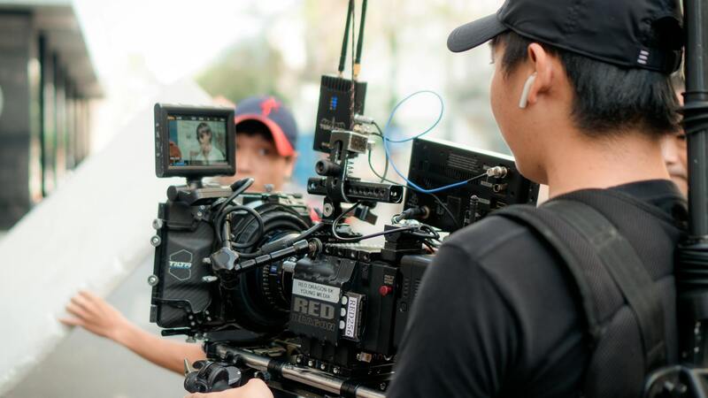
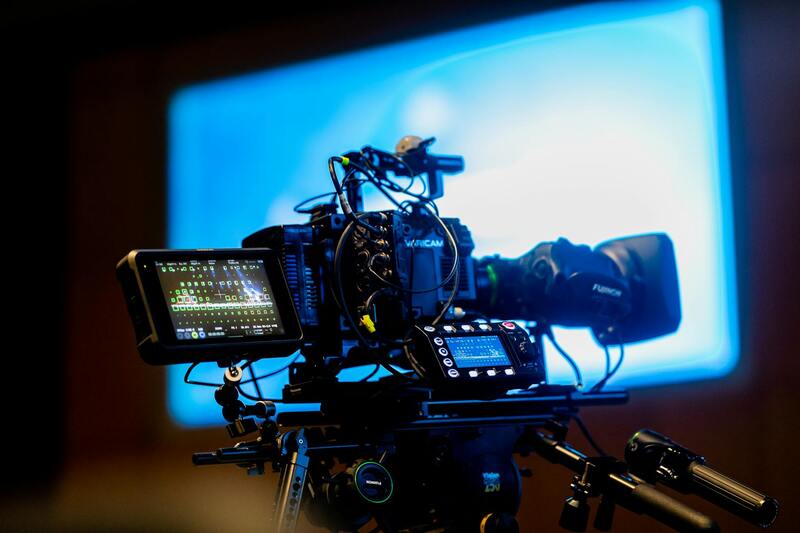
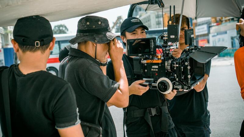
Successful execution of 3d property photography relies on a combination of advanced technologies and specialized tools. High-resolution 3D scanners are at the core, capturing precise spatial data and textures to create detailed virtual models of properties. These scanners employ laser or structured light to measure distances between surfaces, ensuring accuracy in dimensions and details vital for realistic representations.
Complementing the scanning hardware are powerful processing software platforms that compile and render the captured data into comprehensive, interactive models. Such software allows professionals to manipulate, edit, and enhance the virtual environment, optimizing visual quality and functionality. Features include the ability to add annotations, simulate lighting conditions, and produce walkthrough animations.
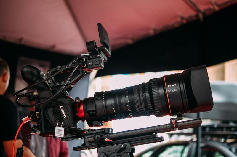
Additionally, specialized camera systems with panoramic and fisheye lenses are often employed to capture wide-angle images that integrate seamlessly into the 3D space. These images serve as the foundation for creating immersive virtual tours that allow potential buyers to explore a property remotely.
Emerging technologies, such as augmented reality (AR) and virtual reality (VR), are increasingly integrated into the 3D imaging process. VR headsets enable clients to walk virtually through a property, enhancing engagement and providing a realistic sense of space. AR applications can overlay digital information onto physical spaces, making property details more interactive.
The Process of Creating 3d Property Visuals
Developing high-quality 3d property visuals involves a systematic process that begins with meticulous data collection. The process typically entails the following steps:
- Initial Survey and Scanning: A professional uses 3D laser scanners or photogrammetric tools to capture precise measurements and details of the entire property or targeted areas.
- Data Processing: The collected data is uploaded into specialized software where it is aligned, cleaned, and optimized for rendering. This ensures accuracy in dimensions and realism in textures.
- Model Construction: The processed data is translated into a comprehensive 3D model. Textures, lighting, and materials are applied to enhance visual fidelity.
- Virtual Tour Creation: Designers embed navigation points, hotspots, and interactive elements, transforming static models into immersive virtual tours.
- Final Rendering and Delivery: Rendering the virtual environment produces the high-quality images and videos used for marketing, with adjustments made based on client feedback.
This entire workflow demands technical expertise and attention to detail, guaranteeing that the final product accurately reflects the physical property.
Best Practices for Shooting 3d Property Photography
Achieving optimal results in 3d property photography hinges on adherence to certain best practices, including:
- Proper Planning: Schedule scans during periods of optimal natural lighting to maximize image clarity and color accuracy.
- Consistent Equipment Calibration: Regularly calibrate scanners and cameras to maintain precision and uniformity throughout the project.
- Minimal Disruption: Ensure the space is tidy and free of clutter to prevent interference with sensors and to produce a clean, professional appearance.
- Optimal Positioning: Position scanners and cameras at strategic points to cover all critical areas, including corners, hallways, and unique architectural features.
- Lighting Control: Balance natural and artificial lighting to reduce shadows and highlights, which assists in capturing consistent textures and details.
- Post-Processing: Invest time in editing and refining virtual models to correct any discrepancies and enhance visual appeal.
Benefits for Miami Realtors and Property Developers
In Miami’s competitive real estate market, leveraging 3d property photography offers distinct advantages:
- Enhanced Listing Appeal: The immersive quality of 3D visuals captivates potential buyers and tenants, increasing interest and engagement.
- Reduced Physical Visits: Virtual walkthroughs enable remote evaluation, saving time for both clients and agents.
- Better Decision-Making: Accurate spatial representations help buyers and investors make informed choices, reducing uncertainties.
- Broader Reach: Digital content can be easily shared across multiple platforms, expanding visibility beyond traditional channels.
- Market Differentiation: Employing cutting-edge visualization techniques distinguishes real estate professionals in a saturated market.
- Accelerated Sales and Leasing: The interactive nature of 3D presentations often shortens transaction timelines by providing comprehensive property insights upfront.
Key Technologies and Tools Used in 3d Property Photography
Creating compelling 3D property visuals relies on a blend of advanced equipment, sophisticated software, and precise techniques that, together, produce highly detailed virtual representations of real estate spaces. The core of 3D property photography involves employing specialized hardware such as laser scanners, high-resolution 360-degree cameras, and tripod-mounted DSLR cameras. Laser scanners are particularly vital as they generate accurate point clouds, capturing every nook and cranny of a property with millimeter precision. These point clouds serve as foundational data that can be processed into detailed 3D models, providing an authentic spatial understanding for viewers.
Complementing hardware, powerful software platforms facilitate the transformation of raw data into immersive virtual environments. Programs such as Matterport, Revit, and Cyclone are widely used for stitching images, constructing 3D models, and creating interactive walkthroughs. These tools include features for optimizing textures, adjusting lighting, and refining geometric details, ensuring that the final visuals accurately reflect the property's real-world condition.
Technological advances have also introduced drone photography and photogrammetry, further expanding the scope of virtual staging. Drones equipped with high-definition cameras are used to capture aerial perspectives, providing context-rich views of property exteriors and surrounding landscapes. Photogrammetry — the process of deriving measurements from photographs — enables detailed 3D reconstructions of complex architectural features or outdoor spaces, supplementing interior models for a comprehensive virtual experience.
A combination of meticulous scanning, high-quality imaging, and advanced processing facilitates the production of detailed, realistic 3D representations that serve as invaluable tools for marketing, planning, and client engagement. The integration of these technologies ensures a seamless visualization process, from initial capture to final virtual presentation.
Key Technologies and Tools Used in 3D Property Photography
At the core of professional 3D property photography are advanced technologies and sophisticated tools that convert raw data into immersive visual experiences. The central hardware components include high-resolution imaging devices, laser scanners, and aerial drones, each playing a pivotal role in capturing comprehensive property data. High-precision laser scanners generate detailed point clouds of interior and exterior spaces, enabling precise 3D reconstructions. Meanwhile, drones equipped with ultra-high-definition cameras expand the capture capabilities to aerial views, offering valuable context about a property's surroundings.
Complementing hardware, powerful software platforms facilitate the transformation of raw inputs into engaging virtual environments. Programs such as Matterport, Revit, and Cyclone serve as the backbone of the process, allowing specialists to stitch images seamlessly, generate precise 3D models, and craft interactive virtual walkthroughs. These software solutions incorporate features for optimizing textures, balancing lighting, and refining geometric details, ensuring that the virtual representations genuinely mirror the physical property.
Emerging technologies such as photogrammetry and aerial imaging further expand the scope of virtual staging. Photogrammetry involves deriving spatial measurements from photographs, which is instrumental in creating accurate outdoor and architectural features. Drones equipped with high-definition cameras facilitate capturing expansive aerial perspectives, providing crucial visual context about surrounding landscapes and neighborhood features. These tools collectively enable detailed, realistic, and user-friendly virtual tours that resonate with prospective buyers and investors.
Additionally, integrated hardware and software systems allow for meticulous scanning and high-quality imaging, culminating in the creation of intricate 3D visualizations. Such detailed models support various real estate activities, including property marketing, architectural planning, renovation visualization, and client engagement. The streamlined interplay between cutting-edge equipment and robust software guarantees a smooth visualization pipeline—from initial capture through to final virtual presentation—ensuring accuracy and visual appeal.
Optimizing the Capture Phase for 3d Property Photography
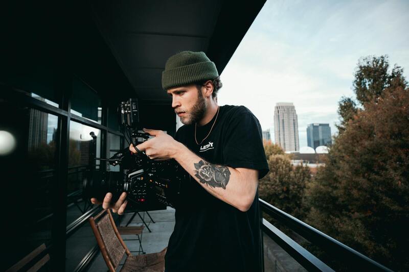
Achieving high-quality 3D property visualizations relies heavily on meticulous planning and execution during the shooting process. To ensure precision and clarity in the virtual models, professional photographers and technicians adhere to strict protocols that emphasize the importance of consistent lighting, accurate measurements, and proper spatial organization.
Effective lighting is paramount in 3D property photography. Natural daylight is preferred whenever possible, as it reveals true colors and textures, minimizing shadows and glare that can distort details in the final model. Supplementary artificial lighting should be evenly distributed to eliminate uneven shadows, especially in interiors with complex layouts. Proper lighting setups facilitate the capture of detailed images required for accurate reconstruction of spaces.
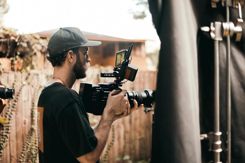
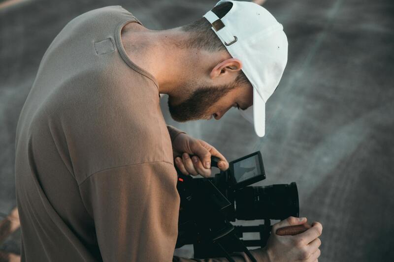
Angles and camera positioning are equally critical. Shooting from multiple viewpoints ensures comprehensive coverage of all architectural features and interior details. High-resolution cameras with wide-angle lenses are typically used to maximize field of view, reducing the need for extensive post-processing. When capturing images, maintaining consistency in camera height, focal length, and exposure settings across all shots guarantees a uniform dataset for processing.
Measuring and calibrating space accurately forms the foundation of precise 3D reconstructions. Specialized tools such as laser scanners or structured-light scanners record the dimensions and spatial relationships within the property. These measurements aid in aligning the digital model with the physical space, avoiding discrepancies that could undermine the model’s usefulness for marketing or renovation planning. During the shoot, securing calibration markers and reference points helps maintain accuracy throughout the process.
Staging the property thoughtfully can also significantly enhance the virtual presentation. Clear, clutter-free spaces with neutral decor highlight architectural features and allow the 3D models to focus on the property's strengths. Additionally, homeowners and agents should remove personal items and excess furniture to create a more appealing and versatile visual experience for prospective buyers.
Finally, ensuring data integrity during the capture process involves backing up images and measurement data regularly. Employing reliable storage solutions mitigates the risk of data loss and maintains the quality of the project at every stage.
Key Technologies and Tools Used in 3d Property Photography
Implementing high-quality 3d property photography relies on advanced technologies that ensure precision, efficiency, and realistic virtual representations. The core tools usually encompass laser scanning devices, structured-light scanners, 360-degree cameras, and photogrammetry software, each contributing uniquely to capturing accurate spatial data and visual details.
Laser scanners are pivotal in obtaining detailed and precise measurements of interior and exterior spaces. They emit laser beams that bounce back from surfaces, creating a dense point cloud that maps the property's dimensions with high accuracy. This data serves as the foundation for constructing detailed 3D models, which are essential for virtual tours, floor plans, and architectural visualizations. r>r> Structured-light scanners operate similarly but project specific light patterns onto surfaces to record depth information. These devices are often used in smaller or more intricate spaces where fine detail capture is necessary. They excel at capturing complex geometries, including decorative moldings and architectural features, which enhance the realism of virtual representations.
360-degree cameras are increasingly popular for their ability to quickly produce immersive spherical images that are integrated into virtual tours. They allow real estate professionals to showcase properties interactively, providing prospects with a comprehensive view from any device. Popular models include those with high-resolution sensors and low-distortion lenses, which ensure clarity and realism in the final presentation.
Photogrammetry software plays a crucial role in transforming images captured by drones, cameras, or scanners into accurate 3D models. This process involves software algorithms analyzing overlapping photographs to calculate spatial coordinates, generating textured meshes that replicate the property’s surfaces. Advanced software solutions further enable editing, annotation, and integration of models into marketing platforms, streamlining the workflow from capture to presentation.
For professionals dedicated to property visualization, understanding and leveraging these tools allows for the creation of compelling and accurate virtual representations. Regular updates and calibration of equipment are essential to maintain the integrity and quality of the data collected, which directly impacts the effectiveness of marketing campaigns tailored for diverse real estate markets like Miami.

Implementing 3d Property Photography in Marketing Strategies
Integrating 3d property visuals into all facets of marketing strategies significantly enhances the property’s visibility and appeal. Real estate professionals should prioritize incorporating high-quality 3d images and virtual tours into online listings, which serve as the primary touchpoints for prospective buyers and tenants. These immersive experiences allow potential clients to explore properties remotely, providing a realistic sense of space, layout, and design without the need for physical visits.
Additionally, embedding 3d visuals within user-friendly websites optimizes engagement. When viewers can interact with virtual models directly on the property’s webpage, it increases the likelihood of attracting serious inquiries and accelerating decision-making processes. Real estate firms should ensure that their websites are equipped with intuitive navigation, enabling users to switch between different perspectives and obtain comprehensive property insights easily.
Virtual tour platforms and social media channels further amplify reach. Sharing 3d virtual experiences across multiple platforms broadens exposure and enhances brand recognition. Content that includes panoramic views and walkthroughs can be optimized for various devices, ensuring consistent quality whether accessed via desktops, tablets, or smartphones.
Moreover, leveraging analytics tools to monitor user interactions with 3d property visuals provides valuable data. Insights into visitor behavior can inform marketing decisions, such as highlighting specific property features that generate the most engagement. Incorporating 3d imagery into email campaigns and digital advertisements also boosts the overall effectiveness of outreach efforts.

Choosing a 3d Property Photography Service in Miami
When selecting a service provider for 3d property photography in Miami, it is essential to consider several key factors that ensure quality and professionalism. Start by evaluating the technical expertise and portfolio of previous projects. A reputable provider should demonstrate proficiency in capturing detailed 3d models that accurately reflect the property's features and layout.
Experience with local Miami real estate market trends can be advantageous, as professionals familiar with regional aesthetics and property types are better equipped to produce visuals that resonate with target audiences. Additionally, inquire about the types of equipment used, including laser scanners, drone integrations, and high-resolution 360-degree cameras, as these tools directly influence the accuracy and realism of the end product.
Service providers should also offer comprehensive packages that include consultation, data processing, and post-production editing. The ability to customize visualizations and incorporate branding elements can further enhance marketing efforts. Turnaround times and ongoing support are also critical considerations to ensure timely project completion and seamless integration into existing marketing campaigns.
Finally, client testimonials and industry reputation serve as strong indicators of reliability and quality. Selecting a Miami-based expert familiar with the local real estate landscape guarantees tailored solutions that meet specific property presentation needs.
Ensuring Accurate and Detailed 3D Property Visuals
One of the most critical aspects of producing high-quality 3d property photography is the accuracy and detail captured in the visualizations. To achieve this, professionals employ an array of specialized tools and techniques that focus on meticulous data collection and rendering. This process begins with precise laser scanning, which allows for the creation of comprehensive point clouds representing the entire property. These point clouds serve as the foundation for developing detailed 3D models that faithfully replicate the spatial characteristics of the property, including dimensions, fixtures, and unique architectural elements.
Equipped with high-resolution 360-degree cameras, professionals can capture immersive images that support the generation of virtual walkthroughs and interactive tours. The use of drone technology further enhances the visual dataset by providing aerial perspectives that showcase property exteriors, landscaping, and surrounding environments from various angles. Integrating these datasets allows for comprehensive 3D models that are both precise and captivating, serving as invaluable assets for marketing and sales strategies.
Advanced Software and Rendering Techniques
Post-capture, the use of sophisticated software is vital for processing raw data into usable, polished visuals. Many industry-leading applications enable detailed modeling, realistic texturing, and lighting adjustments to replicate real-world conditions accurately. These tools often include features for editing and enhancing visuals, ensuring consistent quality and aligning results with the property's actual aesthetic.
Further refinement involves integrating virtual staging, furniture placement, and landscaping elements, which help potential buyers visualize the space more effectively. The combination of precise data collection and advanced rendering techniques results in a compelling visual presentation that communicates the property's strengths clearly and convincingly.
Attention to Lighting and Environmental Context
Effective 3d property photography also emphasizes lighting conditions and environmental context. Capturing images during optimal daylight hours ensures natural lighting illuminates the property’s interior and exterior, highlighting architectural features without harsh shadows or overexposure. Complementary environmental shots — such as surrounding neighborhood views, nearby amenities, and natural landscapes — enhance the comprehensive storytelling of the property’s setting.
By paying meticulous attention to these technical details and environmental factors, 3d property photography emerges as a precise, vivid, and highly informative asset that elevates property listings and effectively engages prospective buyers. Achieving this level of quality involves consistent use of cutting-edge technology, skilled professionals, and an unwavering commitment to accuracy and visual excellence.
