Overview of Commercial Property Aerial Photography
Commercial property aerial photography has become an integral component of modern real estate marketing and asset management strategies, especially within vibrant markets like Miami. This specialized form of imaging involves capturing high-resolution photographs of commercial properties from elevated perspectives, providing a comprehensive visual understanding of the property’s layout, surrounding environment, and structural features.
In the context of Miami's dynamic commercial real estate landscape, aerial images serve a vital role in aiding investors, developers, and brokers to present properties more effectively. By showcasing the full scope of a commercial site — including parking facilities, landscaping, accessibility points, and neighboring infrastructure — aerial photography offers a distinctive vantage point that ground-level images often cannot provide. This vantage allows for detailed analysis, superior marketing presentation, and strategic planning.
The relevance of this imaging technique extends beyond marketing; it supports activities such as site assessment, construction progress monitoring, and land use planning. For property owners and stakeholders, aerial photographs deliver a clear overview, improve decision-making, and help attract prospective tenants or buyers. When leveraging the unique visual advantages of aerial imagery, Miami-based commercial properties can stand out in a competitive market, gaining increased visibility and credibility among targeted audiences.
Effective commercial property marketing relies heavily on a combination of traditional and innovative visual techniques. Aerial photography constitutes a vital tool in this arsenal, helping to create compelling visual narratives that entice potential tenants, investors, and partners. As the commercial real estate sector in Miami continues to grow and evolve, so too does the importance of high-grade aerial imagery that captures the essence of each property in a single, striking frame.
Moreover, advancements in drone technology and aerial imaging platforms have democratized the ability to produce professional-grade photographs, making high-quality imagery accessible to a wide range of stakeholders. This has resulted in increased competition among marketing campaigns and an upward trend toward the adoption of aerial photography as a standard in commercial property promotion and strategic planning.
Legal and Regulatory Considerations in Miami
When conducting commercial property aerial photography within Miami, it is essential to adhere to established protocols governing aerial imaging practices. Authorities in Florida oversee regulations that ensure the safe and responsible use of aerial platforms, including drones and manned aircraft. Prior to initiating any aerial photographic activities, property owners and photographers must review local ordinances and federal regulations to confirm compliance with airspace management, privacy standards, and operational guidelines.
One critical aspect involves understanding Miami-Dade County’s specific guidelines concerning drone operations, which often stipulate restrictions on flight altitude, no-fly zones, and flight permissions over certain districts. These rules are designed to mitigate risks associated with air traffic and public safety, especially in densely populated urban areas.
Operators should also be familiar with Federal Aviation Administration (FAA) regulations, as they govern all drone flights across the United States. The FAA mandates that drone pilots obtain the appropriate certifications, such as the Part 107 license, which attests to their understanding of safe flying procedures and airspace awareness. Ensuring proper registration of drones is also essential, as unregistered devices may attract penalties.

Additionally, privacy considerations must be observed during aerial imaging. This involves respecting the privacy rights of neighboring property owners and avoiding unlawful surveillance activities. Property owners or representatives should work with licensed aerial imaging providers who adhere to all regulatory standards, thereby guaranteeing a legal and responsible approach to capturing high-quality visuals.
To streamline operations and mitigate potential disruptions, obtaining necessary permits in advance is recommended. Many Miami municipalities require permits for commercial drone use, especially when conducting flights over private property or within regulatory flight corridors. Engaging with official agencies early in the planning process can prevent delays and ensure that all legal requirements are met.

By respecting these considerations and working with experienced professional service providers familiar with Miami’s regulatory landscape, stakeholders can effectively utilize aerial photography to enhance property marketing, asset management, and development planning. This responsible approach not only optimizes visual outreach but also fosters a trustworthy reputation in the competitive real estate environment.
Equipment and Technology Used in Aerial Photography
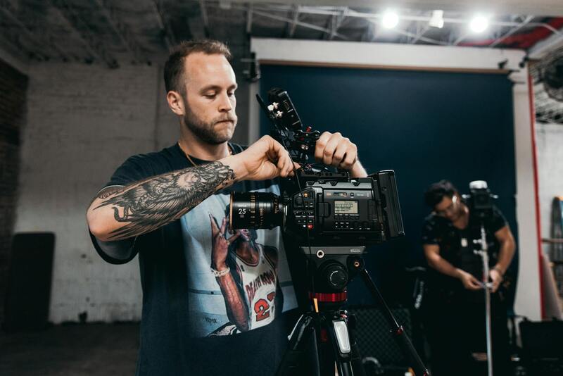
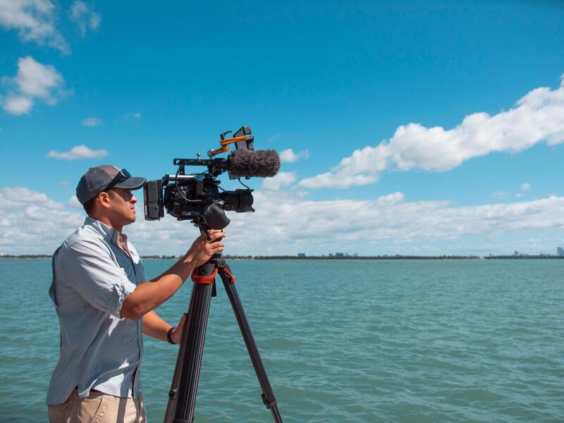
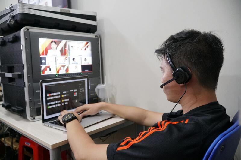
Optimal results in commercial property aerial photography hinge on the deployment of state-of-the-art equipment and technology. High-resolution drones equipped with professional-grade cameras are fundamental for capturing sharp, detailed images that effectively showcase the property's features from diverse angles and heights. These advanced drones often feature gimbal stabilization systems, which ensure smooth, blur-free footage even in challenging wind conditions, providing crisp visuals essential for marketing and analysis.
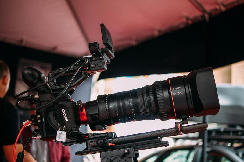
Beyond drones, photographers may leverage specialized aerial camera systems that offer superior zoom capabilities and high dynamic range imaging. These tools are critical when capturing large-scale commercial sites, industrial complexes, or multi-structure developments, allowing for comprehensive visual documentation.
In addition to camera technology, the integration of sophisticated flight control systems enhances safety and precision during shoots. GPS-enabled navigation ensures accurate flight paths, helping operators maintain optimal positioning for targeted shots. Some equipment also incorporates obstacle detection sensors, reducing the risk of collisions and safeguarding valuable assets.

Other technological considerations include remote control systems with real-time video feed, enabling operators to make on-the-spot adjustments for superior image composition. The use of thermal imaging cameras can also provide additional insights into property conditions, such as energy efficiency or plumbing and electrical system issues, adding value to the visual data collected.
As technology continues to evolve, the adoption of artificial intelligence-driven image processing and automated flight planning tools further enhances efficiency and quality. These innovations enable quick turnaround times and consistently high standards in aerial imagery, which are critical for competitive commercial real estate marketing campaigns.
Benefits of Advanced Equipment in Commercial Property Imaging
- Enhanced image clarity and detail, supporting high-impact visual marketing
- Increased safety with obstacle avoidance and automated flight features
- Efficiency gains through automated flight planning and real-time monitoring
- Ability to capture a variety of imaging types, including thermal and HDR photography
- Greater flexibility in capturing complex site layouts from multiple perspectives
Legal and Regulatory Considerations in Miami
When engaging in commercial property aerial photography within Miami, adhering to established protocols is essential to ensure smooth operations and compliance with local standards. It involves understanding aviation regulations that govern drone flights over urban and commercial areas, which often include restrictions on altitude, flight times, and designated no-fly zones. Operators must be familiar with Miami’s specific airspace restrictions, especially near airports, government buildings, and other sensitive sites.
Proper authorizations and permits are necessary before initiating any aerial shooting activities. This entails submitting detailed flight plans and security measures to relevant authorities. Compliance with privacy laws is also critical; capturing images over private properties requires respecting individuals’ and businesses’ rights, avoiding intrusive or unauthorized surveillance.
Operators should conduct thorough site risk assessments, considering environmental factors such as weather conditions and obstacles that could affect the safety and quality of the imagery. Maintaining an up-to-date calibration of equipment ensures the images rendered are accurate and meet professional standards.
To further streamline projects, establishing clear communication channels with local authorities and property owners helps mitigate potential issues. Documentation of all operational plans, permits, and safety procedures provides accountability and facilitates smoother project execution.
Equipment and Technology Used in Aerial Photography
Choosing the right equipment is essential for capturing high-quality images that effectively showcase commercial properties. Modern aerial photography relies heavily on advanced drone technology equipped with high-resolution cameras, stabilized gimbals, and automated flight features. These drones often feature GPS-based navigation systems that enable precise flight paths and positioning, ensuring comprehensive coverage of the target area.
Additionally, professional-grade cameras capable of capturing Ultra High Definition (UHD) or 4K imagery are standard in commercial aerial photography. This level of detail is critical for highlighting property features, surrounding infrastructure, and landscape elements that appeal to investors and tenants.
Stabilization technology plays a vital role in minimizing vibrations and movements during flight, resulting in sharper images even under challenging weather conditions or in windy environments. In more complex projects, multi-rotor drones with intelligent flight modes, such as waypoint navigation and automated orbiting, enhance efficiency and consistency across multiple shots.
Advanced sensors and thermal imaging capabilities are also integrated into some UAV (Unmanned Aerial Vehicle) systems. These features provide additional insights, such as heat loss analysis for energy assessments or detecting insulation issues, which can be valuable in commercial property evaluations.
Data Management and Post-Processing Tools
Beyond capturing images, processing and managing aerial data are crucial steps. Software platforms specializing in photogrammetry can compile multiple images into detailed orthomosaics, 3D models, or flythrough videos, offering an immersive view of the property and its surroundings. These tools enable accurate measurements, site visualization, and enhanced marketing materials that attract prospective clients.
Photogrammetric processing typically involves stitching overlapping images, correcting distortions, and calibrating spatial data to produce georeferenced outputs. This technological approach ensures the resulting visuals meet industry standards for clarity, accuracy, and informational value.
Safety and Maintenance Protocols
To maintain consistent image quality and safety standards, routine maintenance of aerial equipment is mandatory. This includes regular calibration, firmware updates, and thorough pre-flight inspections to identify potential issues that could impact performance. Operators must also adhere to strict safety protocols, such as verifying battery health, ensuring propeller integrity, and validating GPS connectivity before each flight. Proper safety measures prevent accidents, uphold image integrity, and protect valuable equipment investments.
Investing in cutting-edge technology and robust data management practices allows real estate professionals to leverage aerial photography as a vital tool in the competitive commercial property market, delivering compelling visual narratives that elevate marketing strategies.
Maximizing Commercial Property Aerial Photography Through Approved Methods
When aiming to elevate the marketing appeal and informational depth of commercial property listings, employing standardized and recognized aerial photography techniques is essential. Each approach is designed to ensure high-quality visuals while adhering to regional guidelines and safety standards, ultimately enhancing client confidence and operational efficiency.
Utilizing Drone Photography for Precision and Detail
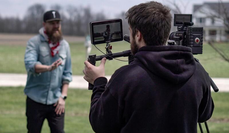
Unmanned aerial vehicles (UAVs) equipped with high-resolution cameras are the cornerstone of current commercial aerial imaging. They allow for flexible flight paths, controlled positioning, and targeted shots that capture the property from optimal angles. To achieve consistency and compliance, operators follow strict flight plans that specify altitude, flight speed, and camera settings aligned with industry best practices. These plans are developed considering factors such as property layout, surrounding infrastructure, and lighting conditions, ensuring comprehensive coverage without infringing on restricted zones.
Additionally, using pre-programmed flight paths and autonomous drone operations enhances accuracy and repeatability, which is particularly valuable for property comparisons over time or for detailed site documentation. These methods also facilitate the creation of multi-view panoramas, detailed site surveys, and high-resolution videos, augmenting marketing materials and stakeholder presentations.

Employing Certified Aerial Photography Services
Partnering with professional aerial photography providers who operate within regional certification and licensing standards delivers consistent, high-caliber results. These services typically incorporate advanced equipment, such as stabilized gimbals, multiple camera systems, and georeferencing tools, to ensure sharp images and facilitate accurate mapping. Staffed by experienced pilots trained in operational safety and data management, these providers also maintain compliance with airspace regulations, including restricted zone clearances and flight altitude restrictions, to avoid violations and ensure unobstructed service delivery.
Certification and adherence to recognized protocols reinforce the authenticity and quality of the imagery, which enhances transparency for clients and aligns with industry expectations for professional commercial real estate documentation.
Implementing Photogrammetry Using Approved Software Platforms
For truly detailed site analysis, photogrammetric techniques are employed to convert multiple overlapping images into 2D orthomosaics and 3D models. This process involves capturing high-resolution images from various angles and processing them through reputable software that aligns, stitches, and calibrates the spatial data. Proper use of these platforms ensures the final outputs are georeferenced and accurately represent the physical environment, aiding in property valuation, planning, and development assessment.
Utilizing such technology within authorized frameworks guarantees that data integrity, spatial accuracy, and visual clarity meet industry standards, offering clients a reliable basis for decision-making.
Adhering to Safety and Data Management Standards
In carrying out aerial photography projects, strict adherence to safety protocols and data management procedures is mandatory. This includes pre-flight equipment checks, calibration routines, and ongoing training for personnel to handle unpredictable conditions effectively. Data captured during flights is securely stored, backed up, and processed using approved encryption and storage practices to protect client confidentiality and project integrity.
By committing to these proven methods, aerial photography providers contribute to a seamless workflow that maximizes imagery quality while minimizing operational risks, ensuring that commercial property stakeholders receive dependable and accurate visual data for their marketing and analytical needs.
Equipment and Technology Used in Aerial Photography
Precision and clarity in commercial property aerial photography are achieved through the utilization of advanced equipment and cutting-edge technology. High-resolution drone cameras equipped with professional-grade lenses capture detailed imagery, ensuring that even the smallest features of a property are visible. These cameras often feature stabilization technology, such as gimbals, which counteract drone movements and vibrations, resulting in sharper images essential for detailed analysis and marketing purposes.
Beyond traditional cameras, multispectral and thermal imaging sensors are also employed in specialized aerial surveys. Multispectral sensors capture data across various wavelengths, providing insights into vegetation health, land use, and material properties — valuable information for large-scale commercial developments. Thermal imaging, on the other hand, detects heat emissions, helping identify structural issues or energy inefficiencies in commercial buildings.
Remote sensing technologies, including LIDAR (Light Detection and Ranging), significantly enhance data collection capabilities. LIDAR systems mounted on aerial platforms produce highly accurate 3D models and topographical maps, which are crucial for planning construction, assessing site conditions, and analyzing landscape features with high precision. The integration of GNSS (Global Navigation Satellite System) and inertial measurement units (IMUs) ensures accurate georeferencing of all collected data, creating a reliable spatial foundation for subsequent analysis.
Contemporary aerial photography also benefits from the deployment of autonomous flight systems, which allow for systematic, repeatable data collection over time. Such capabilities are instrumental in tracking property development, monitoring construction progress, and conducting environmental assessments. Furthermore, the evolution of software platforms for image processing and analysis enables efficient stitching, orthorectification, and 3D modeling, streamlining workflows from data capture to final delivery.
Operators of these sophisticated systems are trained in handling and calibrating the equipment to maintain optimal image quality and data accuracy. Regular maintenance, calibration routines, and adherence to operational standards are vital to ensure consistent performance, especially when capturing images in diverse weather conditions and complex environments.
The continued development of these technologies is set to further enhance the accuracy, efficiency, and scope of commercial property aerial photography, providing stakeholders with invaluable insights into their assets and surrounding environments. Employing the latest equipment within approved operational frameworks guarantees the integrity of data collected, facilitating informed decision-making and strategic planning in Miami's dynamic commercial sector.
Legal and Regulatory Considerations in Miami
Executing commercial property aerial photography within Miami requires adherence to specific procedures that ensure compliance with local authorities' guidelines. Proper authorization for flight operations involves securing the necessary notifications or permits from the relevant aviation and municipal agencies. These measures help maintain a structured environment for aerial activities and ensure safety for both operators and the public.
Operators must understand restricted zones, which include densely populated areas, government facilities, and other sensitive locations. Identifying these zones beforehand minimizes the risk of interference with critical infrastructure and community spaces. Establishing clear flight corridors and maintaining communication with local authorities are integral to lawful aerial photography practices.
Coordinate with Miami’s municipal planning departments to align aerial activities with city-specific stipulations. This often involves demonstrating responsible drone handling, providing detailed flight plans, and ensuring the work does not disrupt normal city operations. Such protocols foster a seamless collaboration between aerial photography providers and regulatory bodies, reinforcing a culture of safety and professionalism.
Moreover, operators should stay informed about evolving policies, especially those related to privacy considerations. Securing prior consent from property owners or relevant stakeholders not only streamlines project execution but also aligns with best practices for responsible data collection. Employing a thorough, methodical approach in obtaining necessary clearances underlines a commitment to the integrity of the project and the community's well-being.

Utilizing official channels and verified documentation is fundamental in ensuring aerial operations are carried out within the accepted standards. Keeping detailed records of permits, flight logs, and communication with authorities provides transparency and accountability. This meticulous approach supports the delivery of high-quality imagery while respecting city regulations and community interests.
Engaging with experienced aerial service providers who understand Miami’s regulatory landscape ensures that all operations are conducted smoothly, legally, and efficiently, setting a professional standard for commercial property imaging projects.
