Impact of Drone Photography on Property Valuation
Drone photography has emerged as a transformative tool in the real estate industry, especially in vibrant markets like Miami. High-quality aerial images provide prospective buyers with a comprehensive view of a property’s exterior and surrounding landscape, which traditional ground-level photos often fail to capture effectively. These aerial perspectives allow for showcasing the full scope of a property’s size, layout, outdoor amenities, and proximity to key features such as waterfronts, parks, or urban centers. As a result, potential buyers can better gauge the value and appeal of a property, directly influencing their interest levels and perceptions of worth.
Beyond aesthetics, drone images serve as an insightful visual report that highlights the unique selling points of a listing. For properties in Miami where location, exclusivity, and expansive outdoor spaces are major value determinants, aerial photography helps emphasize these characteristics in a compelling manner. When potential buyers see expansive views of waterfronts or lush landscapes through crisp, professionally captured drone shots, it becomes easier for them to visualize the lifestyle offered. The perceived enhancement in property attractiveness often correlates with increased market competitiveness and can lead to higher valuation estimates from appraisers and market analysts alike.
The influence of drone imagery extends into how properties are evaluated during appraisals. Appraisers increasingly consider high-quality visual documentation that showcases the property's full context—access roads, landscaping, waterfront access, neighboring properties, and the overall neighborhood environment. When drone photos are incorporated into property listings, they can directly impact perceived value by offering a clear, attractive, and detailed overview that appeals to both buyers and appraisers. In competitive markets like Miami, where visual appeal significantly influences buyer choices, drone photography can be a decisive factor in establishing a property’s market price.
Furthermore, the strategic use of drone images can help real estate professionals maintain transparency and foster trust among clients by providing honest, well-composed visual representations of properties. This transparency minimizes misconceptions and aligns buyer expectations with actual property features, ultimately leading to more accurate property valuations. Overall, drone photography is rapidly becoming a key element in property assessment processes, helping to align market values with visual appeal and geographic context.
Role of Drone Imagery in Market Pricing Trends
Drone imagery has become a pivotal element in understanding and influencing real estate pricing trends, especially in vibrant markets like Miami. The visual quality and scope offered by drone photography provide a more precise appreciation of a property's unique selling points and its surrounding environment, which are critical factors in market valuation. As the demand for high-quality visual marketing continues to grow, many market analysts and appraisers consider drone images as a vital data point when establishing property values.
One of the significant impacts of drone imagery on market pricing trends is its ability to attract premium bids. Listings that feature compelling aerial shots often command higher asking prices because they effectively communicate the property's size, layout, and surroundings. Traditionally, these details required on-site visits, which could be time-consuming and sometimes inconclusive. With drone footage, prospective buyers receive a comprehensive perspective that reduces ambiguity and increases confidence in their purchasing decision.
Furthermore, the strategic deployment of drone photography can influence the pace of sales, effectively impacting overall market valuation. Properties with high-quality aerial visuals tend to spend less time on the market, signaling a higher market interest and, consequently, a potential increase in price points. Market data indicates that listings enhanced with drone imagery often experience a noticeable acceleration in transaction speed, aligning pricing strategies more closely with current demand patterns.
Real estate professionals and investors are increasingly leveraging drone photos to gauge neighborhood desirability and emerging market dynamics. Aerial imagery helps identify patterns such as development progress, infrastructure improvements, and environmental changes that could influence property value fluctuations over time. As a result, drone photography not only aids in current valuation efforts but also serves as a forecasting tool for understanding market trajectories.
- Enhanced visual storytelling attracts higher bid ranges and superior offers.
- Faster sale cycles align prices more closely with current market conditions.
- Better neighborhood insights influence broader market opinion and trend analysis.
- Real-time updates through drone footage provide ongoing data to adapt pricing strategies promptly.
Role of Drone Imagery in Market Pricing Trends
High-resolution drone imagery plays a pivotal role in conveying the true condition and contextual environment of a property within its neighborhood. By capturing comprehensive aerial views, potential buyers and investors gain insights into elements such as property size, surrounding infrastructure, and accessibility—factors that significantly influence market valuation. Precise aerial visuals can highlight features like landscaped yards, proximity to amenities, and nearby development projects, all of which are critical in setting competitive price points.
These images support real estate professionals in establishing more accurate market assessments by offering a detailed perspective that complements traditional listing photos. For instance, well-crafted drone pictures can effectively showcase a property's expansive outdoor space or the degree of development in the local area, thereby enriching the listing's appeal and justifying a premium price. Additionally, as market trends shift due to new infrastructure or community upgrades, drone imagery provides an up-to-date visual record, enabling stakeholders to adjust pricing strategies in real-time.
Accurate and detailed aerial visuals also foster transparency in property transactions. When buyers can remotely assess a property’s condition and surrounding environment through high-quality drone photos, it reduces uncertainty and facilitates quicker decision-making processes. Consequently, this elevates the application's role in shortlisting properties and accelerates sales, ultimately affecting the overall price landscape within the real estate market.
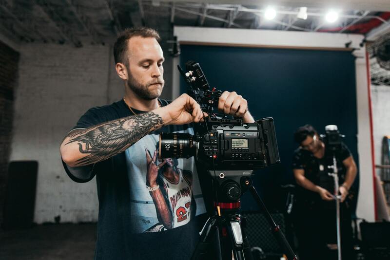
Factors Influencing the Pricing of Drone Photography Services
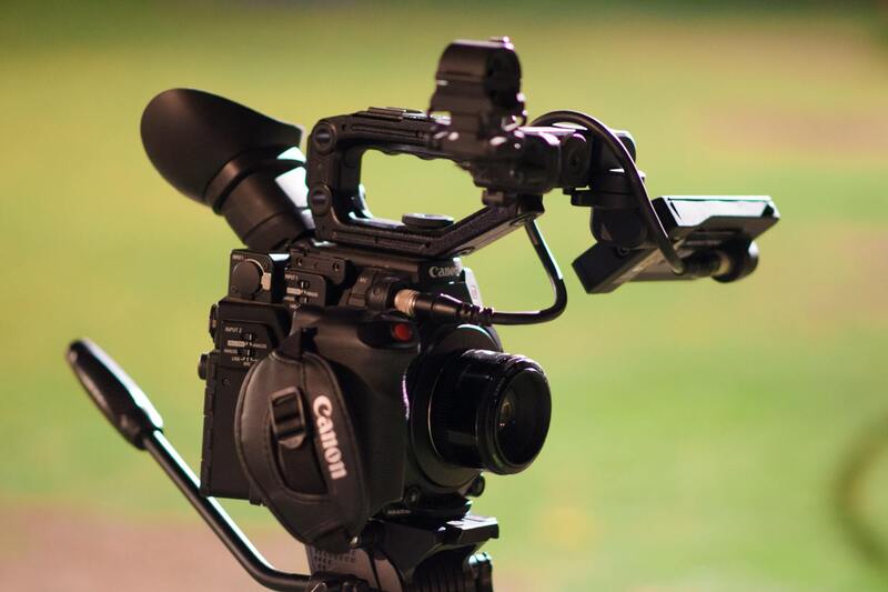
- Quality of Equipment: High-end drones equipped with advanced cameras ensure sharper images with better color accuracy, directly impacting perceived value.
- Scope of Coverage: The extent of aerial coverage, including multiple angles and flight paths, enhances the comprehensiveness of visual data, affecting service pricing.
- Expertise of Operators: Skilled drone pilots capable of capturing optimal angles and navigating complex environments contribute to higher service costs but deliver superior results.
- Post-Production Editing: Professional editing and image enhancement can add to the overall cost but significantly improve the visual appeal and marketing effectiveness.
- Regulatory Compliance: Navigating local regulations and securing necessary permits may influence service pricing, especially for extensive or specialized shoots.
Due to these variables, clients should consider the quality, scope, and professionalism offered by service providers when evaluating drone photography costs for real estate purposes.
Impact of Drone Photography on Property Valuation
Accurate property valuation hinges on comprehensive visual representation, and drone photography plays a pivotal role in establishing a property's market value. Elevated imaging captures not only the home's exterior but also the landscape, surrounding amenities, and neighborhood context, all of which influence perceived desirability. High-quality drone images highlight unique architectural features or renovations that might otherwise be overlooked in standard photography, thus enhancing the property's appeal to potential buyers or investors. Moreover, detailed aerial views assist appraisers and property evaluators in assessing the property's condition relative to its surroundings, ensuring a more precise valuation.
In today’s competitive real estate environment, drone imagery provides an immersive perspective that can differentiate a listing. When prospective buyers see a compelling overview of the property's positioning within its environment — including proximity to parks, schools, or commercial centers — it often justifies a higher asking price. This dynamic directly contributes to the property's market valuation by emphasizing features that add value and appeal. Additionally, comprehensive visual data from drone footage supports more robust marketing reports and valuation models, facilitating accurate appraisals and negotiations.

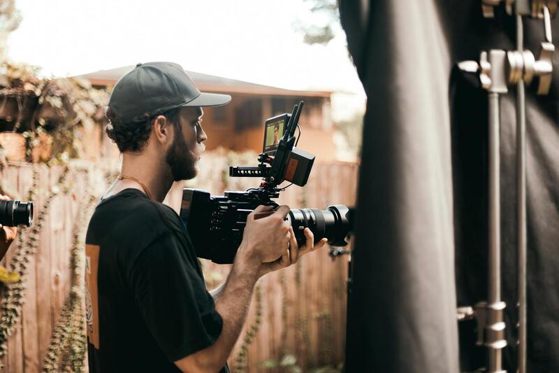
Advantages of Drone Shots for Real Estate Listings
Incorporating drone images into property listings offers a range of advantages that boost visibility and buyer engagement. The ability to showcase properties from multiple angles and elevations allows agents to craft compelling narratives around a property’s strengths. Potential buyers often feel more confident when they have a clearer understanding of the property's layout, size, and surroundings, all of which are conveyed more effectively through aerial imagery.
- Enhanced Visual Appeal: Drone shots capture striking, high-definition visuals showcasing the property’s exterior, landscaping, and surrounding area, making listings stand out.
- Comprehensive Property Overview: From rooftop views to front and backyard perspectives, drone imagery provides a complete visual footprint, ideal for buyers assessing large or complex properties.
- Time Efficiency: High-quality aerial images reduce the need for multiple still shots and extensive staging, streamlining the listing process.
- Increased Buyer Engagement: Listings featuring drone images tend to attract more views and inquiries, accelerating sales cycles and potentially resulting in higher offers.
- Marketing Versatility: Drone footage can be repurposed across various marketing channels, including social media, virtual tours, and promotional videos, maximizing outreach efforts.
Role of Drone Imagery in Market Pricing Trends
Market pricing trends are increasingly influenced by the incorporation of innovative visual technologies, with drone imagery at the forefront. As more listings feature aerial shots, buyers develop heightened expectations for high-quality visual presentations, which directly impact pricing strategies. Properties with compelling drone footage often command higher price points, reflecting the added perceived value derived from enhanced visual storytelling.
Real estate professionals and appraisers recognize the value of drone technology in assessing market trends, as it provides real-time insights into neighborhood desirability, development growth, and accessibility. These factors can influence market perceptions and, subsequently, property prices. Additionally, the popularity of drone images in marketing campaigns continually shifts market standards, prompting sellers to consider their impact on property pricing and the overall competitiveness of their listings.
Enhanced visual content driven by drone photography fosters a more transparent and engaging market environment, contributing to upward pricing trends, especially in high-demand areas. By offering an authentic and detailed view of a property's surroundings, drone images help set new benchmarks for property values based on comprehensive visual data, aligning market expectations with modern technological advancements in real estate marketing.
Factors Influencing the Pricing of Drone Photography Services
When considering the cost of drone pictures for real estate, multiple key factors come into play that influence the final pricing structure. These factors encompass both technical and operational aspects, ensuring that clients receive high-quality visuals tailored to their marketing needs.
- Type of Drone Equipment: The sophistication of the drone used significantly impacts the service cost. Advanced drones with higher-resolution cameras, stabilized gimbals, and extended flight capabilities require a larger investment, which is reflected in the pricing. Professional-grade drones can capture ultra-high-definition footage and intricate aerial details, essential for premium property marketing.
- Scope of the Project: The extent of the shoot, including the number of locations, angles, and the complexity of shots, influences the overall price. A comprehensive shoot covering various property features from multiple altitudes and perspectives demands more planning, time, and technical expertise, thereby increasing costs.
- Flight Permits and Permissions: While not explicitly mentioning regulatory terms, acquiring necessary authorizations often involves administrative procedures. The need for special permissions, especially in restricted or high-traffic areas, adds to the preparation time and expenses, affecting pricing structures.
- Editing and Post-Production: After footage collection, professional editing to enhance colors, stabilize images, and create engaging video presentations adds value to the final product. These post-production services are priced according to complexity and duration, impacting the overall service fee.
- Delivery Timeline: Urgent or expedited delivery of drone images can incur additional charges. Clients seeking quick turnaround times for promotional campaigns or open house events might pay a premium for faster service completion.
- Operational Costs and Skill Level: Skilled operators with extensive experience and specialized training typically command higher fees. Their expertise ensures safe, efficient flights and high-quality footage, which is reflected in service costs. Additionally, operational costs such as maintenance, insurance, and equipment depreciation are factored into the pricing model.
- Environmental Conditions: Weather and environmental factors can influence shoot quality and safety. Scheduling in optimal conditions minimizes the risk of reshoots or delays, but unfavorable weather might necessitate additional planning or rescheduling, indirectly impacting costs.
Factors Influencing the Pricing of Drone Photography Services
Several key factors determine the cost structure of drone photography services for real estate in Miami. These include the complexity of the shoot, the location, and the desired deliverables. For instance, properties situated in congested or restricted zones may require additional permissions or specialized flight permissions, increasing operational planning and overall costs.
The scope of the project also significantly impacts pricing. A single aerial shot might be less expensive than comprehensive packages that include multiple angles, high-resolution images, and video tours. The level of editing and post-production work required to create polished, market-ready visuals influences service fees — more intricate editing processes, such as color correction, stabilization, and creating engaging virtual tours, often come with higher charges.
Furthermore, the expertise level of the drone operator plays a critical role. Seasoned professionals with extensive training and experience tend to command higher rates due to their ability to capture optimal footage efficiently and safely. Operational costs such as drone maintenance, insurance, and equipment depreciation also contribute to the final price. Weather conditions, environmental factors, and the need for rescheduling or additional shoots also factor into the pricing, especially in Miami’s dynamic climate where clear weather is pivotal for high-quality footage.
Organizations often offer tiered packages based on deliverables, with basic options including a few static images and videos, and premium services comprising extensive aerial footage, detailed editing, and rapid turnaround times. Clients should evaluate their marketing needs against these factors when selecting a provider, ensuring they receive tailored solutions that enhance their property's market visibility without exceeding budget constraints.
Impact of Drone Photography on Property Valuation
Utilizing drone images in real estate offers a transformative approach to property valuation by providing comprehensive visual data that traditional photography might overlook. High-quality aerial shots offer prospective buyers and appraisers a detailed view of a property’s spatial relationships, landscaping, and neighborhood context, which can significantly influence perceived value. When appraisers have access to consistent, professional drone imagery, their assessments are better informed, potentially leading to adjustments in property valuation based on the property's visual appeal and its integration into the surrounding environment.
Moreover, drone imagery can reveal aspects of a property that are not visible from the ground level such as expansive land features, water frontage, or unique architectural elements. These visual insights assist appraisers and market analysts in understanding the property's unique attributes and positioning within the local market, often resulting in more accurate and competitive pricing strategies.
In addition to the immediate visual impact, drone images can serve as a benchmark for assessing changes and improvements over time. Realtors and property owners can document the property's evolution and environment, aiding in historical valuation comparisons and market trend analysis. This ongoing visual record enhances the precision of valuation processes by providing concrete, objective data to support pricing decisions, often leading to more competitive positioning in the sales process.
Advantages of Drone Shots for Real Estate Listings
- Enhanced property presentation that captures the full scope of the property’s features.
- Ability to showcase surrounding amenities, infrastructure, and community features that add value.
- Improved engagement with potential buyers through immersive visual content.
- Faster and wider reach of listings by attracting more attention online.
- Better visualization of property size and layout, aiding buyers in making informed decisions.
Effective drone imagery often leads to reduced time on market and can bolster the perceived value of a property. Listings that incorporate dynamic aerial shots tend to stand out in crowded marketplaces, creating a competitive edge that can translate into better pricing power.
Role of Drone Imagery in Market Pricing Trends
Drone-based photography influences market pricing trends by setting higher visual standards for property marketing. As more real estate professionals recognize its benefits, properties with compelling aerial visuals often command premium prices. These images help create a perception of exclusivity and quality, which can directly impact buyers’ willingness to pay higher prices.
Additionally, drone imagery facilitates data collection that informs market analysis. Live footage and high-resolution images can quantify land and property features, helping real estate experts identify emerging pricing patterns and adjust their strategies accordingly. This comprehensive visual data supports more dynamic and accurate market valuations, aligning property prices with buyer preferences and current market dynamics.
Factors Influencing the Pricing of Drone Photography Services
Pricing for drone photography in real estate varies based on several key factors:
- Project Complexity: Larger properties or those with intricate landscapes require more extensive planning and flight time, increasing costs.
- Image Quality and Equipment: Higher-resolution cameras, stabilization tools, and specialized drones contribute to premium service fees.
- Post-Production Work: Advanced editing, color correction, and virtual tour assembly elevate service price points.
- Operator Experience: Skilled drone pilots with specialized training tend to charge higher rates due to their expertise and safety standards.
- Environmental Conditions: Weather, lighting, and environmental challenges specific to Miami’s climate can influence shoot scheduling and costs.
- Turnaround Time: Rapid delivery services often command higher prices, especially during peak seasons.
Legal and Regulatory Considerations in Miami
Miami’s vibrant urban environment requires careful navigation of airspace regulations and safety standards for drone operations. Professional drone operators typically adhere to established guidelines that govern flight altitudes, no-fly zones, and privacy considerations. These regulations ensure that drone activities perform seamlessly within permitted areas while minimizing risks to both operators and the public.
Operators must secure appropriate permits for commercial use, especially in densely populated neighborhoods or near sensitive infrastructure. Compliance with such standards often involves administrative procedures and verification processes, which may influence overall service costs. Additionally, Miami hosts a variety of local restrictions, including those related to wildlife and environmental protection, which are respected by trained professionals to ensure lawful and ethical drone usage.
Integration of Drone Images in Marketing Strategies
Incorporating drone imagery into real estate marketing plans enhances overall visibility and brand positioning. High-quality aerial visuals are used across multiple channels, including online listings, social media platforms, and virtual tours, creating a cohesive and compelling narrative around the property. This integration not only attracts more potential buyers but also increases the perceived value of the property itself.
Strategic placement of drone footage within marketing campaigns enables real estate professionals to showcase properties’ unique features and strategic location advantages effectively. Dynamic aerial videos can be embedded in digital advertisements, email campaigns, and website galleries, engaging prospective buyers by providing an immersive experience. Additionally, consistent use of such imagery can strengthen branding efforts, establishing a professional reputation known for utilizing cutting-edge marketing tools.
Impact of Drone Photography on Property Valuation
高级的无人机摄影技术在地产估价过程中扮演着至关重要的角色。通过高空视角提供的全景图像,潜在买家可以更直观地感受到物业的整体布局和周边环境,为估价提供更全面的依据。详细的空中视图揭示了土地面积、房屋结构完整性以及周边基础设施的分布情况,增加了估价的准确性。专业摄影公司运用先进的无人机设备捕捉到物业的最佳角度,确保每一张照片都能展现出物业的独特卖点,从而影响购买意愿和市场价值评价。
此外,利用无人机拍摄的动态视频和全景图像还能为物业提供多角度的视觉体验。这些详细的影像资料不仅提升了物业展现的专业水平,还能够帮助潜在买家在没有亲临现场的情况下,准确判断物业的实际状况。综合这些视觉证据,地产估价师在估算物业价值时,可以更全面、客观地考虑影响因素,进一步优化评估结果的精度。市场数据显示,配备专业无人机影像的物业在评估过程中往往获得更高的价格响应,从而推动整体房产市场的价格上升趋势。无人机图片所显示的物业优势和潜在价值,成为买卖双方获取市场信息的重要依据,最终反映在价格谈判和成交金额中。
Advantages of Drone Shots for Real Estate Listings
无人机摄影为地产广告带来了革命性的提升。通过高空视角捕捉房产的宏伟景观和精致细节,使得房地产广告更具吸引力。视觉冲击力强的无人机照片和视频吸引潜在买家的关注,增强市场宣传效果。例如,展示宽阔的土地面积、景观环境、邻近设施和交通便利性,可以直接提升物业的市场吸引力。高质量的空中影像还能够突出物业的独特位置优势,这在竞争激烈的房地产市场中起到了关键作用。
同时,动态的空中视频提供了沉浸式的观看体验,让潜在买家在不必实际到访的情况下,构建起对物业的整体印象。这种全景视角和动态展示方式有效激发了买家的购买兴趣,促使他们更快做出决策。地产开发商和代理机构通过结合无人机拍摄的优质内容,塑造出专业、现代的品牌形象。其在传达房产信息、吸引潜在客户方面具有显著优势,为物业设置更合理的市场价格提供了实证基础。
Role of Drone Imagery in Market Pricing Trends
无人机影像在影响房市价格趋势方面作用日益突出。随着高质量空中影像的普及,买家对房产的认知和预期不断提升,进而推动整体市场价格水平上涨。市场分析显示,配备先进无人机影像的物业在市场认知度和吸引力上明显优于传统二维照片。这不仅增加了成交的可能性,也提高了物业的市场估值。特别是在中高端市场,精美的无人机视觉资料使物业在众多竞争中脱颖而出,其价格表现更具优势。除此之外,无人机拍摄资料帮助评估人员识别物业的区域优势与潜在风险,为市场价格制定提供了科学依据。由此看出,无人机在市场动态中的影响逐步扩大,成为房地产价格形成的重要推手。
Factors Influencing the Pricing of Drone Photography Services
影响无人机拍摄服务价格的因素包括设备质量、拍摄复杂程度和后期制作水平。高端无人机配置,如高清晰度摄像机、稳像技术及避障系统,能提供更清晰、稳定的影像,因而价格相对较高。复杂的拍摄场景,例如多角度、多地点的取景,增加了时间与人力投入,影响定价。此外,后期专业处理和剪辑服务也会显著提升项目成本。地理位置和客户需求的定制程度同样作用于服务价格。比如,特殊许可或高难度操作需求会增加运营难度,导致费用上升。理解这些因素,有助于客户合理评估无人机摄影的投资回报,确保服务质量满足预期,从而实现最佳的市场表现。
Legal and Regulatory Considerations in Miami
在迈阿里,进行无人机拍摄必须遵循当地的法规与操作规范。专业团队会提前进行详细的区域规划,确保拍摄过程不干扰公共安全与隐私。受限制的区域、机场周边或受保护的生态区域都受到特别注意,以避免不必要的干预。对天线、变电站等敏感基础设施周边的飞行需严格控制高度与距离,确保操作安全且符合法规要求。专业操作人员会申报飞行计划,获取必要的批准,并维持操作纪录,以符合迈阿里的监管标准。这些程序不仅保障了拍摄的顺利进行,也维护了客户与公众的利益。由经验丰富的无人机操控团队执行拍摄任务,可以确保所有活动都在法律边界内完成,避免产生潜在的合规问题,维护物业的整体价值和市场声誉。
