Overview of 3D Drone Photography
3D drone photography is transforming how industries capture and analyze their aerial environments. By utilizing advanced drone technology equipped with high-precision cameras, this specialized form of imaging generates three-dimensional visual representations of landscapes, structures, and infrastructure. Unlike traditional aerial photography, which produces flat, two-dimensional images, 3D drone photography captures spatial depth and detailed topographical information, providing a comprehensive perspective of the area under observation.
This technology significantly enhances the clarity and accuracy of visual data collection, enabling detailed inspection, planning, and analysis in sectors such as construction, real estate, environmental monitoring, and urban planning. For example, in construction, 3D models generated from drone data allow engineers to monitor progress, identify potential issues early, and make informed decisions without the need for on-site inspections. Similarly, real estate professionals utilize this photography to offer immersive, detailed virtual tours, helping potential buyers better understand property features and spatial relationships.
The relevance of 3D drone photography extends across various industries because it provides precise, scalable, and dynamic visual data. This technology's ability to generate detailed models enhances project accuracy, facilitates better communication among stakeholders, and accelerates decision-making processes. In urban environments like Miami, where development projects, environmental assessments, and infrastructure inspections are ongoing, 3D drone imaging plays an increasingly critical role in supporting sustainable growth and efficient planning.
As drone hardware and software continue to advance, the capabilities of 3D aerial imaging are expanding further. The integration of lidar sensors, photogrammetry software, and GPS technology ensures that the data collected is both highly accurate and rich in detail. These advancements empower professionals to document changes over time, conduct in-depth site analysis, and develop detailed spatial models that support a wide array of professional applications.

In the digital age, the importance of high-quality aerial visuals cannot be understated. 3D drone photography offers an innovative, efficient, and reliable approach to capturing complex visual information from above, making it an invaluable tool for diverse applications across industries. Its significance continues to grow as technology evolves, enabling businesses and organizations to leverage detailed visual insights to enhance operational efficiency and strategic planning.
Key Technologies Used in 3D Drone Imaging
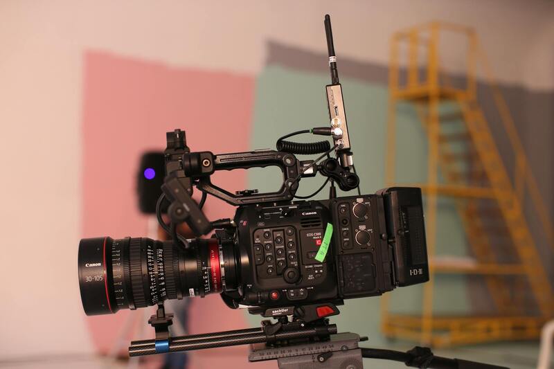
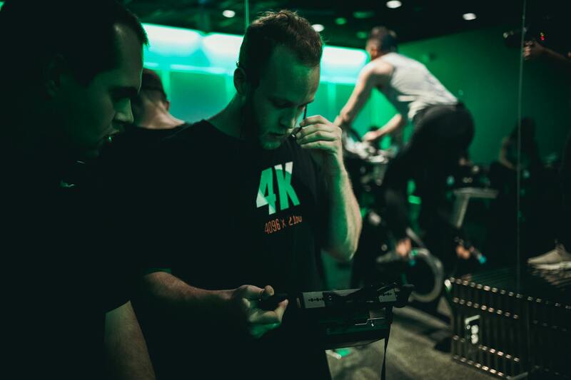
Creating precise and detailed 3D models through drone photography relies on a combination of advanced hardware and sophisticated software solutions. At the core of this process are high-resolution cameras, LIDAR sensors, and integrated GPS systems, each playing a vital role in capturing comprehensive spatial data.
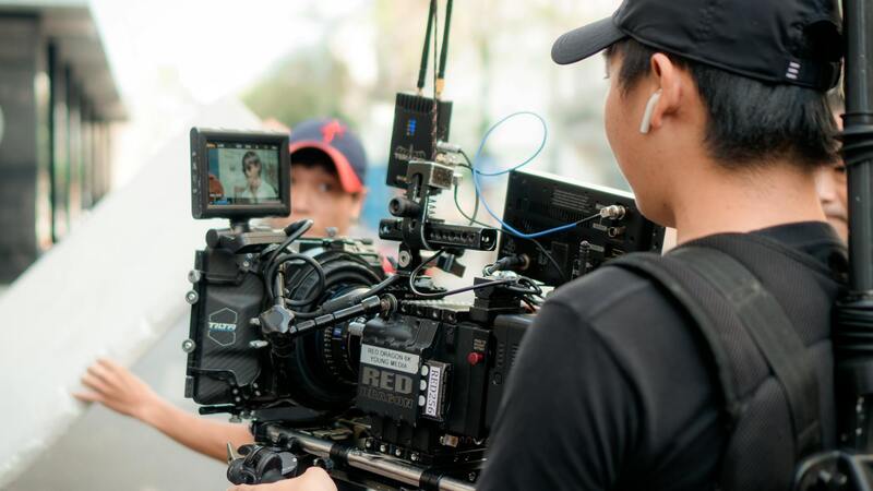
High-resolution cameras mounted on drones are fundamental for capturing detailed images from various angles and elevations. These images serve as the primary data points for photogrammetry—the process of constructing 3D models from 2D images. When combined with precise GPS and inertial measurement units (IMUs), the captured images are accurately geo-referenced, ensuring models align perfectly with real-world locations.
LIDAR sensors, a cutting-edge component in modern drone systems, extend the capabilities of traditional photogrammetry by emitting laser pulses to measure distances to surfaces very precisely. This technology allows for detailed surface and obstacle detection, even in challenging environments or low-light conditions. LIDAR data can be integrated with imagery to create highly detailed point clouds, serving as the foundation for accurate 3D modeling.
Software solutions play a crucial role in processing the collected data. Photogrammetry software uses algorithms to analyze overlapping images, identify common points, and generate dense point clouds. These point clouds are then transformed into textured meshes, enabling the creation of realistic, high-fidelity 3D models. Advanced software also offers tools for editing, annotating, and analyzing models, providing invaluable insights for engineering, construction, environmental monitoring, and other industry applications.
Fundamentally, the integration of these technologies—sensor suites, GPS, imaging hardware, and processing software—ensures that data collected from the field is both rich in detail and highly reliable. This combination allows professionals in Miami to undertake detailed site inspections, monitor construction progress, and perform environmental assessments with a level of accuracy that enhances decision-making and project outcomes.
Legal Considerations and Regulations in Miami
Operating 3D drone photography services in Miami entails adherence to specific operational guidelines designed to ensure safety and compliance within the airspace. Professionals in this field must familiarize themselves with local and federal regulations governing drone use, including restrictions on flight zones, altitude limits, and privacy safeguards. These rules are established by governing bodies to promote responsible drone operation, especially in densely populated urban areas like Miami where airspace is shared among various users.
Before commencing any 3D drone photography project, service providers typically conduct a thorough review of Miami’s No-Fly Zones, which may include airports, military bases, and certain government facilities. Elevated awareness of these restricted areas prevents unintentional incursions and ensures compliance with established standards. Moreover, obtaining necessary permissions or waivers for specific flight plans—particularly those involving higher altitudes or operations over private property—is integral to ethical practice and project success.
Regulators also emphasize maintaining precise operational records, including flight logs and safety protocols, to demonstrate adherence to guidelines. With the rapid evolution of drone technology, ongoing training becomes essential for operators to stay informed about emerging standards and best practices. Local authorities often require drone operators to complete certification or registration processes, which may include passing safety courses and submitting detailed operational plans.
Legal compliance is not merely a procedural requirement but a foundational element that upholds high professional standards and fosters trust within the Miami community. By leveraging official channels and adhering to established regulations, specialists can focus on delivering high-quality 3D visualization services that respect privacy and safety standards, ultimately enhancing their reputation and client confidence in the vibrant Miami market.
Advanced Techniques for 3D Data Acquisition and Processing
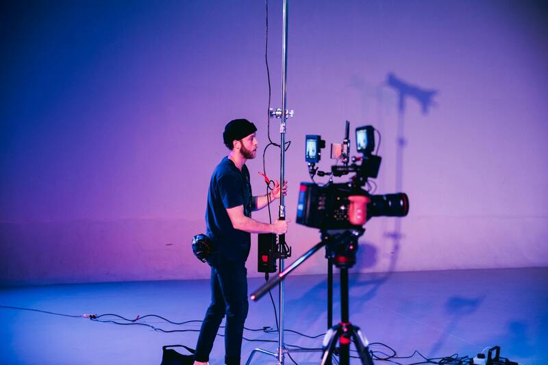
To achieve highly detailed and accurate 3D models through drone photography, professionals employ a combination of cutting-edge data acquisition strategies and sophisticated processing algorithms. High-resolution cameras equipped with precise GPS and IMU (Inertial Measurement Unit) sensors are essential for capturing multiple overlapping images from diverse angles, ensuring comprehensive coverage of complex structures and terrains.
During the data collection phase, plan flight paths carefully to maximize coverage while maintaining safe operational distances. Overlap between adjacent images should typically be at least 60-80% to facilitate effective image stitching. It is equally vital to control for consistent lighting conditions, as variability can adversely affect the quality of 3D reconstructions.
Post-flight, the captured images are processed through specialized photogrammetry software that utilizes algorithms such as Structure from Motion (SfM) and Multi-View Stereo (MVS). These computational techniques analyze the image set to identify common features, determine camera positions, and reconstruct the scene in three dimensions. The resulting point clouds serve as the foundation for generating textured meshes and detailed 3D models.
Advanced software solutions also incorporate orthorectification, which aligns images to a geographical coordinate system, enabling precise spatial measurements and integrations with Geographic Information Systems (GIS). This integration is particularly beneficial for urban planning, construction monitoring, and real estate development, where geographic accuracy is paramount.
Ensuring Data Accuracy and Quality Control
To deliver high-quality 3D models, operators should implement rigorous quality control procedures, including:
- Calibration of drone sensors before flights to minimize measurement errors.
- Conducting test flights to evaluate environmental conditions and optimize camera settings.
- Utilizing ground control points (GCPs) with known coordinates to improve georeferencing accuracy.
- Reviewing intermediate outputs during processing to identify anomalies and adjust parameters as needed.
Adherence to these meticulous steps ensures the final 3D visualizations meet professional standards for precision and clarity, which is critical for stakeholders relying on accurate data for decision-making.
Process of Capturing 3D Drone Data
Successful 3D drone photography hinges on meticulous planning and execution. The process begins with comprehensive flight planning, where operators determine the optimal flight path, altitude, and camera settings based on the project's objectives and site-specific conditions. This planning phase encompasses evaluating environmental factors such as wind speed, lighting conditions, and potential obstructions, which can all influence data quality.
Prior to flight, drone calibration is essential to ensure sensor accuracy. This involves checking camera focus, lens calibration, and IMU (Inertial Measurement Unit) alignment. Proper calibration minimizes measurement errors during image capture, which is crucial for the subsequent reconstruction process.
Once the drone is deployed according to the flight plan, systematic image acquisition is performed. To create accurate 3D reconstructions, multiple overlapping images are captured from various angles, typically with at least 70% front and side overlap. This redundancy enables advanced software to identify common features in multiple images, facilitating precise matching during processing.
After data collection, the images undergo rigorous processing to produce detailed 3D models. The initial step involves processing software employing techniques such as Structure from Motion (SfM) and Multi-View Stereo (MVS). These computational methods analyze the image set, identify common features, and compute camera positions, ultimately reconstructing a three-dimensional representation of the surveyed environment.
High-quality point clouds generated during this stage form the basis for textured mesh creation. Additional processes like orthorectification can align images to geographic coordinates, enhancing spatial accuracy. Throughout these steps, professional quality control is vital; calibration checks, environmental assessments, and the use of ground control points (GCPs) help verify data precision.
Ultimately, the refined 3D models serve a multitude of applications, providing stakeholders with accurate, detailed visualizations that support decision-making, planning, and development initiatives. Ensuring the integrity of each step in this process underscores the value of professionally conducted 3D drone photography projects.
Legal Considerations and Regulations in Miami
Operating 3D drone photography services in Miami requires adherence to specific rules and regulations designed to ensure safe and responsible drone use within urban and private environments. These guidelines help maintain the safety of airspace, protect private property, and foster community trust in drone operations. While navigating these regulations, it is important for service providers to stay informed about the latest standards issued by local authorities and aviation agencies.
Key compliance elements typically involve obtaining appropriate operational permissions, which might include drone registration, pilot licensing, and adherence to altitude restrictions. In Miami, operators must remain aware of designated no-fly zones around critical infrastructure, airports, and densely populated areas. Detailed pre-flight planning, including risk assessments and route approvals, mitigates potential conflicts or safety concerns.
Safety protocols extend to maintaining visual line-of-sight, avoiding interference with manned aircraft, and respecting privacy boundaries. Each drone operation should be documented and conducted in accordance with local guidelines, ensuring that all relevant permits are secured before commencing flights. This systematic approach safeguards both drone operators and the public while facilitating high-quality 3D data collection.
Additionally, understanding the nuances of Miami's specific regulations—such as restrictions on night flights or over certain neighborhoods—is crucial to prevent disruptions or legal issues. Compliance with these local standards ensures that 3D drone photography projects proceed smoothly and contribute positively to urban planning, real estate development, and tourism enhancement efforts in the city.

Legal Considerations and Regulations in Miami
Executing successful 3D drone photography projects within Miami's bustling urban environment requires a comprehensive understanding of the applicable operational standards and standards governing unmanned aerial vehicles. Prior to each flight, operators should conduct thorough planning, which includes obtaining necessary permits, verifying operational areas against no-fly zones, and coordinating with local authorities when necessary. This meticulous approach minimizes risks associated with airspace conflicts and ensures seamless data collection.
Operational parameters such as flight altitude, proximity to airports, and usage hours are typically dictated by Miami's specific guidelines for unmanned aircraft. These guidelines are designed to safeguard both public safety and the integrity of existing air traffic operations. Ensuring compliance involves pre-flight assessments, including detailed mapping of the survey area to identify potential hazards and restricted zones. Pilot certifications and drone registration documents are also crucial components verified before each mission to uphold rigorous operational standards.
Environmental conditions, including wind speed and weather patterns, must be considered to mitigate risks associated with uncontrolled drone movements. Night operations often necessitate additional provisions, such as specialized lighting equipment and heightened oversight, to maintain visibility and control. Moreover, operators must respect privacy boundaries and avoid intrusive surveillance that could infringe upon personal rights, especially in residential or culturally sensitive areas of Miami.
Adherence to these established guidelines fosters a safe operating environment and delivers consistent, high-quality 3D data. Maintaining detailed logs of flight plans, permissions, and safety checks is essential for accountability and future project auditing. Regular training and updates for drone pilots ensure they stay aligned with evolving standards and technological advances, further contributing to the professional excellence expected in Miami's competitive 3D drone imaging industry.
Implementing comprehensive safety and regulatory practices extends beyond individual flights, embodying a commitment to responsible operation within Miami’s dynamic urban settings. This proactive approach not only ensures project success but also helps to foster positive relationships with local communities, authorities, and stakeholders. Staying informed about updates to local laws and maintaining open communication channels with relevant agencies are best practices that contribute to a sustainable and transparent drone photography ecosystem.
Advanced Data Processing and Integration of 3D Drone Imagery
Once the 3D data has been captured through drone flights, the subsequent step involves sophisticated processing to generate accurate, detailed models. This process typically employs specialized software capable of stitching together multiple images and point clouds to produce comprehensive three-dimensional reconstructions. High-resolution photogrammetry tools transform overlapping photographs into precise mesh models, textured with realistic surface details that reflect the actual environment. These models are then refined through algorithms that optimize accuracy and surface smoothness, ensuring that every nuance, from architectural features to terrain variations, is faithfully represented.
The integration phase involves combining these 3D models with existing geospatial data, creating layered maps that can include topography, infrastructure, vegetation, and cultural assets. Geographic Information Systems (GIS) are often employed to overlay additional datasets, facilitating detailed analysis of spatial relationships. This synthesis allows professionals such as urban planners, architects, and developers to visualize proposed modifications in context, evaluate environmental impacts, and simulate future scenarios with a high degree of confidence.

Application of 3D Data for Urban Planning and Development in Miami
Miami’s dynamic urban landscape benefits immensely from the detailed insights provided by advanced 3D drone imaging. City planners and developers use these models to assess land use, optimize infrastructure placement, and plan public spaces with precision. For example, 3D visualizations enable stakeholders to evaluate the visual impact of new buildings within the city skyline, facilitating informed decision-making that aligns with aesthetic and functional goals.
Furthermore, 3D models support environmental management efforts, such as flood risk assessments by analyzing terrain elevations and drainage patterns. Emergency response planning also gains value from detailed models that allow first responders to familiarize themselves with disaster-prone areas and develop effective strategies before incidents occur.
Enhancing Real Estate and Commercial Marketing through 3D Drone Imaging
Real estate professionals leverage 3D drone photography to craft immersive virtual tours and to provide high-fidelity visualizations of properties and neighborhoods. This technology captures the building’s architecture alongside the surrounding environment, highlighting proximity to amenities, natural features, and urban infrastructure. Such comprehensive visualizations aid potential buyers in making informed decisions, expanding the market reach, and speeding up sales processes.
Commercial developers also utilize these models to showcase project plans to investors and the public, providing a tangible sense of scale and spatial relationships that static images cannot achieve. This enhanced presentation fosters greater transparency and engagement, which can accelerate development approvals and community support.
Technical Challenges and Solutions in 3D Drone Data Collection
Achieving high-quality 3D models involves overcoming several technical hurdles. Variability in lighting conditions, reflective surfaces, and dense urban structures can hinder image clarity and accurate point cloud generation. To address these issues, operators often employ multi-pass scanning at different times of day to ensure consistent lighting and capture shadow variations. Utilizing drones equipped with high-precision GPS and IMU sensors enhances positional accuracy, reducing errors during data stitching.
Moreover, sophisticated algorithms correct for distortions caused by motion, vibrations, and environmental factors such as wind. Post-processing workflows further refine models to eliminate artifacts and fill gaps, maintaining the integrity of the 3D representation. Investing in high-quality sensors and adaptive flight planning remains key to overcoming environmental constraints common in dynamic settings like Miami.
