Overview of Aerial Real Estate Photography
In the dynamic world of property marketing, aerial real estate photography has become an indispensable tool for showcasing properties in a compelling and detailed manner. This specialized service involves capturing high-quality images and videos of real estate assets from elevated perspectives, often utilizing advanced drone technology. The strategic use of aerial imagery allows real estate professionals, property developers, and homeowners to present properties in a way that highlights their unique features, surroundings, and overall appeal.
Within the Miami real estate market, aerial photography services have gained prominence due to the city's vibrant landscape, stunning waterfront connections, and distinctive architectural styles. These services enable clients to effectively communicate a property's scale, proximity to key attractions, and aesthetic appeal, driving increased interest from prospective buyers and investors.
Modern aerial real estate photography typically involves the use of drones equipped with high-resolution cameras, which can capture images and video footage from various angles and altitudes. This approach offers a level of detail and perspective that traditional ground-based photography cannot provide. By incorporating aerial shots into marketing listings, real estate agents and property owners can deliver an immersive viewing experience that sets their offerings apart.
The significance of aerial imagery extends beyond simple visual appeal. It provides a comprehensive view of a property’s layout, surrounding amenities, and geographical context. For properties situated near beaches, parks, or urban centers, aerial images can effectively illustrate proximity to desirable features, thereby influencing buyer decisions.
Adopting aerial real estate photography services also symbolizes a commitment to high-quality marketing practices. As with other essential marketing tools, these services require professionalism and expertise to produce images that meet industry standards and resonate with target audiences.
In essence, aerial real estate photography represents a transformational approach in property marketing—delivering engaging, informative, and visually stunning content that helps properties stand out in Miami’s bustling real estate landscape.
Types of Aerial Shots and Equipment Used
In aerial real estate photography, the variety of shots captured plays a significant role in showcasing a property's unique features. Different types of aerial images serve distinct marketing purposes, providing potential buyers with a comprehensive understanding of the property's layout and surrounding environment.
- Vertical Shots: Also known as nadir views, these images are captured directly overhead, offering a clear depiction of property boundaries, roof condition, and lot size. Vertical shots are particularly useful for illustrating the overall footprint of the property and its relationship to neighboring structures.
- Oblique Angles: These shots are taken from an angle, typically between 30° to 45°, providing a more dynamic perspective. Oblique images highlight architectural features, landscaping details, and the property's proximity to nearby amenities, giving viewers a sense of dimension and depth.
- Cinematic Video Footage: Besides static images, high-quality drone videos provide a virtual walkthrough experience. Motion footage can capture sweeping views of the property, surrounding landscape, and neighborhood, making the listing more engaging and informative.
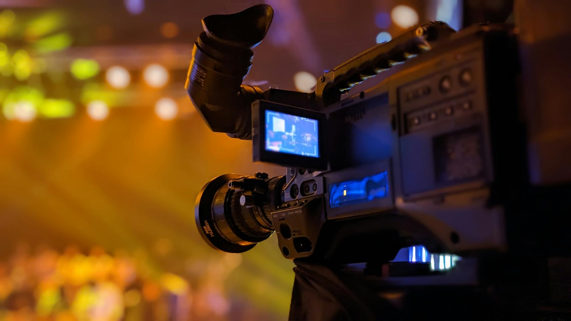
Modern aerial photography heavily relies on advanced equipment to produce crisp, high-resolution images. Drones equipped with stabilized gimbals ensure smooth, distortion-free shots even in challenging conditions. The cameras used typically feature 4K or higher resolution sensors, enabling detailed images that stand up to professional printing and digital display standards.
Other equipment aspects include GPS stabilization systems for precise positioning and intelligent flight modes that facilitate complex shots with minimal operator effort. The combination of state-of-the-art drones and professional-grade cameras allows for capturing comprehensive visuals that elevate real estate marketing strategies.
Types of Aerial Shots and Equipment Used
In aerial real estate photography, the choice of shot types and equipment directly influences the quality and impact of the images. Common drone techniques include vertical shots, which provide a straightforward view of the property, highlighting its size and layout. These are ideal for showcasing entire estates or large commercial properties. Oblique shots, captured at various angles between 30° and 45°, reveal architectural details and landscaping features, offering viewers depth and a comprehensive understanding of the property’s design.
Flyover videos and panoramic sequences are increasingly popular, creating a dynamic presentation that allows potential buyers to virtually explore the property surroundings. Such footage facilitates a virtual walkthrough, demonstrating the property’s proximity to nearby amenities, parks, and transportation routes.
To achieve these diverse shot types, specialized equipment is employed. The core of professional aerial imagery involves drones equipped with stabilized gimbals, which ensure smooth footage even under windy conditions or complex maneuvers. High-resolution cameras, typically featuring 4K or higher sensors, capture crisp, detailed images suitable for both digital marketing and print media.
Additional equipment includes GPS stabilization systems that provide accurate positioning, enabling precise flight paths and consistent shot framing. Intelligent flight modes are programmed to automate complex shot sequences and ensure safety and precision. The use of state-of-the-art battery technology allows for extended flight times, which is essential when capturing multiple angles or extensive footage.
Legal Regulations and Permits in Miami
Engaging in aerial real estate photography within Miami requires adherence to specific guidelines established by aviation authorities and local regulations. These protocols are designed to ensure safe operation of unmanned aircraft systems (UAS) while facilitating high-quality imaging for real estate marketing. Professionals offering aerial photography services possess comprehensive knowledge of these rules, which include securing appropriate authorizations and understanding operational limitations.
Operating within designated airspace involves obtaining necessary clearances through established processes. This includes submitting flight plans, especially for flights in controlled airspace or near sensitive locations such as airports and government facilities. The certification of drone pilots encompasses rigorous training and adherence to best practices that promote safe and responsible flying behaviors. Additionally, operators are required to maintain updated registration of their drone systems with relevant authorities, which simplifies tracking and ensures compliance.
Understanding local restrictions is vital for planning effective shoots without disruptions. Miami-specific regulations may include altitude restrictions, limitations on flying over crowded areas or private property, and restrictions during certain times of the day. Professionals specializing in aerial real estate imaging are well-versed in these parameters, allowing them to deliver high-quality videos and photos without legal complications.
Moreover, ethical considerations guide the operation of drones, such as respecting privacy boundaries and avoiding disruptions to residents or local events. By working with licensed and experienced operators, real estate developers and agents ensure their marketing efforts are both effective and compliant with Miami's aerial operation standards.
Working with Certified Aerial Photography Experts
- Verify professional credentials and licensing
- Ensure familiarity with Miami's airspace restrictions
- Confirm the use of compliant equipment and safety protocols
- Request detailed planning to avoid operational delays
Adhering to these practices not only mitigates potential issues but also underscores a commitment to responsible and high-quality service delivery in aerial real estate photography.
Best Practices for Aerial Real Estate Photography
Optimizing aerial real estate images requires adherence to proven techniques that highlight a property's unique features while maintaining safety and professionalism. To achieve compelling visuals, professionals employ a combination of strategic planning, advanced equipment, and precise techniques.
Pre-Shoot Planning and Site Assessment
Effective aerial photography begins with a comprehensive site assessment. This involves analyzing the property layout, identifying optimal angles, and understanding local lighting conditions. Site assessments help in selecting the best times of day for shooting, ensuring natural light enhances the property's appeal. Additionally, planning the flight path minimizes unnecessary movements and maximizes shot efficiency.
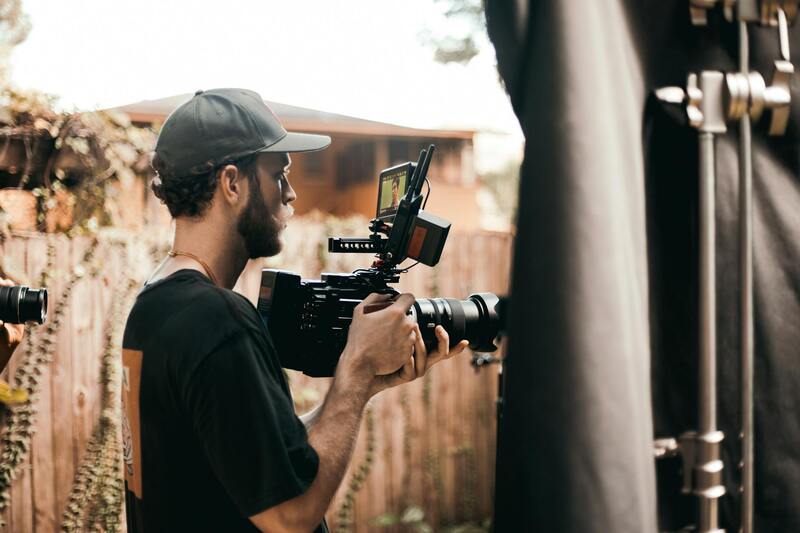
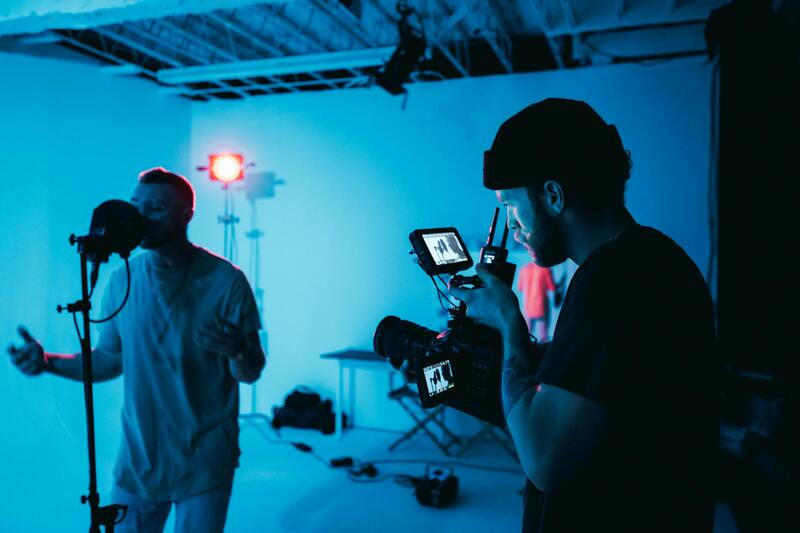
Optimal Equipment Use
High-quality drones equipped with stabilized gimbals and high-resolution cameras are essential for capturing sharp, detailed images. Wide-angle lenses facilitate expansive shots that encompass the property's surroundings, providing context and attracting potential buyers. Using adjustable camera settings, such as aperture, shutter speed, and ISO, ensures images are well-exposed and vibrant.
 igure>
Composition and Perspective
Effective composition is critical in aerial real estate photography. Incorporating leading lines, framing, and symmetry draws viewers' attention to the property's best features. Varying altitudes and angles offer diverse perspectives, emphasizing indoor-outdoor flow, architectural details, and landscaping. Utilizing height and vantage points strategically can showcase features such as swimming pools, gardens, or panoramic views more effectively.
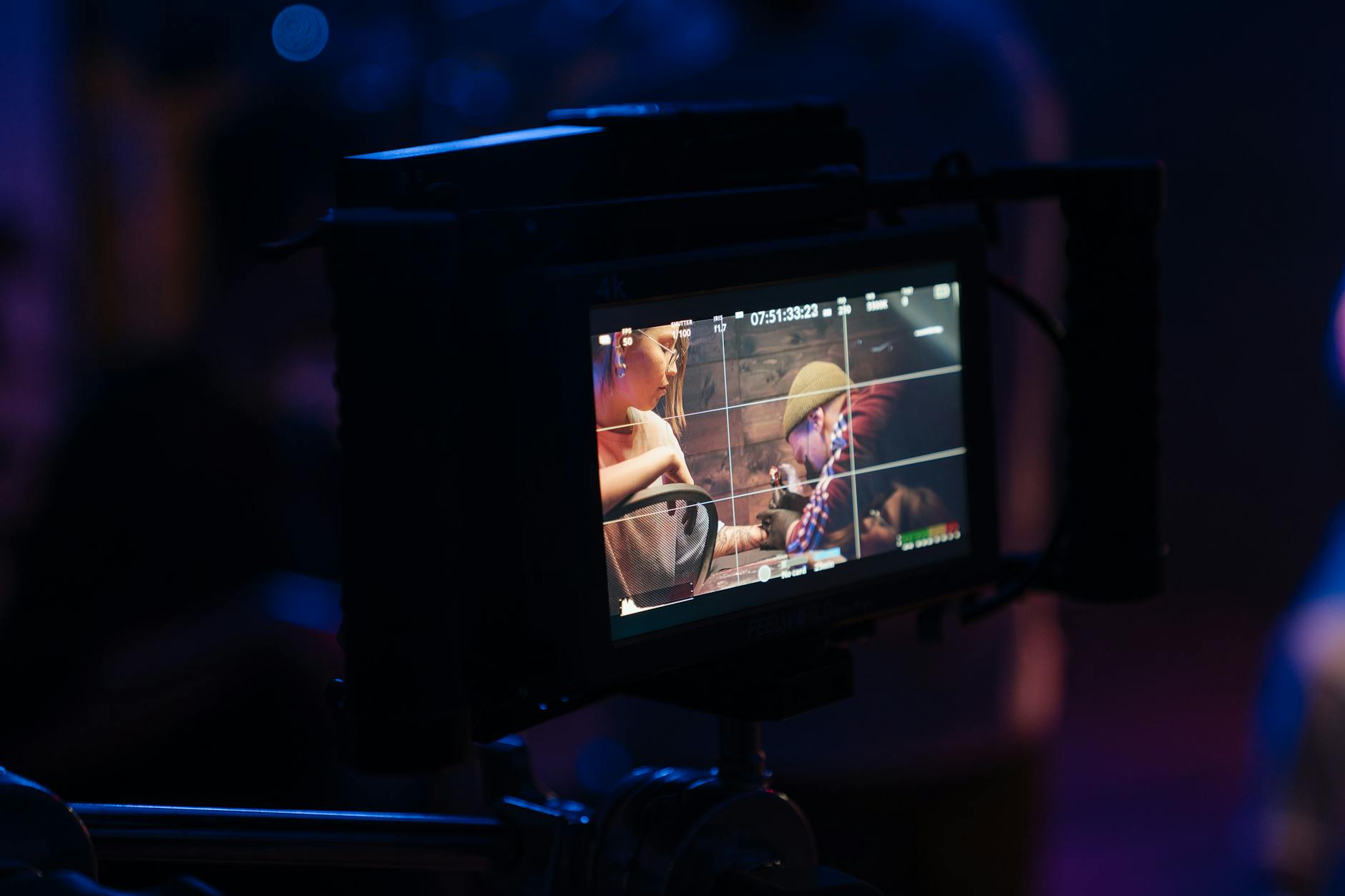
Edit and Post-Processing
Post-processing enhances the visual impact of aerial images. Adjustments to brightness, contrast, and color saturation bring out the property's details and vibrancy. Correcting lens distortion and removing distractions ensures a polished presentation. For video content, smooth transitions and stabilization techniques elevate overall quality, making the property stand out in marketing materials.
Maintaining Consistent Branding
For real estate professionals, consistency in branding across all visual content reinforces brand recognition. Incorporating logo overlays subtly within images or videos maintains professionalism without distracting from the property's features. High-quality visuals should align with the property's marketing strategy, creating a cohesive and memorable impression for prospective buyers.
Legal Regulations and Permits in Miami
Executing aerial real estate photography in Miami requires adherence to specific procedures that ensure safe and compliant drone operations. It is essential for professionals to obtain necessary authorizations before conducting aerial shoots, particularly within congested urban environments or restricted airspaces.
Operators must acquire permits from relevant authorities, which often involves submitting detailed flight plans, safety protocols, and proof of pilot certification. This process guarantees that drone flights are conducted in accordance with city and federal guidelines, minimizing potential disruptions or hazards.
Additionally, certain zones within Miami may be designated as no-fly areas, such as near airports, government buildings, or sensitive infrastructure. Advanced planning and thorough checks are imperative to identify these areas and secure the required permissions for flight operations.
Particularly, operators should familiarize themselves with Miami-Dade County's drone policies, which may include restrictions on altitude, flight times, and proximity to populated structures. Collaboration with licensed drone service providers who stay updated on local regulations can facilitate seamless compliance.
Engaging with the FAA's Remote Pilot Certificate program ensures pilots are qualified, further safeguarding the quality and legality of aerial captures. Proper documentation and adherence to these standards are instrumental in executing successful, legally compliant aerial real estate photography projects.

Best Practices for Aerial Real Estate Photography
Executing high-quality aerial real estate photography requires meticulous planning and adherence to industry standards. To capture compelling images that enhance property marketing, operators should consider the following best practices:
- Pre-Flight Planning: Conduct a thorough site assessment prior to the shoot. This involves reviewing maps for restricted zones, identifying optimal flight paths, and determining weather conditions that could impact flight safety or image clarity. Ensuring that the drone's battery life is sufficient for the planned coverage area minimizes interruptions.
- Optimal Shooting Conditions: Schedule shoots during periods of ideal lighting—early mornings or late afternoons—when natural light is soft and shadows are minimized. Overcast days can also serve as suitable conditions to reduce glare and uneven lighting.
- Camera Settings and Equipment: Use a camera with high-resolution capabilities to ensure crisp detail in images. Set appropriate ISO, aperture, and shutter speed to balance exposure and motion stability. For capturing expansive views, drones equipped with gimbal stabilization systems help achieve smooth footage.
- Flight Technique: Maintain steady altitude and consistent flight paths to produce uniform images. Incorporate multiple angles—top-down shots, oblique angles, and panoramic vistas—to showcase the property comprehensively.
- Safety and Environmental Awareness: Always prioritize safety by maintaining line-of-sight with the drone and avoiding obstacles like trees, power lines, and other structures. Respect privacy zones and avoid flight over crowds or sensitive locations.
- Post-Processing: Edit images for color balance, contrast, and sharpness to enhance visual appeal. Properly processed photographs convey professionalism and attract potential buyers effectively.

Advanced Techniques and Current Trends in Aerial Real Estate Photography
In the rapidly evolving realm of aerial real estate photography, professionals continually integrate cutting-edge technologies and innovative methodologies to offer clients exceptional visual storytelling. These advancements not only elevate the quality of imagery but also provide deeper insights into property features, contributing to more informed marketing strategies.
Emerging Technologies Enhancing Aerial Imagery
One of the most notable innovations is the integration of high-resolution multispectral and infrared imaging systems. These tools allow photographers to capture detailed views of a property's landscaping, drainage, and material conditions that are not visible in standard photographs. Such technology is particularly useful for identifying potential issues or highlighting sustainable features that set properties apart in competitive markets.
Furthermore, the development of autonomous drone flight systems, equipped with advanced obstacle detection and avoidance algorithms, ensures safer and more efficient flights. These systems enable consistent coverage of large estates or commercial properties, minimizing human intervention while maintaining utmost precision in aerial captures.
Enhanced Data Collection and 3D Modelling
Beyond conventional imagery, 3D mapping and modelling technologies are gaining popularity. LiDAR (Light Detection and Ranging) sensors mounted on drones generate highly accurate topographical data, facilitating detailed 3D visualizations of terrains and structures. This capability proves invaluable for clients interested in development planning or landscaping projects, providing comprehensive spatial analysis with minimal physical site disturbance.
Expanding Usage and Innovative Techniques
The increasing adoption of virtual reality (VR) and augmented reality (AR) integration in real estate marketing has revolutionized how properties are presented. High-resolution aerial images are now seamlessly integrated into immersive virtual tours, allowing potential buyers or investors to explore properties remotely with realistic perspectives. This approach significantly broadens the reach and appeal of property listings, especially during times when physical visits are limited.
Additionally, the utilization of hyper-lapse and time-lapse techniques offers dynamic storytelling options, showcasing property development over time or the surrounding area's evolution. These engaging visual narratives can leave a lasting impression on viewers, increasing the likelihood of interest and inquiries.
Future Outlook and Continuous Innovation
As the Miami real estate market continues to grow competitively, aerial real estate photography services are expected to adopt even more sophisticated tools. The integration of AI-driven image analysis for automatic tagging and categorization, alongside real-time data sharing capabilities, will streamline the marketing workflow. This will enable agents and developers to access and update visual content promptly, maintaining a fresh and compelling online presence.
Moreover, the potential for drone swarms—multiple drones operating collaboratively to capture expansive areas simultaneously—is on the horizon. This technology could drastically reduce the time needed for comprehensive property coverage, delivering highly detailed and varied imagery in shorter periods.
Summary of Key Future Trends:
- Adoption of multispectral and infrared imaging for detailed analysis
- Implementation of autonomous flight with advanced obstacle avoidance
- Enhanced 3D mapping and GIS integration for precise spatial data
- Seamless VR and AR integration for immersive property showcasing
- Use of drone swarms for rapid, large-scale aerial coverage
- AI-powered automated editing and tagging for efficient marketing workflows
By embracing these technological advancements, aerial real estate photography services in Miami will continue to elevate marketing strategies, providing clients with compelling, precise, and immersive visual content that stands out in a competitive market landscape.
