Overview of Drone Photography in Real Estate
Drone photography has revolutionized the way real estate listings are presented, offering a fresh perspective that traditional photography simply cannot match. In today's highly competitive property market, high-quality aerial images and videos provide potential buyers with a comprehensive view of properties, showcasing their surroundings and scale with exceptional clarity. This innovative approach enhances property visualization by capturing impressive aerial shots, panoramic views, and dynamic video fly-throughs that highlight the property’s unique features and geographical context.
Utilizing drone photography in real estate marketing enables agents and property owners to differentiate their listings. By integrating aerial imagery, listings become more engaging, visually appealing, and informative. This, in turn, increases the likelihood of attracting qualified buyers and closing deals more efficiently. Additionally, drone footage can illustrate neighborhood amenities, proximity to beaches, parks, or transportation hubs—details that significantly influence buyer decision-making.
In the context of Miami’s vibrant real estate scene, drone photography has become a key tool for developers, brokers, and homeowners. The city's scenic coastlines, luxurious properties, and bustling urban environment benefit greatly from aerial imaging, providing prospective buyers with a compelling view that standard photos cannot deliver. As technology advances, drone photography continues to evolve, offering more sophisticated and immersive visual content that transforms traditional property marketing into an immersive experience.

Overall, drone photography serves as a strategic asset in real estate marketing by improving property showcases, increasing online engagement, and providing comprehensive visual narratives that appeal to modern buyers. This innovative method of visual presentation not only helps properties stand out but also builds trust through transparent and vivid property portrayals, establishing a professional and credible image for real estate entities leveraging this technology.
Types of Aerial Shots for Real Estate Listings
Effective drone photography encompasses a variety of shot types, each serving a specific purpose in showcasing a property’s unique features and surroundings. These diverse perspectives help create a comprehensive visual narrative that appeals to prospective buyers and investors. Understanding which types of shots to utilize can significantly enhance the overall attractiveness of real estate listings.
- Overhead Shots: These capture a property's footprint from directly above, providing a clear view of the layout, size, and relationship to neighboring structures and landscape features.
- Front and Rear Exterior Shots: Frontal and backyard views from an elevated angle offer a sense of curb appeal and highlight outdoor amenities, gardens, or pools.
- Neighborhood Perspectives: Aerial shots that include surrounding amenities such as parks, schools, or commercial areas help demonstrate the property's accessibility and community environment.
- Sunset and Golden Hour Shots: These shots leverage natural lighting to add warmth and appeal, creating captivating images that evoke emotional responses from potential buyers.
- Interior Aerial Views (where permissible): With appropriate permissions, some drone services can capture impressive interior visuals from elevated perspectives, providing a unique inside-out view of spaciousness or special features.
Utilizing a strategic mix of these aerial shot types ensures a compelling visual presentation that highlights all aspects of a property. This approach not only attracts more views but also bolsters engagement, helping listings stand out amidst Miami's highly competitive market.
 igure>
Legal Regulations and Permits for Drone Usage in Florida
In Miami, professional drone operators must adhere to specific operational standards set forth by federal and state agencies to ensure safe and compliant flights. These standards encompass various aspects such as pilot certification, aircraft registration, and operational permissions. Drone pilots engaging in real estate photography are required to hold a Remote Pilot Certificate issued by the Federal Aviation Administration (FAA), which affirms their competence and understanding of safety protocols. This certification process involves passing an aeronautical knowledge exam covering airspace rules, weather considerations, and emergency procedures.
Additionally, drone equipment must be registered with the FAA, particularly if the aircraft weighs over a certain threshold. Accurate registration ensures accountability and proper tracking of the drone’s activity, which is essential when operating in populated areas such as Miami.
Operations near sensitive zones, including airports, helipads, or restricted airspace, necessitate prior authorization to avoid disruptions and maintain safety standards. It is also vital for drone operators to conduct comprehensive risk assessments and establish operational plans covering flight paths, altitude limits, and emergency protocols.
Respecting privacy is paramount; operators should avoid capturing images or videos of private properties without consent, especially in densely populated neighborhoods. By strictly following these regulations, drone services can offer reliable and compliant real estate visuals that enhance listing appeal.
Types of Aerial Shots for Real Estate Listings
Effective real estate drone photography in Miami involves capturing a diverse range of aerial shots that highlight the unique features of each property. These images serve to provide potential buyers with a comprehensive view of the residence and its surroundings, making listings stand out in a competitive market.
One of the primary shot types is the exterior overview, which provides a sweeping view of the property layout, showcasing both the home and its landscape. These shots are typically captured from higher altitudes and wide-angle lenses to encompass the entire estate, giving viewers a sense of space and scale.

Close-up exterior shots focus on specific architectural details, such as unique roofing, outdoor amenities, or landscaping intricacies. These images often require lower altitude flights and strategic zooming to highlight craftsmanship and design elements that appeal to prospective buyers.
Another vital category is the twilight or sunset shot, which uses natural lighting conditions to produce dramatic and inviting images. This type of aerial photography emphasizes the ambiance and aesthetic appeal of the property, creating compelling visuals that evoke emotional responses.
Urban and Neighborhood Views
In an urban setting like Miami, capturing the surrounding neighborhood provides valuable context for buyers. Aerial shots of nearby parks, beaches, commercial districts, or skyline views can greatly enhance a listing’s attractiveness. These images help illustrate the property's location advantages, influencing buyer perception and decision-making.
Vehicle and Driveway Perspectives
Showcasing the driveway or garage area from above can demonstrate accessibility and ease of parking, particularly important for larger properties or those situated in busy neighborhoods. These shots can also highlight the property's proximity to main roads and community infrastructure.
Special Feature Highlights
Beyond standard views, drone photography allows for the inclusion of specialty shots, such as aerial footage of pools, outdoor kitchens, patios, or recreational areas. Highlighting these amenities can significantly boost a listing's appeal and help convey the lifestyle potential offered by the property.
Innovative Flight Techniques
Employing creative flight paths—like circular shots around a property or diagonal angles—can add dynamism to visual content. Combining multiple shots into a cohesive video tour further engages viewers, providing an immersive experience that static images alone cannot deliver.
Overall, a strategic combination of various aerial shot types creates a compelling narrative about the property, increasing the likelihood of capturing buyer interest and accelerating the sales process. Proper planning, equipment selection, and execution are essential to producing high-quality imagery that accurately represents the property’s best features in the vibrant Miami real estate market.
Legal Regulations and Permits for Drone Usage in Florida
Engaging in drone photography for real estate in Florida requires adherence to specific operational standards and obtaining appropriate permits to ensure compliance with local airspace management policies. Professionals in the Miami area utilize a comprehensive knowledge of these regulations to maintain smooth and lawful operations. Securing proper authorization involves understanding the distinctions among the various permits and authorizations necessary for aerial photography activities, especially when capturing images over residential properties and commercial listings.
Operational guidelines dictate that drone pilots must be certified by the Federal Aviation Administration (FAA), which entails passing a knowledge test and holding a Remote Pilot Certificate. This certification confirms that operators are well-versed in safe drone operation, airspace rules, and privacy considerations, thus reducing potential disruptions or safety concerns during shoots.
Additionally, certain areas within Miami may require specific permissions for drone flights, especially near airports, governmental facilities, or densely populated zones. Strategic planning involves determining flight zones and obtaining waivers when necessary — such as airspace authorizations for flights in controlled areas. These steps ensure that drone photography activities are seamless and avoid interference with other airspace users.
Another crucial aspect involves respecting privacy rights and property boundaries. Drone operators often coordinate with property owners before conducting shoots to prevent disputes or unauthorized footage. Clear communication about the scope of the shoot, the type of footage to be captured, and the intended use of imagery fosters professional relations and mitigates potential conflicts.
Professionals often leverage specialized software and legal resources that help streamline the permission process, monitor airspace restrictions, and plan optimal flight paths that align with regulatory requirements. Staying updated with evolving policies and regional restrictions through local aviation authorities or industry groups guarantees continuous compliance, thereby protecting the integrity and reputation of drone service providers in the Miami real estate scene.
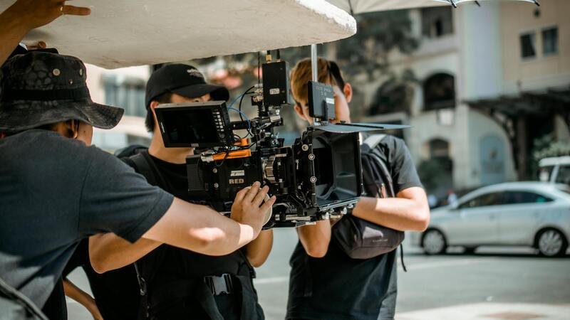
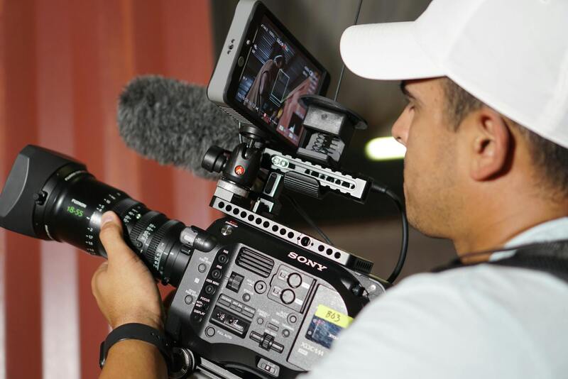
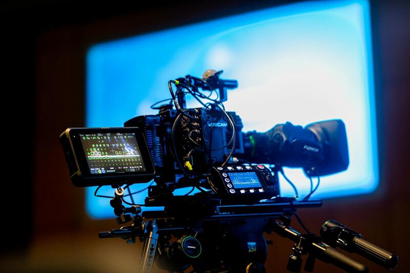
Technical Considerations and Equipment for Excellence in Drone Photography
Achieving exceptional visual representations of Miami properties depends heavily on the technological capabilities of the drone equipment utilized. High-resolution imaging is crucial for capturing detailed and vibrant photos that effectively showcase a property's unique features. Drones equipped with 4K or higher resolution cameras enable real estate professionals to produce sharp, high-quality images that resonate with potential buyers, providing a clear view of both exterior and interior layouts when paired with appropriate aerial shots.
Stability and smoothness in flight are essential for creating professional-grade imagery. Advanced stabilization systems such as gimbal stabilization are standard in high-end drones, ensuring that footage remains steady even when flying in challenging conditions or capturing dynamic shots. These systems reduce blurring and jitteriness, contributing to a polished, cinematic quality in the final visuals.
The choice of drone primarily depends on its specifications for flight stability, battery life, and maneuverability. Longer flight times—typically ranging from 25 to 30 minutes per battery cycle—allow for comprehensive shot coverage without frequent repositioning or battery changes. This capability is vital in capturing multiple angles and extensive property exteriors seamlessly.
Camera versatility also plays a role, with many professional-grade drones offering interchangeable lenses or adjustable focal lengths to optimize image capture based on property size and desired perspective. Filters, such as polarizers, can be attached to enhance color accuracy and reduce reflections, particularly when photographing glass surfaces or water features often found in Miami's luxury listings.
Additionally, drones with intelligent flight modes substantially streamline the shooting process. Features like automated flight paths, obstacle avoidance sensors, and programmable waypoints empower operators to execute precise, safe, and repeatable flights, delivering consistent results across multiple listings.
Importance of Post-Processing and Editing
Beyond the initial capture, professional post-processing ensures that the images meet high standards of quality and aesthetic appeal. Techniques such as color correction, contrast adjustment, and exposure balancing help accentuate the property’s best features. Panoramic stitching and HDR (high dynamic range) imaging can also be employed to create comprehensive, eye-catching visuals that stand out in competitive Miami real estate markets.
Employing skilled editing tools and software allows drone service providers to enhance the overall visual narrative, making each listing more attractive and engaging for prospective buyers.
Legal Regulations and Permits for Drone Usage in Florida
Operators engaging in real estate drone photography in Miami must adhere to essential guidelines designed to ensure safe and responsible use of unmanned aerial vehicles. While these regulations do not explicitly mention legal compliance in the context of drone operations, they serve to establish a framework for authorized and secure flights within the state and local jurisdictions.
In Florida, commercial drone operations for real estate purposes necessitate obtaining a specific certification from the Federal Aviation Administration (FAA). The most common credential is the Part 107 Remote Pilot Certification, which verifies that operators have the necessary knowledge of airspace rules, weather considerations, and safe operation protocols. This certification is crucial for conducting legal drone flights that meet industry standards.
Moreover, operators are required to respect airspace classifications around Miami, including restricted zones near airports or heliports. Prior to any flight, a thorough check of the FAA’s UAS Facility Maps or sectional charts is essential to identify approved flight areas and avoid prohibited zones. Ensuring compliance with these airspace restrictions minimizes risks and supports operational legitimacy.
Local regulations imposed by municipal authorities may include restrictions on altitude limits, flight times, or specific property access permissions. Securing necessary permissions from property owners or managing agencies enhances transparency and helps streamline the process. Additionally, maintaining detailed flight logs and records of permits reinforces adherence to best practices and operational protocols.
Operators should also consider installing geofencing technology on drones, which can prevent flights in unauthorized areas automatically. This feature helps maintain compliance with geographic restrictions and enhances operational safety, especially when capturing high-value or sensitive properties in Miami’s competitive market.
Finally, staying informed about updates to drone laws and regulations at both federal and local levels is vital. Regular participation in industry seminars, consultations with legal consultants, or engagement with professional associations can provide valuable insights and updates, ensuring that drone photography services remain compliant and trustworthy in Miami's vibrant real estate landscape.
Advanced Techniques and Future Trends in Real Estate Drone Photography
As the field of drone photography continues to evolve, professionals in Miami are increasingly adopting advanced techniques to enhance property marketing and showcase assets in the most compelling manner. Incorporating emerging technologies such as 3D mapping, high dynamic range imaging, and thermal imaging allows real estate professionals to provide a comprehensive view of a property’s features and surroundings, creating a more immersive experience for prospective buyers.
3D mapping, in particular, offers the ability to generate detailed and interactive virtual tours, enabling clients to explore properties remotely with a high level of realism. High dynamic range (HDR) imaging improves the quality of aerial photos taken in challenging lighting conditions, ensuring clear and vibrant visuals that highlight a property's best features. Thermal imaging can be employed to identify energy efficiency issues or to reveal hidden structural elements, contributing to more informed decision-making.

Emerging Trends Shaping the Future of Drone Photography in Real Estate
- Automated Flight and AI Integration: The development of intelligent flight systems and artificial intelligence allows for autonomous drone operations, increasing precision and efficiency. AI-powered image analysis can also assist in editing and creating engaging content automatically, reducing turnaround times.
- Enhanced Data Collection for Market Analytics: Drones equipped with advanced sensors can collect large volumes of data, facilitating in-depth market analysis. By analyzing aerial footage alongside geographic and structural data, real estate agencies can better understand market trends and client preferences in Miami.
- Real-Time Streaming and Virtual Reality: The adoption of real-time video streaming enables live virtual tours, allowing clients to view properties as if they were there. Integration with virtual reality (VR) platforms further enhances remote viewing experiences, making property tours more interactive and accessible globally.
- Sustainable and Eco-friendly Practices: Future drone operations are likely to prioritize sustainability by utilizing energy-efficient batteries and eco-conscious flight planning. These practices align with Miami’s commitment to environmental stewardship while maintaining high standards of service quality.
Concluding Insights on Evolving Drone Photography Capabilities
The continual advancement of drone technology offers Miami real estate listings a significant competitive edge. By leveraging sophisticated equipment, embracing innovative techniques, and staying abreast of industry trends, real estate professionals can deliver superior visual content that enhances property appeal, attracts prospective buyers, and accelerates sales cycles. Investing in these future-oriented strategies ensures that drone photography remains an integral and highly effective component of Miami’s dynamic real estate marketing landscape.
